| Highways, Byways, And Bridge Photography |
Minneapolis & Saint Louis Bridge
Minneapolis & St. Louis Railway Minnesota River Crossing
Carver, MN
|
• Structure ID: |
N/A. |
|
• Location: |
River Mile 36.2. |
|
• River Elevation: |
696 Feet. |
|
• Railroad: |
Union Pacific Railroad. |
|
• Bridge Type: |
Steel Plate Girder w/Wooden Trestle Approaches. |
|
• Length: |
685 Feet (Estimated). |
|
• Width: |
One Track. |
|
• Navigation Channel Width: |
Non-Navigable. |
|
• Height Above Water: |
???. |
|
• Date Built: |
Built 1917, Using 1871 Piers. |
A number of railroad companies were chartered in Minnesota in the 1850s, well
before the Civil War, and only a few years after railroads were established
on the east coast. However, despite having big dreams, financial realities
prevented most of these railroads from laying even a single mile of track.
The business climate changed dramatically after the Civil War. By 1870, there
was a wholesale railroad rush happening across the Midwest as everyone wanted
to be the first to lay rails across the rich farmlands and connect to the
transcontinental line.
One such railroad that got its start in 1870 is the Minneapolis & Saint
Louis Railway. The M&StL headed southwest out of Minneapolis with the
idea of serving farms southwest of the cities, and eventually connecting with
the transportation hub in Saint Louis. It never did reach the gateway city,
but it did build track throughout southern Minnesota and Iowa, with branches
into South Dakota and Illinois.
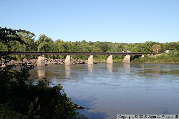
The M&StL crossed the Minnesota River in Carver, Minnesota, on its way
between Hopkins (in the Twin Cities area) and Albert Lea. The Minnesota
River was navigable at that time, which meant that any bridge over the river
had to allow for river boat traffic. For railroads, this most often meant
building a swing span. The M&StL did just that in 1871, building a sturdy
wooden trestle with a 270-foot long wood swing span. The swing span was
unusual in that it was a truss, but had an arch shaped rib at the top of the
truss. Most truss spans have horizontal ribs. As was common on early
swing spans, this one used the center pin design. That is, the swing span
was a single truss that was balanced on the pivot point. In contrast, more
recent swing spans are two trusses that are joined together at the pivot
point. The center pin spans are very difficult to balance. The swing span
was operated by hand. A worker would insert a crank into a hole between the
tracks, and then turn a gear that would turn the bridge.
The wooden swing span bridge was replaced by an iron swing bridge in the early
1890s. This new bridge reused the 1871 bridge piers. The replacement swing
span featured two trusses that were connected over the pivot point. This
style of swing span was much easier to balance than the original center pin
design.
The 1890s swing span deteriorated relatively quickly and was declared unsafe
by 1915. The United States War Department met with the railroad in 1916 to
discuss the condition of the bridge, expressing concerns that the unsafe
bridge might impede the movement of farm goods should the US become
involved in the World War. Since the railroad had made riverboats obsolete,
there was no longer a need for a swing bridge. As a result, a steel deck
plate girder bridge was proposed.
The United States entered the war in April of 1917. The 1890s bridge was
removed in September. The center pier for the swing span was removed and
was replaced by three concrete piers. The wooden trestle spans were
trimmed back, and one additional concrete pier was placed on each end of
the bridge. The result is the seven piers that we see today, including
two remaining original 1871 piers. The steel was ordered in November, and
the new bridge was open by the spring of 1918.
The M&StL continually had financial problems. It operated in
receivership for decades after filing for bankruptcy on several occasions. In
1960, it was absorbed by the Chicago & North Western Railway. The
C&NW subsequently merged with the Union Pacific Railroad in 1995. The
M&StL mainline from Chaska to Hopkins was abandoned in the 1990 or 1991.
As a result, the rail line through Carver was reduced to a spur line for raw
materials being shipped into the American Crystal Sugar plant in Chaska.
In addition to the railroad having problems, this bridge has also experienced
its share of problems. Since the river remains open most winters from the
Mississippi River up to and just beyond Carver, the open water carries ice
downstream as it breaks up. The bridge, however, acts as a dam for the ice
chunks. As the ice builds up behind the bridge, the water level rises
accordingly. The weight of the ice and water puts huge stresses on the
bridge piers. Nearly every pier on the bridge is out of alignment, with
two piers towards the south end having moved so far that the bridge deck
has a kink in it.
In late March of 2007, high water weakened a trestle located about a mile
south of the Minnesota River crossing. That trestle failed as a train was
crossing the structure. Three cars ended up in the river with one being
completely submerged. As of May, 2007, the bridge is still closed. It is
possible that Union Pacific will abandon the rail line rather than fixing
the collapsed trestle.
Update—the current bridge owner, Union Pacific did in fact file a
request in January, 2008, to abandon this rail line and bridge. Local
governments are working on ideas for the possible reuse of the bridge as a
regional trail. The bridge appears to be in good condition, and the weakened
rail line to the south of the river should support foot and bicycle traffic
for many years in the future.
Update—as of the Spring of 2010, this bridge is doomed. The two
counties on either side of the river have been unable to make a deal with
the Union Pacific Railroad to obtain title to the bridge. Scott County
considered purchasing the bridge outright, but that deal was scuttled when
an inspection found the bridge to be in very poor shape. As a result, the
Union Pacific is planning to remove the bridge. It is hoped that either the
counties or the state DNR will end up with title to the railroad right-of-way
so that a regional trail can be built in the future, complete with a new
river bridge.
Update—as of September, 2010, the deal is back on. The city of Carver
has an agreement with the Union Pacific to purchase the bridge and 5 miles of
right-of-way for $2-million. The two adjacent counties will kick in some
funding, along with the Metropolitan Council. The Met Council wants to use
the path for a regional sewer connector. The deal is not yet final since
Scott County wants to keep the right-of-way in reserve for future light rail,
while the cities of Carver, Chaska, and Carver County want to redevelop
the land.
Update—while the deal for the purchase of the rail line and bridge
was completed in late 2010, the bridge will be removed, likely in May or
June of 2011. It is hoped that a new regional trail bridge can be built
in the future to connect the trail systems in Carver County to the Scott
County System. The rails were removed between Carver and Chaska during
the autumn of 2010.
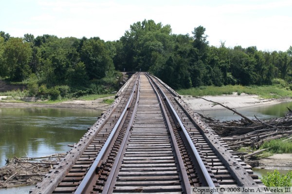
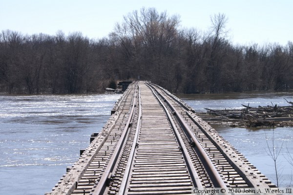
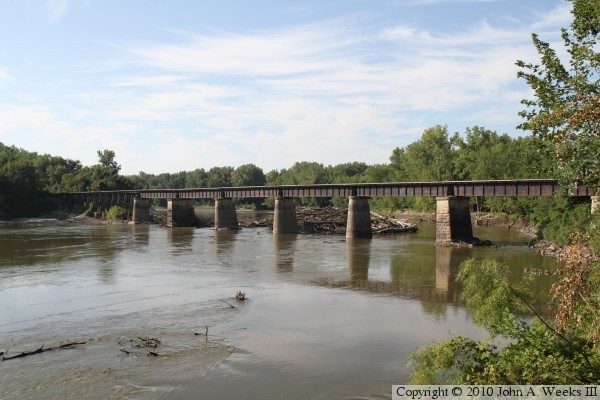
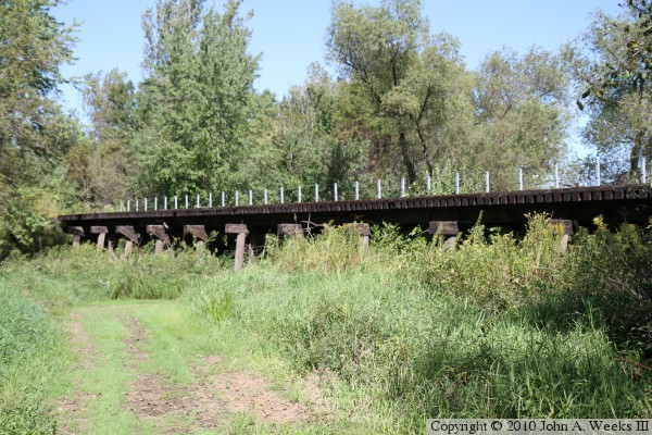
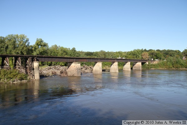
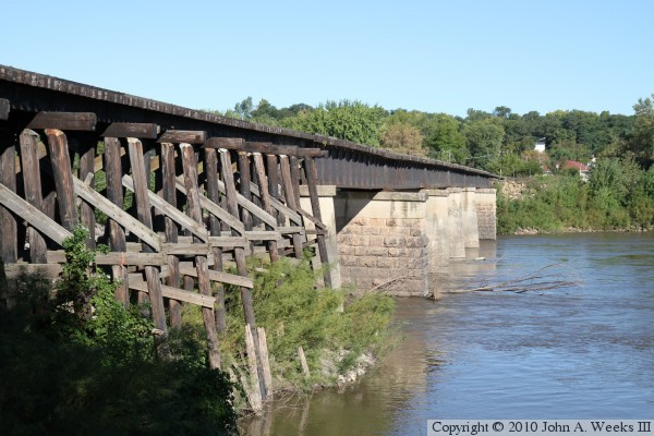
The photo above is a view looking down the length of the bridge deck towards
the southeast from the west bank of the Minnesota River.
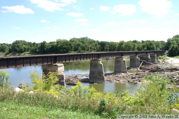
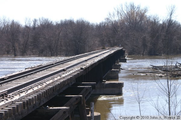
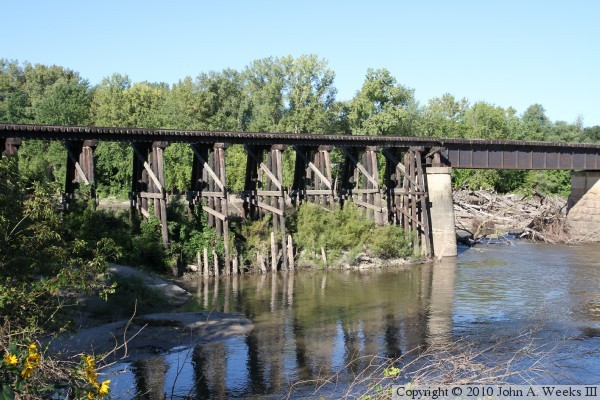
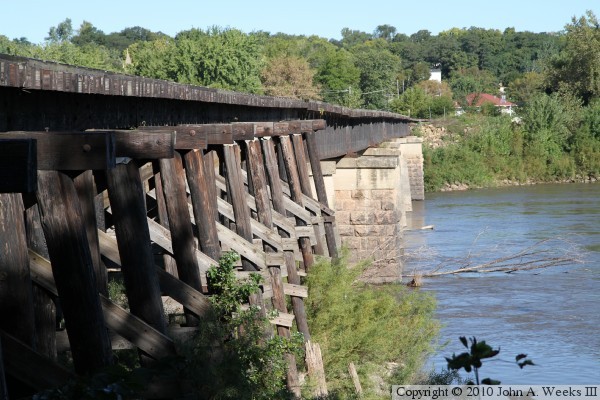
The photo above is the northwest side of the bridge as seen from about 150
feet upriver from the structure. The photo below is the northwest face
of the bridge as seen from the west riverbank.
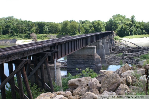

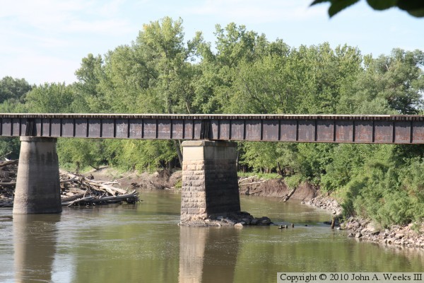
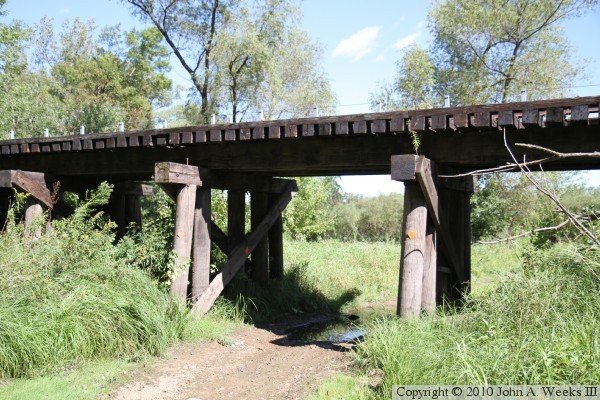
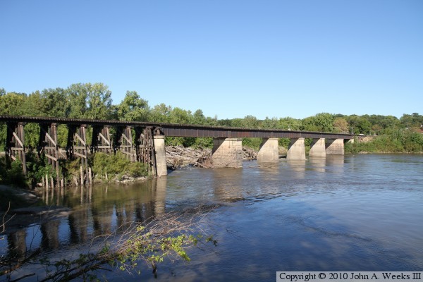
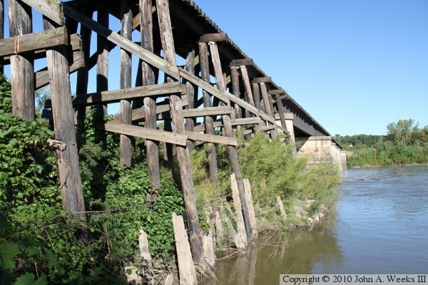
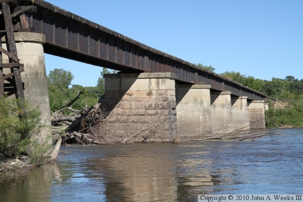
The photo above is a close view of one of the bridge piers on the northwest
end of the structure. The photo above is the northeast face of the bridge
as seen from the west bank of the Minnesota River.

These two photos, and the four that follow, are views from the spring flood
of 2010. The photo above is the deck plate girder spans at the west end
of the railroad bridge. The photo below is the trestle spans on the east
end of the bridge. The water level reached the bottom of the steel girders,
but did not overtop the bridge.

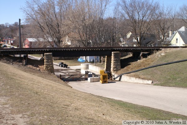
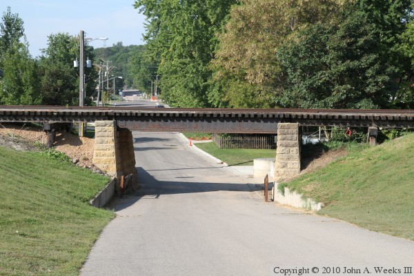
The photo above is the bridge span over Main Street in Carver. Crews were
pumping water that was accumulating in the low spot under the bridge. The
levee was built relatively recently. There was once a wood trestle located
where the levee now stands. The photo below is a detail view where the
trestle passes over the levee. It appears that dirt was simply piled in
under the trestle, leaving only the tops of the trestle bents visible.

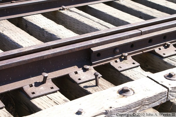
The photo above is a close view of a section of track on the bridge. Note
that most of the spikes are loose. The photo below is a plaque on the
upstream side of the trestle on the north end of the bridge. Jake Anderson
was 9 years old when he slipped and fell into the river just upstream where
Carver Creek empties into the Minnesota. His body has never been recovered
and is believed to have been trapped in the driftwood pile on the upstream
side of the bridge.

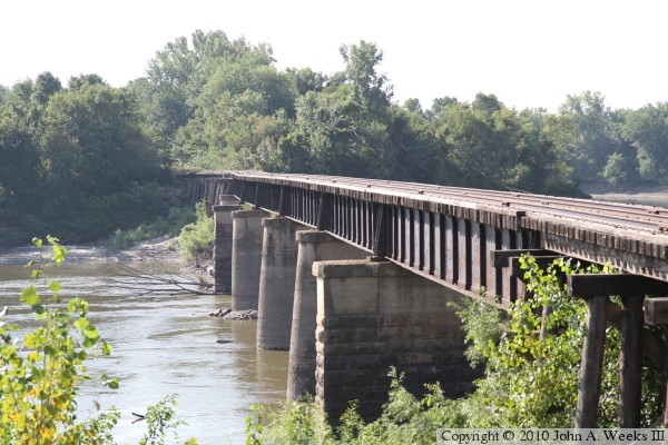
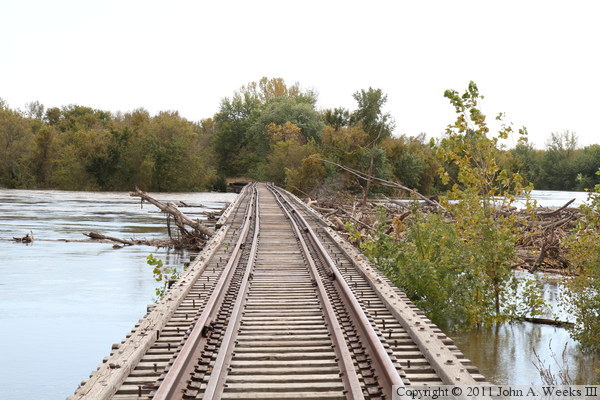
The photo above is looking southeast down the length of the bridge deck. The
photo below is looking southeast along the upriver side of the bridge. Note
that only the tops of the piers remain above water. Note that the bridge is
severely out of alignment at the far end of the structure. The last stone
pier has been shifting, resulting in the bridge no longer being straight
or level. It has been moving for years, but it appears to have moved
significantly since the bridge was abandoned. It is likely no longer safe
for a train.

After hearing that a decision on the bridge was in the works, I revisited
this bridge on a sunny but hazy morning in late August, 2010. These two
photos, and the four that follow, are from this visit. This was the first
time that I have seen the Minneapolis & Saint Louis Bridge early enough
in the morning for sun to be shining on the downriver side of the structure.
Both of these photos are looking upstream from the riverfront park in Carver.

These two photos are views looking upstream towards the east face of the
bridge, focusing on the two original 1871 piers. The photo above is the
pier on the south end of the bridge, while the photo below is the pier on
the north end of the bridge.
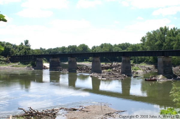
The photo above is looking south along the downstream east face of the
Minneapolis & Saint Louis Bridge. Note that the piers are out of
alignment as well as the bridge deck being crooked. The photo below is
the bridge over Main Street in carver. The trestle spans were filled in
when the flood control levees were built.
In early September, 2010, I decided to walk into the south end of the
Minneapolis & Saint Louis Bridge. There is a parking area for the
Louisiana Swamp located off of US-169 that is about 2 miles from the bridge
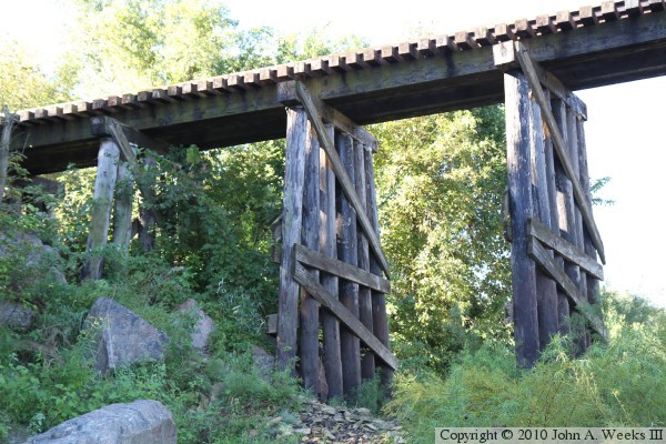
by rail, but about 3 miles using the State Corridor Trail. These two photos
are the trail passing under a trestle on the rail line half way between the
parking lot and the river bridge. The photo above is a profile view of the
trestle, while the photo below is a close view of the span over the trail.
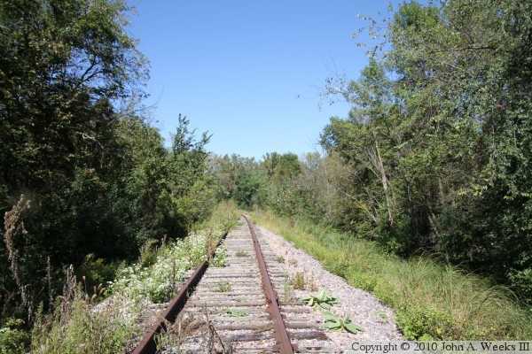
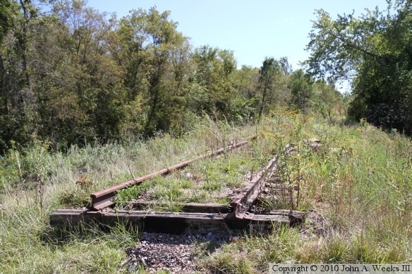
The photo above is the rail line heading north towards the river crossing.
The rails are rusty due to not being used since March, 2007, and weeds are
starting to grow up on the right of way. About 800 feet up the tracks
(8/10-mile southeast of the river crossing), I ran into a gap in the
tracks. This is the location of the trestle that failed during the high
water in 2007.

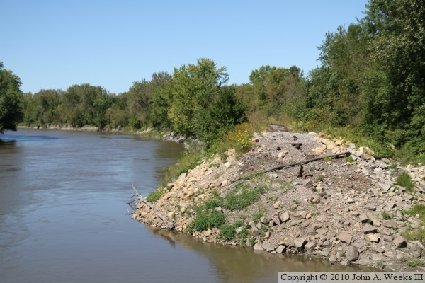
The photo above is a wider view of the accident site. The river runs along
the west side of the right-of-way. The remains of the trestle were
apparently removed when the site was cleaned up after the derailment. The
photo below is looking south where the rails end at the south end of the
failed trestle. Much of the ballast is missing between the ties, likely due
to the flood, and the rail line is pushed out of alignment, likely due to
the derailment.
Since I was not able to reach the river crossing, I turned back towards the
parking lot. Rather than walking along the trail, I decided to walk the
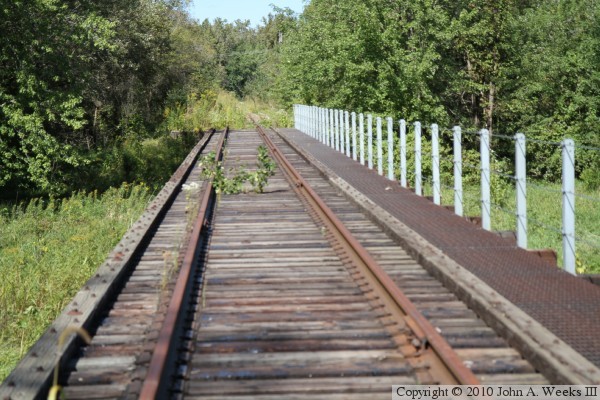
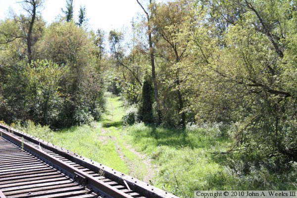
tracks since it was considerably shorter. The photo above is looking south
down the length of the deck of the trestle that crosses the State Corridor
Trail. The photo below is looking southwest down the trail from the top of
the trestle.

The spur that crosses the river at Carver joins the Union Pacific mainline
at a wye. As a result, a small section of the spur is still in use. The
photo above is where the spur is closed. The red sign marks the end. There
is also a sign with the letter D, which is indicating that there is a
derailer attached to the tracks. The derailer is hidden by the weeds. The
photo below is looking south across the wye as a Union Pacific train heads
southbound towards Mankato. The lead locomotive, #4713, is an EMD SD70M
with 4,000 horsepower. It was built in January, 2002.

The next day, I was able to walk in to the south end of the Minneapolis &
Saint Louis Bridge from a DNR parking area located 1-1/2 miles north of the
bridge site. These two photos are views looking upstream towards the east
face of the bridge from two different locations along the south bank of the
Minnesota River.
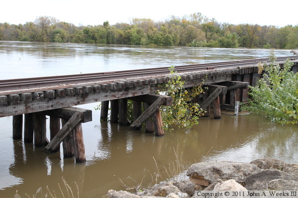
These two photos are additional views looking upstream towards the railroad
bridge from the south bank of the Minnesota River. The photo above is the
trestle section at the south end of the structure, while the photo below is
a profile view of the river crossing.
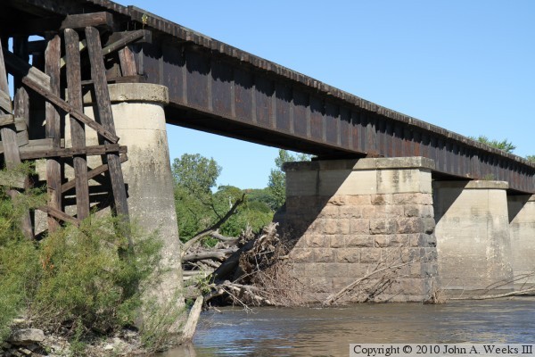
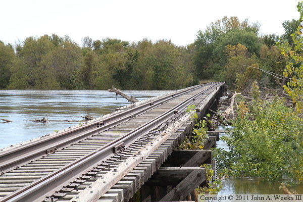
The photo above is a close view of the southernmost river span. The stone
pier is one of the two original 1871 piers. It has sifted out of alignment,
resulting in the bridge having a kink above this pier. The photo below is
looking north along the length of the bridge deck towards the city of Carver.
The bridge alignment issue is very pronounced from this vantage point.

These two photos are views looking north down the east face of the railroad
bridge. The photo above is from about halfway up the riverbank, while the
photo below is a view from about the level of the bridge deck.
These two photos are close views of the trestle section at the south end
of the river crossing. The photo above is looking north along the downriver
east side of the trestle, while the photo below is looking west towards the
east face of the trestle.

The photo above is a close view of the southernmost river span. The photo
below is looking north along the east face of the bridge from the waterline.
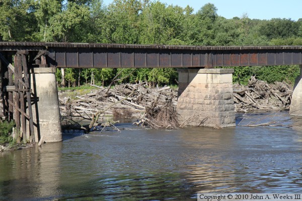
Due to the large log jam just upstream of the bridge, most of the river
current is flowing through this first span at the south end of the bridge.

The photo above is looking north along the upstream west face of the bridge.
This side of the bridge is shaded due to the bright morning sun. The log jam
located upstream of the bridge is visible in this view. It is reported that
this log jam formed due to an underwater sandbar that formed around an
abandoned pier that once supported the end of the swing span when it was in
the open position. The pier has since collapsed into the river and is not
visible. The photo below are several trestle spans near the south bridge
abutment.
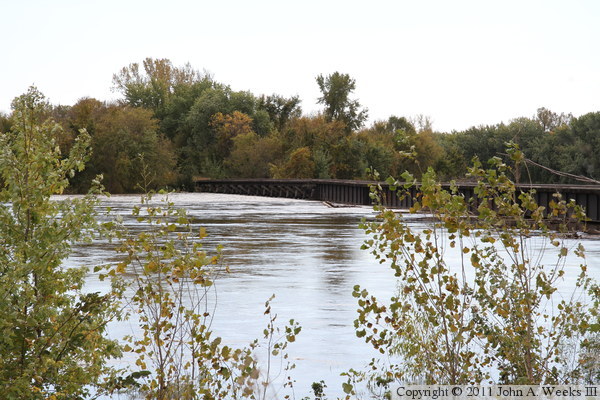
The Minnesota River flooded for a second time in 2010 after heavy rains
drenched the southeastern part of the state in September, resulting in the
river being flooded into early October. The photo above is the upstream
side of the approach trestle as seen from the levee in Carver on the north
side of the river. The photo below is looking southwest along the upstream
side of the Minneapolis & Saint Louis Bridge.
These two photos are additional views of the upstream side of the railroad
bridge at Carver during the autumn 2010 flood. The large pile of driftwood
that had built up on the sandbar just upstream of the bridge
pushed up against the bridge girders. The photo above is the steel
girder spans, while the photo below includes the trestle on the south end
of the structure.

These two photos are views looking along the downstream east side of the
railroad bridge. The water is right at the bottom of the steel girders
at the north end of the bridge, but the girders are sitting in the water
on the south end of the bridge. Some pieces of driftwood has been pushed
under the bridge and is sticking up out of the water on the downstream
side of the structure.
The photo above is looking down the center of the railroad tracks. Despite
the pressure from the water and the driftwood, the bridge does not appear to
have moved any further out of alignment. The photo below is a view of the
upstream west side of the Minneapolis & Saint Louis Bridge about ten
days after the crest of the flood. The water is still higher than normal
despite having dropped about ten feet from the crest.


These two photos are additional views of the upstream side of the bridge
ten days after the crest. These two angles give a good view of the driftwood
pile, which was pushed towards the bridge during the flood. Union Pacific
would bring out a railroad crane to clean out the driftwood every few years
when it operated the bridge. It is yet to be seen what will happen now
that the bridge is publicly owned. Scott County did bring out a backhoe
after the spring flood to remove the drift wood that it could reach, but the
pile is much larger now.
These two photos, and the six that follow, were taken in late March, 2011, as
the Minnesota River was again threatening the city of Carver for the third
time in 12 months. This flood was predicted to be even higher than the two
crests in 2010, so the city was working to raise the levee several feet
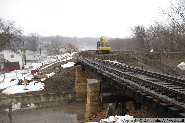
higher. The photo above is the railroad bridge over Main Street. The
abandoned railroad right-of-way would be used as a levee to protect the
city, so clay was being placed right over the tracks. The photo below is
a closer view of the track hoe that was supporting the work.


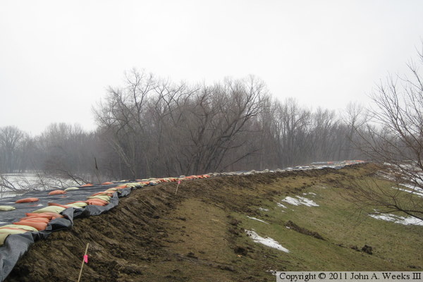
These two photos are a completed section of dike running along the river
just south of the M&StL Bridge. The photo above is the river facing
side that is covered with plastic, while the photo below is the inland
facing side that will remain exposed.
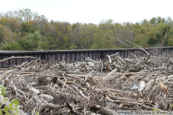
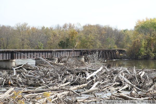
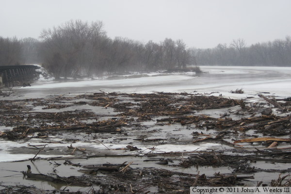
These two photos are views of the log jam area located on the upstream side
of the railroad bridge. The log jam was partially cleared during February
of 2011 when the river was covered with thick ice. Some logs still remain
piled under the bridge. Those logs will float away during the high water.
Logs and debris located below the water line was not removed due to regulations
that prohibit wood from being salvaged from the waters of the Minnesota River.
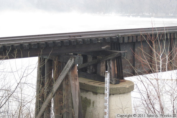
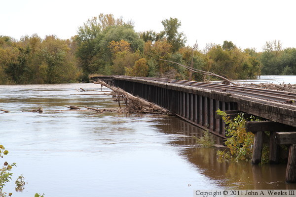
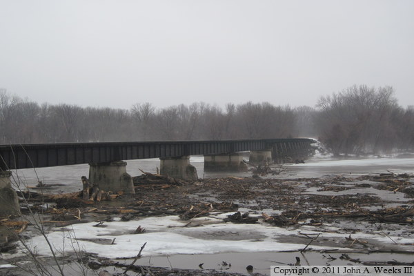
The lack of brush during the winter allows for two detail shots of the bridge
that are otherwise not possible in the summer. The photo above is the
transition from the deck plate spans to the trestle on the Carver side of
the river. Note the very short trestle bent located on top of the concrete
pier. The photo below is a view of the trestle where the trestle is partly
buried by the levee on the west end of the structure.

|
