| Highways, Byways, And Bridge Photography |
The I-35W Bridge At Night
A Look At The New I-35W Saint
Anthony Falls Bridge At Night

The new I-35W Saint Anthony Falls Bridge features an innovative lighting
system. Based on LED technology, it provides more consistent light levels and
uses 13% less energy than traditional high-pressure sodium lamps.
The bridge deck is illuminated by white LED panels mounted on 40-foot tall
poles. The light color is closer to natural light, which is a more comfortable
light color, especially for older drivers. The LED panels provide more
diffused and even light than traditional street lights, providing consistent
light levels on the bridge deck without bright and dark spots. This is the
first segment of Interstate highway in the US to be illuminated with LED
lighting.
The underside of the bridge is lit by a series of multi-color LED fixtures.
These fixtures have red, green, and blue LEDs, allowing nearly any light
color to be displayed. The computerized lighting controller can address
each light fixture individually. It has been reported that MN-DOT is not
quite sure what they plan to do with this lighting system over the long term.
The bridge design called for the bridge to be bathed in a blue glow. Two
different colors of blue have been tried. There was talk of lighting the
bridge in white, with other colors reserved for special occasions. A local
resident who lives near the the bridge reported seeing the bridge in green
for a night while the lights were being tested, and the bridge was lit up in
pink for a night in support of breast cancer awareness. On June 25, 2011,
the bridge was lit in a multicolor pattern for the Twin Cities Pride Festival.
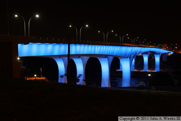
The photo above is a view of the east face of the I-35W bridge looking
north across the Mississippi River. This is perhaps the best view of the
bridge that is available. To get to this location, head towards the
Holiday Inn Metrodome, then follow the street that runs behind the parking
ramp for the hotel. There is on-street parking available. Then walk towards
the river, being careful not to fall off of the rather steep bluff at the
edge of the river.
Note—these materials are covered by copyright and may not be
used without written permission.
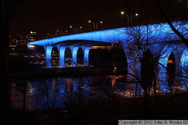
This photo is the downstream east face of the bridge looking south across
the Mississippi River. The green sign just above the far end of the bridge
is the Holiday Inn Metrodome sign mentioned in the caption above. The
vantage point is standing next to the north main pier of the 10th Avenue
Bridge, a large concrete arch bridge located just downstream from the I-35W
bridge. To get to this location, follow SE 2nd Street until you are between
these two bridges, then follow the footpath to the edge of the river bluff.
This view works best in late fall or early spring when the trees do not
have leaves.
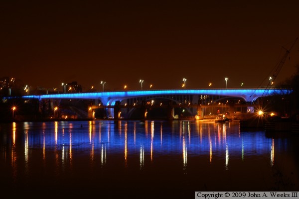
The photos above is a view of the upstream face of the bridge as
seen from Mill Ruins Park on the south bank of the river between the upper
and lower falls. The blue color of the bridge is nothing short of stunning.
It looks like something out of a science fiction movie. Adding to this
scene are the incredible reflections on the surface of the water.
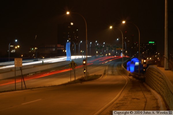
The photo above is a view looking south towards the bridge deck from the
top of the entrance ramp at University Avenue. The light blue lines are a
monument at the north end of the bridge. The deep blue light is from the
underside of the bridge structure. The green light in the background is the
Holiday Inn mentioned above. Note the two different styles of street lights.
The tall orange lights in the foreground are high pressure sodium lights.
The shorter white street lights on the bridge are the newer LED lights.
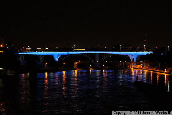
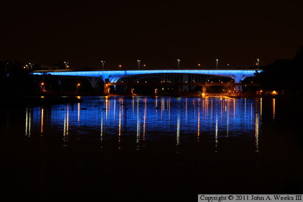
The photo above and the ten that follow are night views from July, 2011, just
days before the fourth anniversary of the bridge collapse. This view is looking
east towards the upstream face of the Saint Anthony Falls Bridge from the deck
of the Stone Arch Bridge. Since we are about 50 feet above the water, the
bridge reflection falls closer to the bridge, landing out of sight on the
downstream side of the Lower Saint Anthony Falls Lock & Dam.
This view is looking directly downstream towards the bridge from the parking
area at Mill Ruins Park. Since we are closer to the water level, we see a
much larger reflection. The reflection isn't as well defined as the 2009
photo above due to the water surface being rough on account of the high river
flow volumes. However, the vertical reflections are much more crisp because
the 2009 photo has a bit of blur, whereas this is a much sharper image.
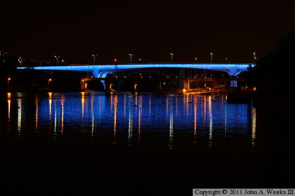
This view is looking northeast towards the bridge from the road leading into
the upstream side of the Lower Saint Anthony Falls Lock & Dam. Note that
main bridge pier on the left side of the photo is less obscured by the dam
structure, and we cannot see into the boat lock as we can in the photo above.
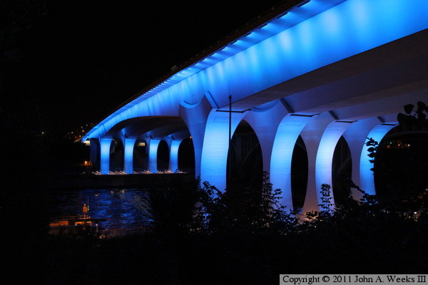
This view is looking north across the Mississippi River along the upstream
west face of the Saint Anthony Falls Bridge. The vantage point is the bicycle
trail running along the edge of the West River Parkway. Note that we don't
see the lights on the bridge deck in this view. The deck lights run along
the center of the bridge, so they are hidden from view from this angle.
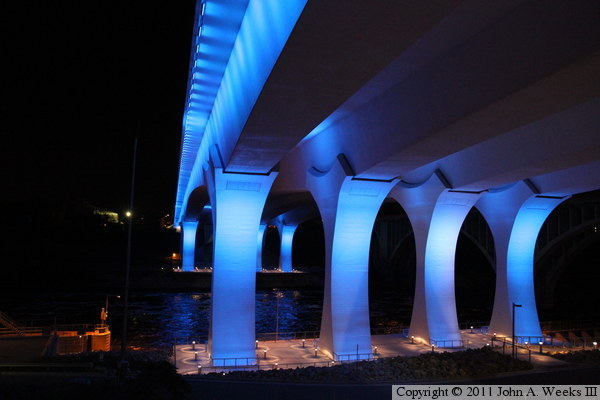
This is another view from the trail running along the West River Parkway.
This view is looking north across the river from just under the upstream
edge of the bridge. The observation deck under the bridge piers is open
24 hours a day and is well lit at night. The structure in the water just
upstream of the bridge is a wall at the downstream exit of the boat lock
at the Lower Saint Anthony Falls Lock & Dam.

This view is looking north across the Mississippi River from just downstream
of the Saint Anthony Falls Bridge. The observation deck is hidden by the
entrance road to the lock & dam. The street lights at the far right
side of the photo are on the nearby 10th Avenue Bridge, which is not lit up
at night.
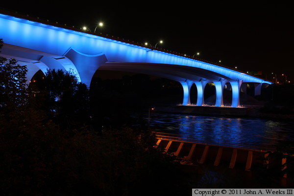
This is another view looking north across the Mississippi River from just
downstream of the Saint Anthony Falls Bridge. The vantage point is the
riverfront trail as it passes under the nearby 10th Avenue Bridge. This
location gives us a good view of the main bridge span, but unfortunately,
there is a tree blocking the view of the south main bridge piers.
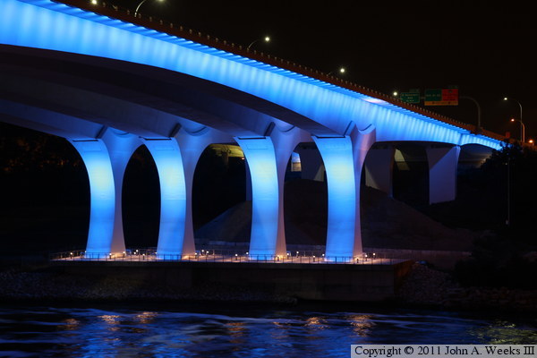
This photo is a closer view of the main bridge piers on the north side of
the Mississippi River. While it is somewhat hard to see in this photo, there
is a large pile of sand and gravel being stored under the bridge just behind
the main bridge piers. This is presumably part of storm drain construction
project in the river flats area.
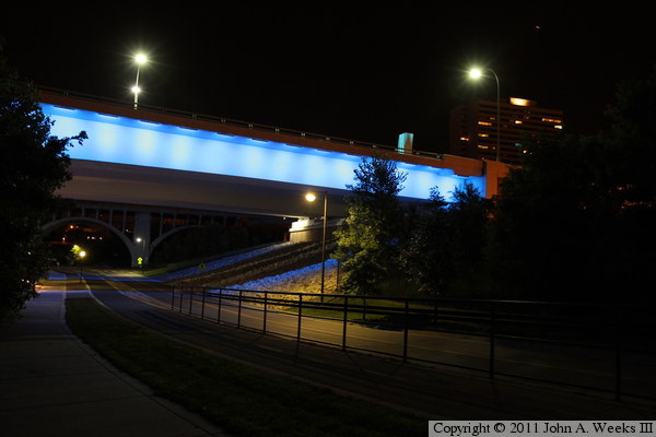
This photo is the bridge span over the West River Parkway. Two smaller arch
spans of the 10th Avenue Bridge are visible in the background just behind
the I-35W Bridge.
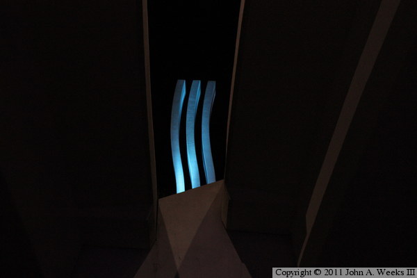
This photo is looking upwards and to the south between the two bridge spans
towards the monument at the south end of the bridge. This monument is made
out of a photocatalytic concrete that removes carbon monoxide, nitrous oxides,
and sulfur dioxide from the air. It is illuminated with a slightly different
color blue than the rest of the bridge.
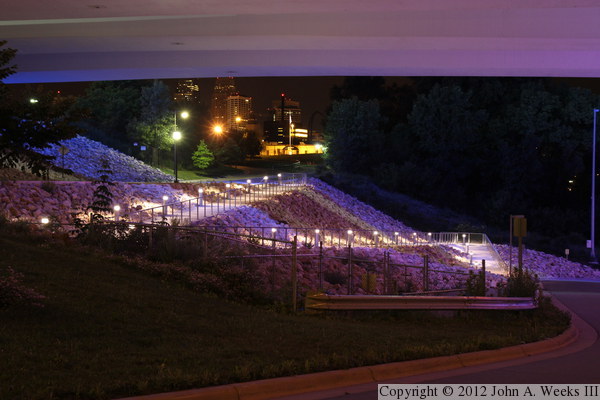
The photo above is the walkway leading from West River Parkway down to
the south observation deck. Specifically, it is the upper three segments
of the walkway from the path running along the north side of the parkway
down to the entrance road to the Lower Saint Anthony Falls Lock & Dam.
There is a nice view of downtown Minneapolis in the background between
the trees where the street goes up the hill and past the Centerpoint Energy
facility.
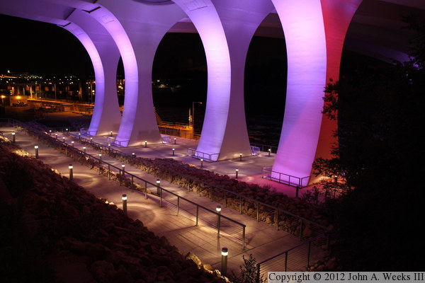
This photo is a view of the lower section of the walkway leading from the
Lock & Dam entrance road down to the south observation deck, as well as
the the observation deck itself. The bridge piers are lit up in purple as
part of the annual Twin Cities Pride Festival.
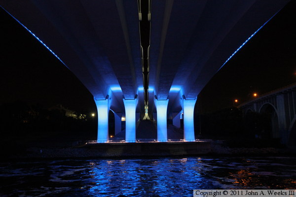
This view is looking directly across the Mississippi River from the observation
deck under the bridge piers. The observation deck on the north side of the
river is not formally open to the public, however, access to the river flats
area is allowed. The reflection in the water is from the bridge piers given
that the underside of the bridge is not illuminated. Note that the monument
on the north side of the river is just barely visible between the two
bridge spans.
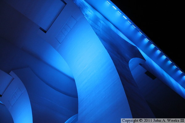
This view is looking up towards the saddle at the top of a main bridge pier.
Since the bridge sits on top of the center of the pier, the saddle is
a decorative feature. There are access doors on the saddles to allow access
to the top of the bridge piers for inspections and maintenance. Note the LED
lighting strips that run along the edge of the bridge deck.
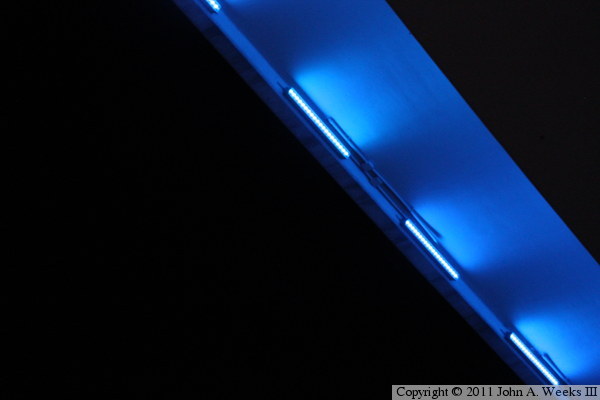
The photo above shows the LED lighting panels that run along the edge of the
bridge deck. This photo is looking straight up, so the blue area that is lit
up actually slopes back towards the ground. That is difficult to visualize
without having any reference points in the background.

This photo shows three LED light panels at the base of a main bridge
pier. While it is a little hard to see, only every third LED bulb is turned
on. These are multicolor panels, so only the blue bulbs are in use, the red
and green bulbs are turned off.
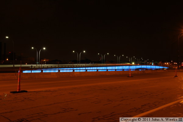
This photo is looking northwest across the deck of the nearby 10th Avenue
Bridge towards the Saint Anthony Falls Bridge. This photo didn't turn out
as well as I was expecting. When viewing this in person, your brain tends
to fill in the parts of the scene that you cannot see, and your eyes change
focal length to pull the far end of the bridge in closer. A camera, however,
only shows what was really there. The red streak on the guardrail is an
automobile taillight. It is too bad that there isn't a walkway on the
upriver side of the 10th Avenue Bridge.
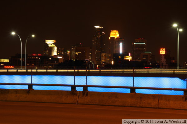
This view is also looking across the deck of the 10th Avenue Bridge, but
in this case, we are looking southwest towards downtown Minneapolis. The
cluster of tall buildings in the center includes the Capella Tower, IDS
Tower, and Wells Fargo Place. The two green horizontal lights are on the
5th Street Towers, while the two vertical lights are the Guthrie Theater.
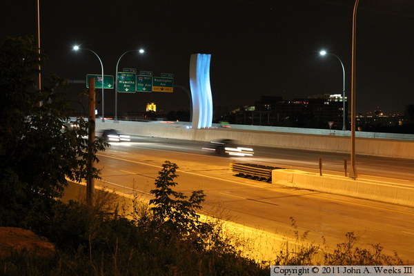
This is the monument at the north end of the Saint Anthony Falls Bridge. The
northbound lanes are on the near side of the bridge, with the exit ramp leading
up to 4th Avenue. The vantage point is the vacant lot between the I-35W
Bridge and the 10th Avenue Bridge that was once the site of a Hardees
restaurant.

The photo above is a view looking south from the 4th Avenue overpass just
north of the Saint Anthony Falls Bridge. The southbound traffic lanes are
on the right side of the bridge. The photo above uses a faster lens with
a shorter exposure time to show the vehicles on the bridge.
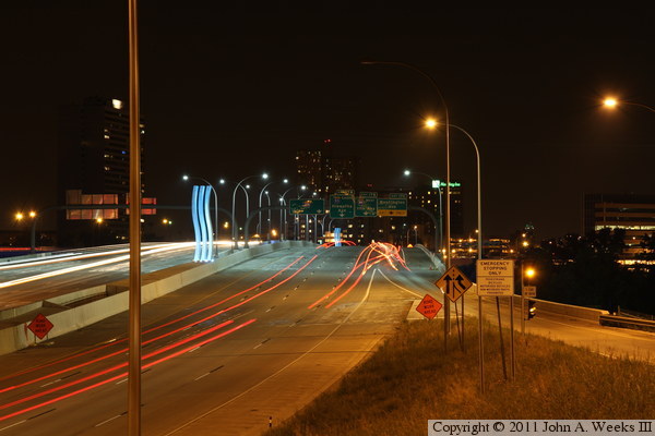
This photo is the same view as the photo directly above, but uses a slower
lens with a high F-stop settings and a long exposure time. We no longer see
the vehicles, but we do see the trails left by their taillights.
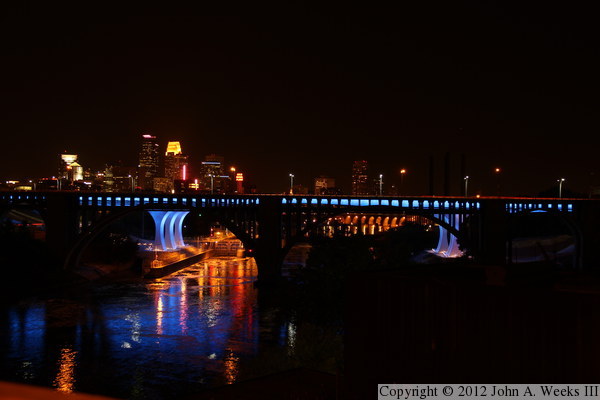
This is a view of the I-35W bridge site looking upstream to the west from the
deck of Northern Pacific Bridge #9, a spectacular old railroad bridge that has
been converted into a bicycle path bridge. Not only do we have a great view
of downtown Minneapolis, but we can see parts of 5 different Mississippi River
bridges as well as two lock and structures. Heading upstream, we see (1) the
railing from Bridge #9 in the lower left, (2) the 10th Avenue Bridge (the
black arch bridge in front of the I-35W bridge, (3) the I-35W bridge lit
up in blue, (4) the Stone Arch bridge (under the right main arch of the 10th
Avenue bridge, and (5) the lights at the top of the towers on the Hennepin
Avenue Bridge (the two lights in the sky above the I-35W pier on the right
side of the photo). We also see the lock of the Lower Saint Anthony Falls
Lock & Dam under the left main bridge arch of the 10th Avenue Bridge,
and lights from the lock at the Upper Saint Anthony Falls Lock & Dam
(very hard to see in this small sized photo).
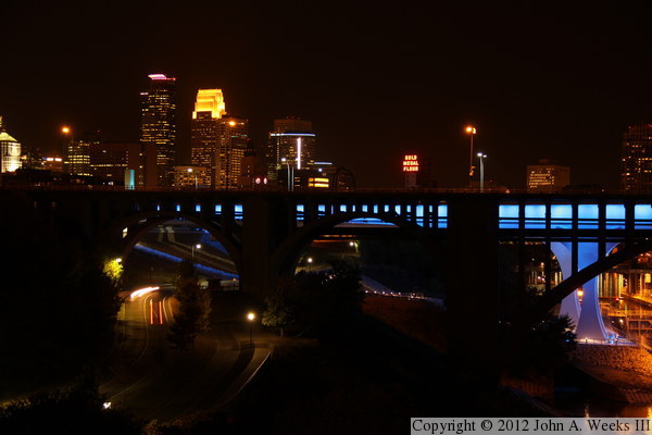
This is another view from the deck of Northern Pacific Bridge #9 looking
upstream towards the I-35W Saint Anthony Falls Bridge. In this photo, we
are looking at the south approach span of the bridge, with the south main
bridge piers near the right side of the image. Two landmarks that are visible
are the Guthrie Theater (the vertical line of light) and the Gold Medal
Flower sign (in the center of the photo).
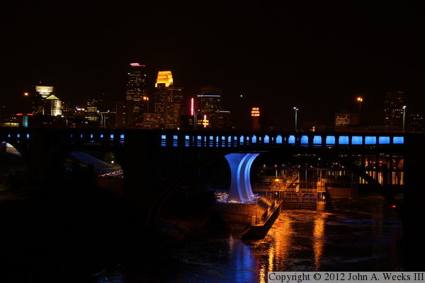
This is another view from the deck of Northern Pacific Bridge #9 looking
upstream towards the I-35W Saint Anthony Falls Bridge. This photo is
centered on the south main bridge piers. It gives a great night view
of the boat lock at the Lower Saint Anthony Falls Lock & Dam.
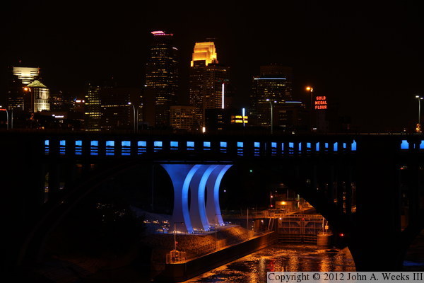
This is another view from the deck of Northern Pacific Bridge #9 looking
upstream towards the I-35W Saint Anthony Falls Bridge. This is a closer
view of the south main bridge piers as seen from a little further north
on the deck of the Northern Pacific Bridge #9. This angle gives us the
best view of the downtown skyline, centering it right above the bridge
piers. The photo is a bit of a compromise. In order to really bring up
the city lights, it would overexpose the bridge lights making them white
rather than blue. As a result, many photographers would use HDR (high
dynamic range) processing to merge parts photos with different
exposures into a single image.
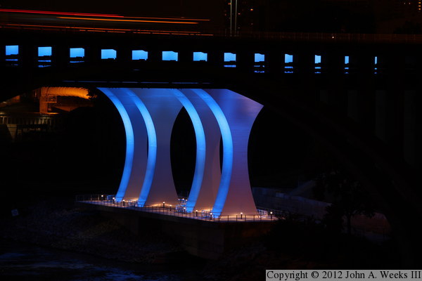
This is another view from the deck of Northern Pacific Bridge #9 looking
upstream towards the I-35W Saint Anthony Falls Bridge. This photo is
centered on the north main bridge piers. There is an observation deck
built at the base of these piers, but the deck is fenced off and not open
to the public yet as of the spring of 2012.
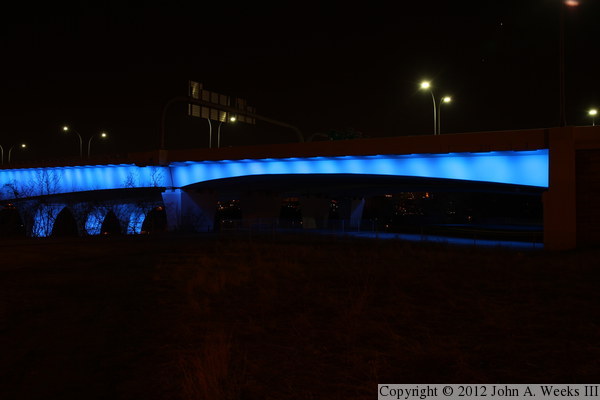
This photo is the downstream side of the secondary span at the north end
of the I-35W Saint Anthony Falls Bridge. This span crosses an old railroad
yard. There is still a single track the runs under the bridge, but it is
rarely used and dead ends just west of the structure. A paved access road
for the University of Minnesota also passes under this span. That road
is marked for U of M vehicles only, but it is heavily used by bicycle traffic
and students on foot.
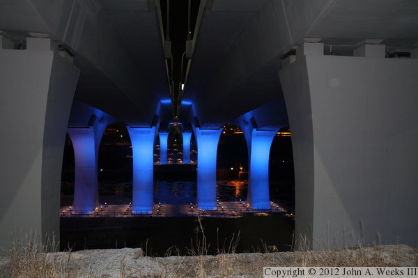
This photo is looking south across the Mississippi River under the I-35W
bridge. The vantage point is the U of M access road mentioned in the previous
caption above, standing directly under the gap between the two bridge spans.
This photo uses a fill-in flash to light up the dark area in the foreground,
allowing us to see the smaller secondary piers at the north end of the
bridge. We also see the top of the wall running along the edge of the
river bluff. This wall is part of the abutment of the long since dismantled
Minneapolis Western Railroad Bridge over the Mississippi River. The
abutment was situated facing west since the approach tracks were parallel
to the river. The bridge then made a 45 degree curve and crossed the river
on a diagonal path.
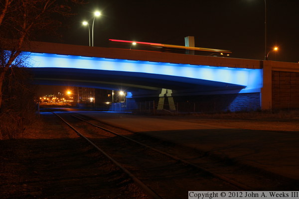
This is another view of the secondary span at the north end of the I-35W
bridge. The north bridge abutment is on the right side of the photo. The
red and orange streaks of light is a bus crossing the bridge. The white
block above the streaks is the top of the bridge monument located above
the bridge deck between the two bridge spans. We can see the remaining
railroad track in this former railroad yard, as well as the U of M service
road.
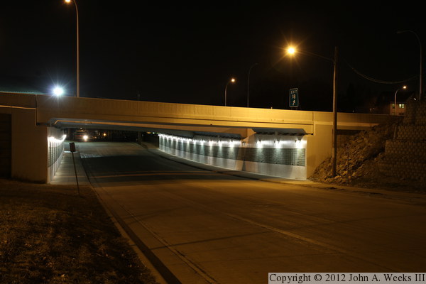
This photo is the bridge that crosses SE 2nd Street, located just north of
the north abutment of the I-35W Saint Anthony Falls Bridge. This bridge
was built at the same time as the new I-35W bridge. Since it is wider than
it is long, it actually qualifies as being a tunnel. The walls of the
tunnel feature tiles made of recycled glass. These tiles were made by
groups of students from Twin Cities area schools. Plaques on the wall
identify the schools that were involved in this project.

This is a view looking north towards the north bridge abutment while standing
under the structure directly between the two bridge spans. The three
curved blue lines at the center is the north bridge monument. It is made
out of a type of photocatalytic concrete that works with ultraviolet sunlight
to break down carbon monoxide, nitrous oxides, and sulfur dioxide, the major
contributors to smog. This is the first known use of this type of concrete
in the United States.
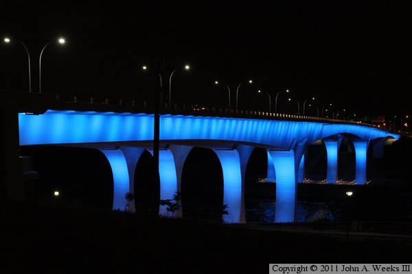
The photo above is an attempt to recreate the photo at the very top of this
page. I was not able to get the guard rail to light up in this attempt as
it is on the 2009 photo. The light on the guard rail comes from cars.
There wasn't as much traffic during this visit, and attempts to leave the
exposure open long enough for a car to travel far enough to light much of
the guard rail left the bridge over-exposed.
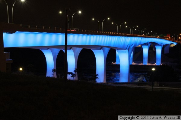
The photo above is another attempt with a slower lens and a longer exposure.
About one-third of the railing is lit up. As it turns out, the 2009 photo
was from November when it gets dark early, and it was taken at the tail end
of rush hour when there was a lot of traffic. These photos are form the
middle of summer, so they were taken about midnight where there was very little
traffic. The photo below is a final attempt using ISO 100 and a very long
exposure. It is a much sharper photo than the two attempts above, and the
street lights are not chopped off like the photo above.
|

