Marseilles Canal
Illinois River Canal
Marseilles, IL

Marseilles Canal

• Structure: Marseilles Canal
• Location: River Mile 244.3 To 247.0
• Structure Length: 2.7 Miles
• Structure Width: 225 Feet (Average)
• River Elevation: 483 Feet
• Date Built: Mid-1920s
The Marseilles Canal was built in the 1920s by the US Army Corps of Engineers to provide a boat and barge bypass around a major rapids near the city of Marseilles, Illinois. The canal is 2.7 miles long. It is a minimum of 225 feet wide, and has a wider pool area near the Marseilles Lock on the west end of the canal. The Lock was opened in 1933 with the completion of the 9-foot navigation project. The lock keeps the canal water level at 483 feet above sea level, despite the river being 24 feet lower at 459 feet.

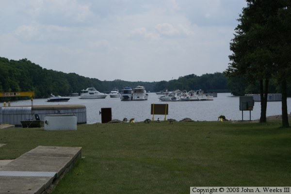
The photo above is looking east upstream into the canal from the Marseilles Lock. The boats are in line waiting to lock through. There is a line due to a large barge tow that tied up the lock for over an hour.

Home  Return To Illinois River Structures Home Page
Photo and text by John A. Weeks III, Copyright © 2007, all rights reserved.
For further information, contact: john@johnweeks.com