| Highways, Byways, And Bridge Photography |
Lewis Street Bridge
CSAH-101 Minnesota River Crossing
Shakopee, MN
|
• Structure ID: |
NBI: 70002. |
|
• Location: |
River Mile 26.9. |
|
• River Elevation: |
693 Feet. |
|
• Highway: |
CSAH-101. |
|
• Daily Traffic Count: |
19,500 (1996). |
|
• Bridge Type: |
Concrete Girder. |
|
• Length: |
815 Feet. |
|
• Width: |
75 Feet, 4 Lanes. |
|
• Navigation Channel Width: |
Non-Navigable. |
|
• Height Above Water: |
18 Feet. |
|
• Date Built: |
Opened 1993. |
The Lewis Street Bridge crossing the Minnesota River in Shakopee was built
just downstream of the old Holmes Street Bridge. The old bridge remains in
place as a regional trail crossing. I wasn't aware that this bridge had a
name until I saw MN-DOT referring to it as the Lewis Street Bridge during
the fall flood of 2010.
This area was once the Minnesota River crossing for US-169. US-169 now
bypasses Shakopee and crosses the river on the new Bloomington Ferry Bridge.
MN-101 also used this crossing, but the state turned this section of MN-101
back to Scott county. MN-DOT wanted to turn back the section of MN-101 in
Carver County south of old US-212, which is about 2 miles north of the river,
but Carver County refused to accept the change. As a result, the new bridge
and the causeway north to the Scott/Carver county line is CSAH-101, but the
causeway north of the county line is still MN-101. Minnesota has two tiers
of county road, the higher class is known as a County State Aid Highway.
These roads are nearly as good as a state highway.
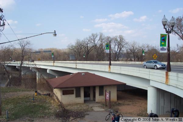
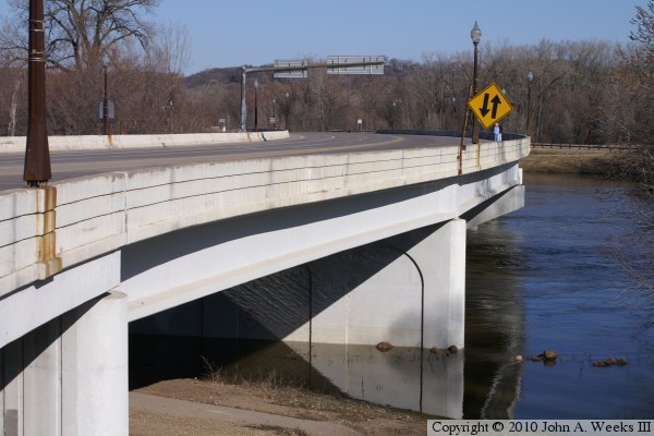
The bridge is a rather graceful concrete girder structure. It is dressed up
with antique style lighting, decorative lines cast into the concrete, and it
features a curved deck. The bridge uses the new style solid guardrails. This
helps keep debris and runoff contained and prevents it from being thrown into
the river by snowplows.
This river crossing has been closed periodically due to flooding. The largest
flood was in 1965. Other notable flood years include 1991, 1993, 2001, and
2010. While the bridge itself is built to withstand very high water levels,
the causeway north of the bridge is only a few feet above normal water levels.
The water has been as high as 20 feet over the road in past floods.
The photo above is a view from the southwest corner of the bridge looking
to the north.
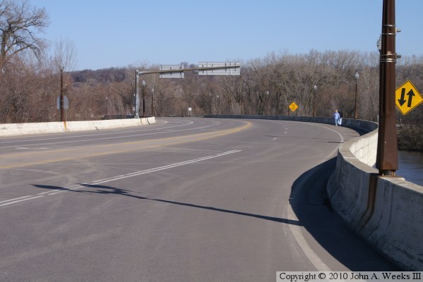
The photo above is looking north down the length of the bridge deck while the
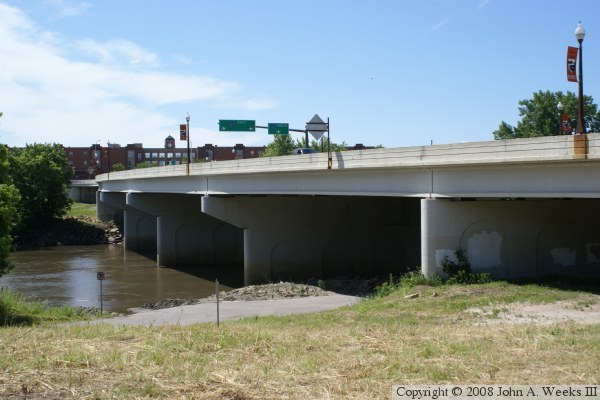
bridge was closed during the spring flood of 2010. The photo below is a view
from the northeast corner of the bridge looking to the south. Note that the
overland piers are of a different style than the mid-river piers. The later
feature a T-shape, while the overland piers are straight on their sides. At
the same time, both piers feature an indented arch, which reflects the design
of the piers on the old bridge located just upstream.
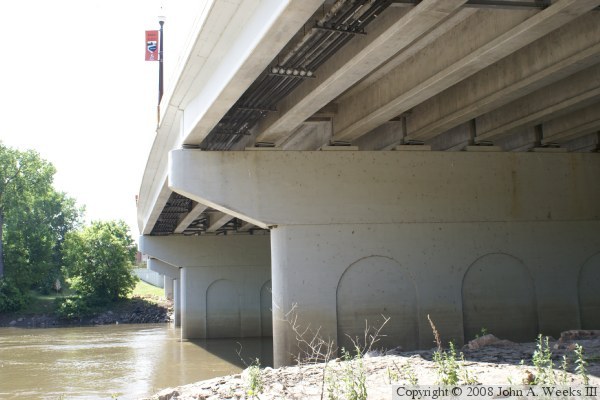
The photo above is a view looking south from the river level under the
bridge on the north side of the main river channel. The photo below is
a view of the south bridge portal looking to the north.
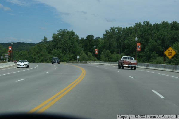
The photo above is a view from traffic level while crossing the Minnesota
River heading northbound. The photo below is a view looking northeast
at the west face of the bridge while the area between the new and old
bridges was being redeveloped into a riverfront park.
These two photos are views from the spring flood of 2010. The photo above
is looking north across the main channel of the Minnesota River along the
downriver east side of the Shakopee Bridge. The photo below is the downriver
east side of the bridge as seen from the DNR parking area on the north
side of the main river channel. The boat landing and the road that runs
under the bridge are under many feet of water.

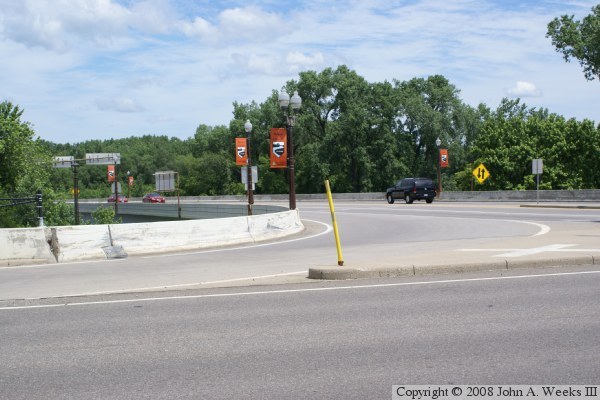
These two photos are additional views from the spring flood of 2010. The
photo above is the road block set up my MN-DOT to prevent vehicles from
attempting to cross the MN-101 causeway. The bridge was blocked in Shakopee,
so this is a second layer of road blocks when traveling northbound. The
photo below shows water crossing the highway. The water has already dropped
about 5 feet since the crest. There was enough damage caused to the highway
to keep it closed for several weeks while repairs were being completed.

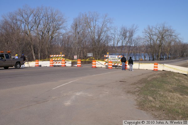
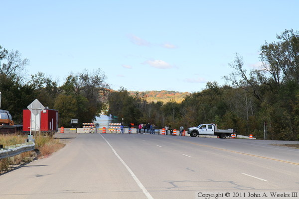
Here we go again. It is October 2, 2010, and the highway MN-101 Lewis Street
Bridge is closed for a second time in one calendar year due to flooding.
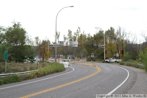
The photo above is the barricades at the south end of the bridge in the city
of Shakopee. The photo below is looking south from near the north end of
the bridge. Many people turned out on this fantastic autumn day to look
at the high water.

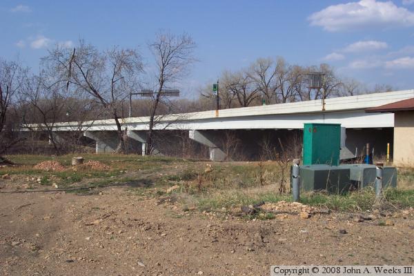
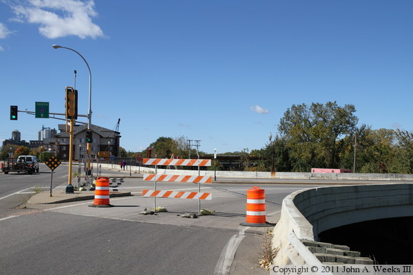
The photo above is the bridge spans at the south end of the bridge. These
spans are usually dry, with the river channel being just beyond the trees.
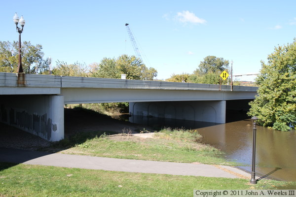
The photo below is looking north along the downstream side of the Lewis
Street Bridge. The bridge does not have a walkway, so pedestrian traffic
is normally not allowed on the structure.

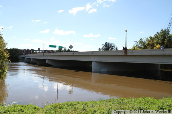
The photo below is the downstream side of the bridge as seen from the DNR
boat landing on the north side of the Minnesota River. The first bridge
span is normally dry given that a roadway passes between the grass in the
foreground and the tree visible on the left edge of the photo. The photo
below is the scene on the causeway north of the bridge. A crew from MN-DOT
is monitoring the flood and answering a myriad of questions from the
spectators.

The photo below is a closer view of the flooded causeway. This water level
is within a few inches of the crest, noting that the water rose up to touch
the very bottom of the highway sign marking the water level of two record
floods in 1965 and 2001. The photo below is the north end of the causeway,
where another MN-DOT crew is monitoring the situation. Here, Police had
the roadway blocked off to prevent any spectators from getting close.
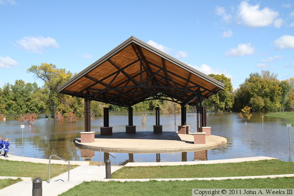
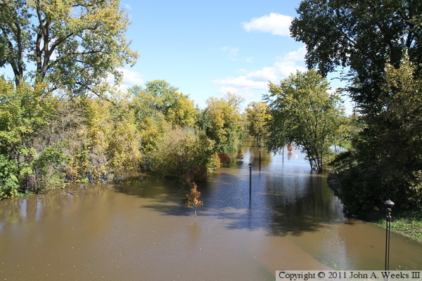
These two photos are views of the riverfront park in Shakopee. The photo
above is a small amphitheater, which now features a moat where the first row
of seating is located. The photo below is looking east along the submerged
riverfront trail on the south side of the river. The trail follows the
left side of the lamp posts.
|
