Current Weather Conditions
John A. Weeks III
Sunday, September 24, 2023, 8:40:10 AM CDT
Home Photo Tours Rail Fan 12 Easy Steps
Aviation Spacecraft Highways & Bridges About The Author
 
Google Search
Maps   Groups   Images   Search
 
  Home
  • 12 Easy Steps
  • Aviation
  • Spacecraft
  • Highways & Bridges
    » Bridge Photography
      - MSP River Bridges
      - C & D Canal
      - Illinois River
        › Joliet - La Salle
          · Dresden Island L&D
          · EJ&E Railroad Br
          · Morris Bridge
          · Seneca Rail Bridge
          · Seneca Bridge
          · Marseilles Dam
          · Marseilles Bridge
          · Marseilles Mill Ruins
          · Marseilles Canal
          · Marseilles Lock
          · Veterans Memorial Br
          · Ottawa Rail Bridge
          · Starved Rock L&D
          · Utica Bridge
          · Abraham Lincoln Br
          · La Salle Rail Bridge
          · Shippingsport Bridge
        › Peru - Peoria
        › Pekin - Beardstown
        › LaGrange - Grafton
      - Minnehaha Creek
      - Minnesota River
      - Mississippi River
      - Missouri River
      - St. Croix River
      - St. Louis River
      - Wisconsin River
      - Best Miss River Photos
      - Cable Stayed Bridges
      - McGilvray Road Bridges
      - I-35W Bridge Disaster
      - Miscellaneous Bridges
      - Madison County Bridges
      - Hist Br Weekend 2013
    » Road Geek Topics
  • Photo Tours
  • Rail Fan
  • About The Author
 
Site Search By JRank
Highways, Byways, And Bridge Photography
Starved Rock Lock & Dam
Illinois River Lock & Dam
Utica, IL

Starved Rock Lock & Dam

• Structure: Starved Rock Lock & Dam
• Location: River Mile 231.0
• Structure Width: 1,429 Feet
• River Elevation (Pool): 459 Feet
• River Elevation (Outflow): 440 Feet
• Water Fall: 19 Feet
• Annual Lock Traffic: 5,212 Vessels, 22,070,000 Tons (2005)
• Date Built: 1933
The Starved Rock Lock & Dam is one of five original navigation lock and dam structures that are part of the Illinois Waterway, and one of three that are on the Illinois River. When built in 1933, it was the southernmost lock and dam on the waterway. The river drops only 20 feet between the downriver side of the dam and the confluence of the Illinois River and the Mississippi River just above Alton. The US Army Corps of Engineers found that the average year around water depth was a little low for navigation traffic, two additional lock and dam structures were built in the late 1930s, at Peoria and Lagrange, plus Lock & Dam #26 on the Mississippi helped raise the water level in the lower Illinois River.

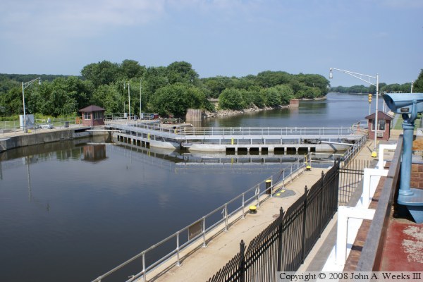
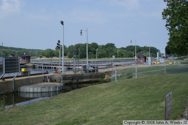
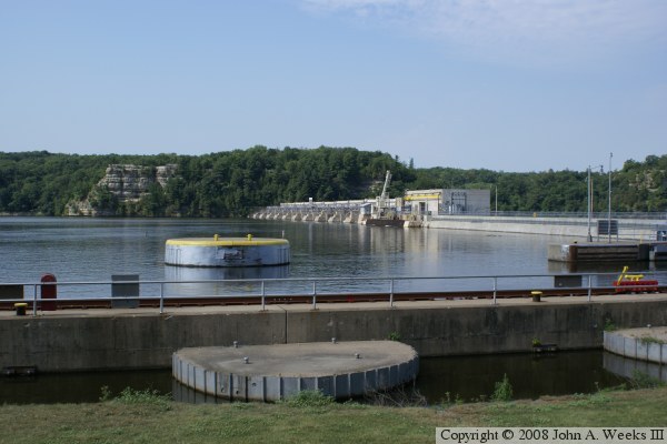
The lock and dam features a standard sized 600 foot long by 110 foot wide lock that raises or lowers boats by 19 feet. Called a Panamax lock, this is the same size lock used on the Panama canal, and it was widely adopted for lock and dam projects of that era. Today, many tows are larger than what a Panamax lock can handle, so tows often have to be broken up and locked in two sections.

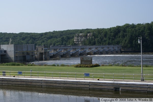
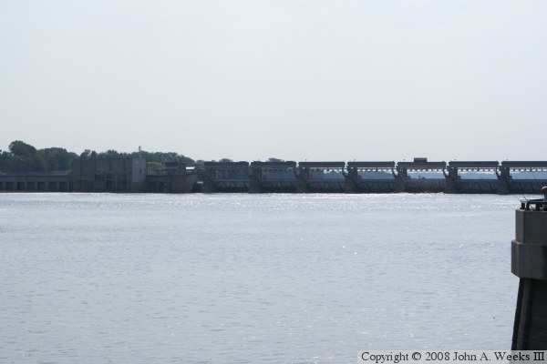
The dam structure is about 1300 feet wide. It features a series of Tainter gates that hold the river water back behind the dam. Tainter gates are large sheets of metal that are balanced by a counterweight. They are easy to move and adjust despite their weight and the force of the water. The dam also features a small hydro-electric plant. It was built with 4 generators. One generator failed shortly after the plant went on-line. As a result, today it is operated with only 2 generators active at one time.

There is a lot of tourist activities in the area. The south side of the river features Starved Rock State Park, which is one of the gems of the Illinois State Park system. The park offers views of both the Utica Bridge and the Lock & Dam. Starved Rock is the highlight of the park. Legend has it that a band of natives were being pursued by another group of unfriendly natives. The first group took refuge on the top of the rock. They ended up starving to death rather than giving themselves up.

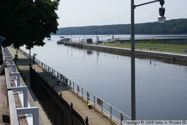
The north side of the river has the I&M Canal, the Illinois Waterway Visitor Center, and the historic downtowns of Utica and Ottawa. The waterway visitor center has a second floor balcony that gives an excellent vantage point to watch navigation traffic locking through the Starved Rock Lock & Dam.


Starved Rock Lock & Dam

Made With Macintosh
Authored by John A. Weeks III, Copyright © 1996—2016, all rights reserved.
For further information, contact: john@johnweeks.com