This is a little known metro area bridge due to it being well off of
the beaten track and hidden by trees. The bridge is located close to
the Saint Paul Police Impound Yard, but you cannot see it from there.
It is also located close to the Saint Paul Airport, but you cannot see it
from there, either, unless you go through the gate and drive along the
perimeter road to the south tip of the airport property. It is located
right next to the Pigs Eye Water Treatment Plant, but in an area that is
off limits since 9/11, so you cannot see it from there, either. You can
catch a glimpse of the truss section from Concord Ave, but you cannot
see the main swing span from that vantage point.
It turns out that there is one pretty good vantage point to view the
bridge from 2 miles away at the top of the hill at Mounds Park. It
takes a long telephoto, however, to photograph it from that location.
That view looks directly over the downtown Saint Paul airport and down
the river channel.
As it turns out, the land just south of the swing bridge is an old
landfill that was improperly closed. The city of South Saint Paul ran
a project in the mid-2000s to strip the trees and cap the landfill with
clay. That will protect the groundwater from future contamination. The
resulting area will be a large park. The trees were cut down in the fall
of 2006, resulting a great vantage point to see the bridge from a regional
trail overpass that crosses both Concord Ave and the Union Pacific rail yard.
After the park opened in 2008, a trail along the river now provides a
great view of the bridge. The photo at the top of the page was taken
from this trail.
This bridge was built by the Saint Paul Bridge and Terminal Company.
It was purchased by the Chicago Great Western Railway, which
became part of the Chicago & North Western, which merged into
the Union Pacific Railroad. As a result, the bridge has a number
of common names. These include the Saint Paul Bridge and Terminal
Railway Bridge, CGW Bridge, C&NW Bridge, UPRR Bridge, the
Beltline Bridge, and the Hoffman Bridge. The original 1910 structure has
been rebuilt several times, the most recent time in 1982.
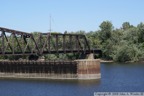
The photo above is a close view of the swing span taken from the new
park located along the edge of the Mississippi River. This is the
northernmost swing span remaining on the Mississippi River. It has
only one navigation channel, whereas the Rock Island Bridge swing
span just downriver has 2 navigation channels. The photo below is
a close view of the truss span and deck girder span on the east side
of the river crossing.
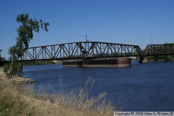
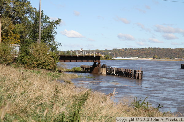
The photo above is a view from the edge of the railroad property. The
photo below is another view from the edge of the river. The wood
barricades near the bridge were installed to prevent barges from hitting
the bridge or its foundation.
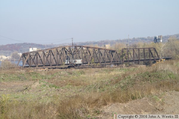
The photo above is a 2007 view from the regional trail overpass that
crosses over Concord Street. The trees have been removed, but cap has
not yet been placed on the landfill. The photo below is a view of the
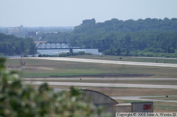
bridge from Mounds Park. This view looks across the downtown Saint Paul
Holman Field airport. Notice the dense grove of trees on the right side
of the river. Those are the trees that were cut as part of the landfill
restoration project.
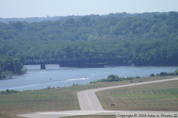
The photo above is another view from Mounds Park. The bridge is over
2 miles from the park. In this view, we see a train crossing the bridge.
We also have an excellent view that shows just how dense the growth of
trees was along the edge of the river. The photo below happened to
catch a business jet on final approach to landing at Holman Field. The
river makes a bend that wraps 2/3 of the way around the airport.
These two photos, and the two that follow, are from early summer of 2011 when
the Mississippi River was at a high water level. The photo above shows
the main swing span and the truss span on the east side of the river
crossing. The photo below is the deck plate girder span on the west side
of the river crossing.
These two photos are additional views from summer of 2011 when the Mississippi
River was at a high water level. The photo above is looking northeast towards
the swing span as it sits in the open position. The photo below is the
fixed position truss span on the east side of the navigation channels.