Construction started at this location in 1882, with the dam going into
operation in 1885. The wooden structure was replaced with concrete
in 1904. The concrete structure consists of 13 gates that are 8
feet each, and one 12 foot log sluice.
The main reservoir behind Pokegama is located to the south
of the main Mississippi River channel. The Ojibwa coined the name
Pokegama to mean the water that juts off from another water. Prior
to the dam, Pokegama lake was mostly swamp described by locals as a
vast region of wild rice. Below the lake was a series of falls. The
Pokegama dam was built in a narrows just above a smaller falls. A
larger 10 foot drop was covered with water when the paper mill dam opened
just down stream. This area of rough water was known as the Grand
Rapids of the Mississippi River.
There is a very nice park and recreation area located around the dam.
The dam itself has a walkway that is open to the public that allows
you to walk across the river on the dam structure.
Update—the Pokegama Dam is getting a major overhaul in 2010 and
2011. According to the bid spec, this work is to include rehabilitation
of six slide gates, removal of wooden stop logs, removal of the hoists
and hoist enclosures, removal of lead paint, repair one abutment wall,
and the construction of a new pedestrian bridge. The new pedestrian
bridge will be a timber walkway placed on the downstream side of the
dam. It will be supported by the concrete walls that separate the
gates. The new walkway will provide excellent access to the trails on
the south side of the river.
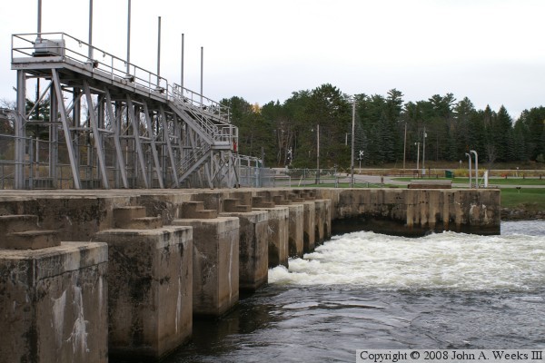
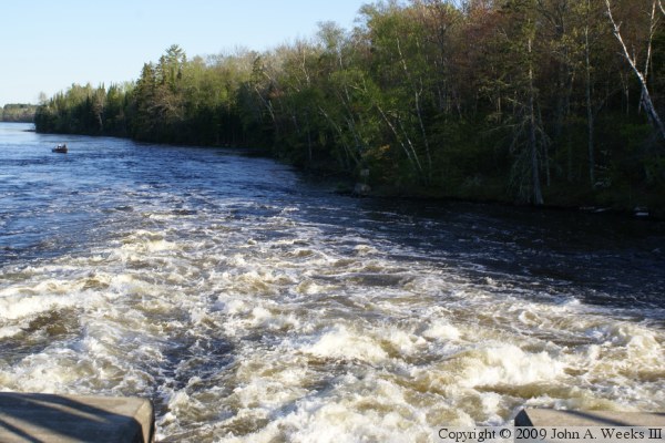
The photo above is a view of the dam from the south end of the structure.
All six movable gates are open to allow spring run-off water to pass
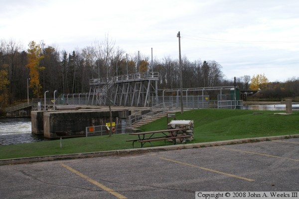
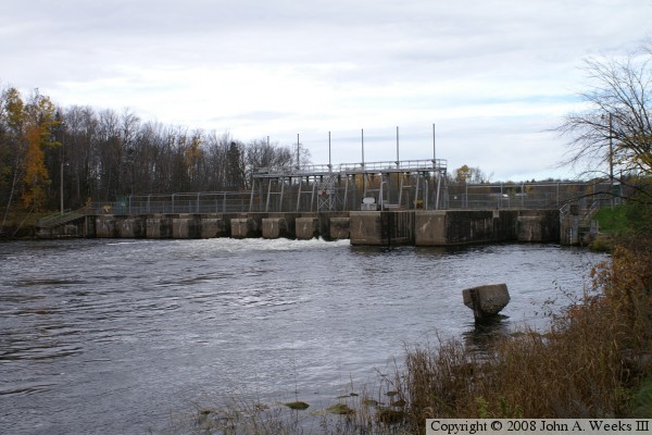
through the structure. The photo below is a profile view of the dam site
as seen from the parking lot. The BNSF rail bridge over the Mississippi
River at Cohasset is visible in the background near the right edge of the
photo.
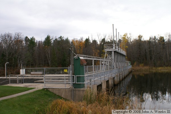
The photo above is the north end of the dam, showing the upriver side
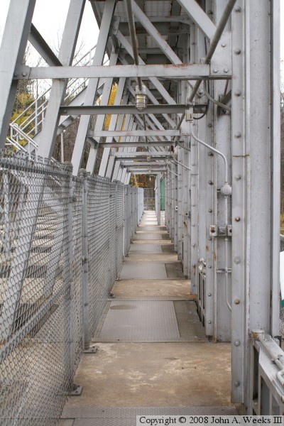
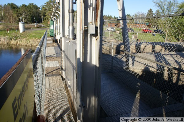
of the structure. The photo below is a view looking down the pathway
that crosses the dam. The steel plates on the floor cover the channels
where water flows after passing through the gates. The gate mechanisms
are located at the right edge of those steel plates.
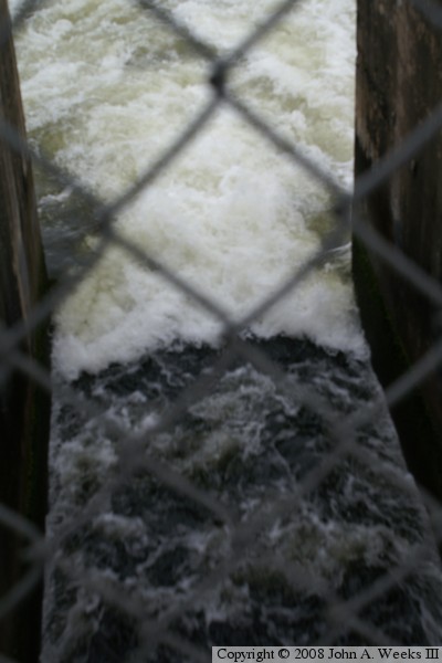
The photo above is a view looking down as water exits one of the 13 gates.
The water is running fast and high due to spring run-off. The photo below
is the downriver side of the dam.
The photo above is looking downriver from the outlet of one of the control
gates. The photo below is a close view of one of the control gates. A
large metal slab is held in place by two vertical metal rails. A round
shaft in the middle of the slab is connected to a mechanism above the gate
that raises and lowers the shaft, which raises or lowers the gate.
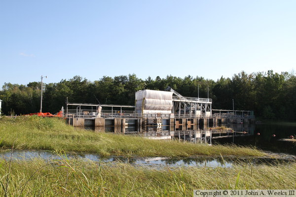
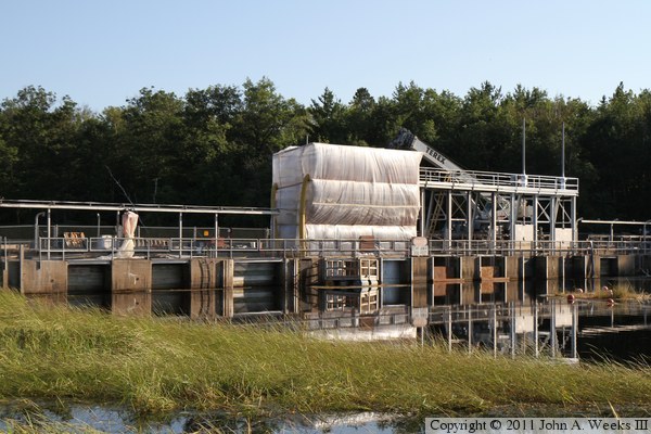
These two photos are late afternoon views of the construction work at
Pokegama Dam as seen on August 21, 2010. The photo above is a wider shot,
while the photo below is a closer view of the main dam structure. The
area enclosed in plastic is covering lead paint removal work. It is very
important to keep the lead paint debris out of the river.
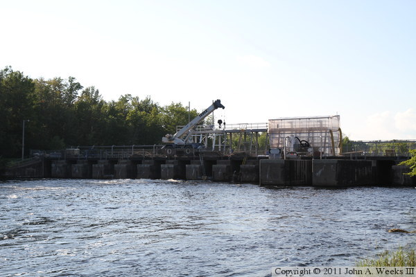
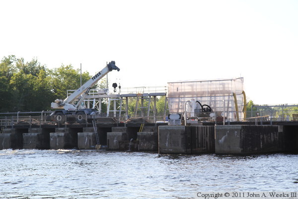
These two photos are looking west into the late afternoon sun towards the
downstream side of the Pokegama Dam. The photo above is a wider shot, while
the photo below is a closer view of the project. The small crane is
supporting work occurring on one of the dam gates.