The first bridge was built a few hundred feet north of the current Government Bridge at the narrowest point in the rapids. It was poorly engineered by being built where the water has the fastest current, and the piers were set at an angle to the current. The bridge was almost as big of a navigation problem as the rapids. The bridge was jointly built by the Missouri and Mississippi Railroad, and the Rock Island Line. It opened on April 22, 1856. The bridge featured 5 Howe Truss sections each 250 feet long, and a 286 foot long swing span (the longest in the world at that time).
Railroad tycoon Thomas Durant merged the Missouri and Mississippi and the Rock Island Line into the Chicago, Rock Island, and Pacific Railroad. Durant took with earnings from this deal to start the Union Pacific, and cash in on the transcontinental railroad bonanza.
Just two weeks after the bridge opened, on the morning of May 6, 1856, the steamer Effie Afton passed northbound through the bridge, lost power, and drifted back into the bridge. The resulting crash and fire destroyed the boat, its cargo, and one of the bridge spans. The steam ship company sued to have the bridge dismantled as a navigation hazard. The railroads joined forces and hired noted attorney Abraham Lincoln. Lincoln prevailed in the lower courts. The case made it to the US Supreme Court during the Civil War, where it was set aside, reaffirming the Railroad's right to bridge the river. The bridge was repaired and back in service within 4 months of the accident.
Perhaps the bridge was a hazard, in 1857, of the 1,667 boats that passed Rock Island, 55 collided with the bridge. In fact, the bridge was struck so many times, and was damaged by ice, it had to first be reinforced, and later was proposed to be dismantled. This reinforced structure is often called the Second Bridge. It was completed in 1866. It was damaged by ice in 1868, with the swing span being pushed off of its foundation and into the river. Later in 1868, the bridge was hit by a tornado and severely damaged. Piers that were not anchored to bedrock slid along the bottom of the river knocking the bridge out of alignment.
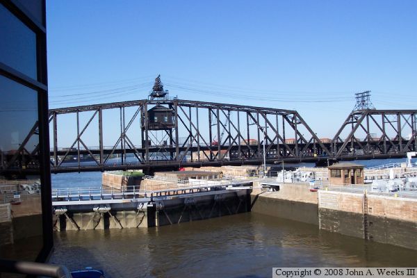
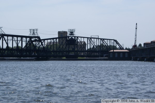
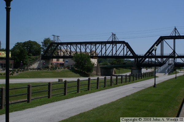
As a result of all the problems with the Second Bridge, a Third Bridge was proposed along the current alignment downstream of the rapids. That bridge was built in 1872, opening in November of that year. It had all the features of the current bridge, including a lower deck for wagon traffic and an upper deck for rail traffic, and a long swing span near the island. The bridge itself was 1,546 feet long, consisting mostly of a single box truss section supported by several piers.
The Third Bridge served well, but it quickly became a bottleneck as demand outgrew the capacity of the single rail line and mule-drawn street cars. Construction on the Fourth Bridge began in March 1895. The plan was to replace one section at a time to minimize disruption to rail traffic. That plan was interrupted when an ice jam caused major damage to the bridge in February 1896. As a result, the new bridge was not opened until December 1, 1896.
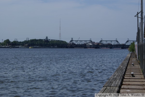
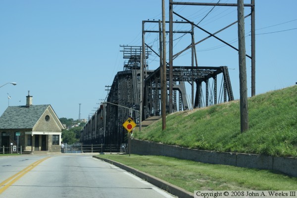
The Fourth Bridge has remained in service largely unchanged for over 100 years. The piers were reinforced in the 1920s. Trolley cars were retired in the 1930s, and automobiles became a major user of the bridge. The biggest change was the construction of Lock and Dam #15, which was built around and under the swing span. The Lock and Dam project was completed in early 1934. A viewing deck and visitors center was added to the Lock and Dam in the 1990s to allow people to watch the swing bridge operate and see boat tows lock through the lock and dam structure. The Chicago, Rock Island, and Pacific went out of business in 1980, so ownership of the bridge has reverted to the US Government, hence the name Government Bridge.
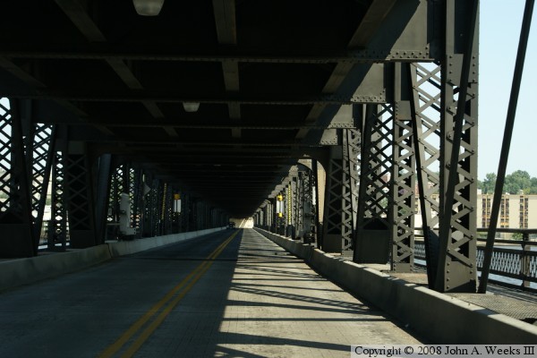
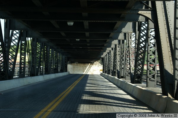
In a post 9/11 world, access to Arsenal Island is restricted. Automobiles, however, can cross the government bridge, then veer right and exit the island via the viaduct and not have to stop at any security checkpoints. As a result, the bridge can be used as a river crossing for the general public.