Current Weather Conditions
John A. Weeks III
Saturday, November 9, 2024, 11:03:53 AM CST
Home Photo Tours Rail Fan 12 Easy Steps
Aviation Spacecraft Highways & Bridges About The Author
 
Google Search
Maps   Groups   Images   Search
 
  Home
  • 12 Easy Steps
  • Aviation
  • Spacecraft
  • Highways & Bridges
    » Bridge Photography
      - MSP River Bridges
      - C & D Canal
      - Illinois River
      - Minnehaha Creek
      - Minnesota River
      - Mississippi River
        › Lake Itasca Area
        › Bemidji Area
        › Cass Lake - Ball Club
        › Grand Rapids Area
        › Blackberry - Crosby
        › Brainerd Lakes Area
        › Little Falls Area
        › St. Cloud Area
        › North Metro Area
        › Port Of Minneapolis
        › St. Anthony Falls Area
        › Mississippi Rvr Gorge
        › St. Paul Area
        › S St. Paul - Hastings
        › Red Wing - Winona
        › La Crosse Area
        › Lansing - Clinton
        › Quad Cities Area
        › Muscatine - Louisiana
          · Lock & Dam #16
          · Norbert F. Beckey Br
          · Lock & Dam #17
          · Keithsburg RR Br
          · Lock & Dam #18
          · Great River Bridge
          · Burlington RR Br
          · Ft Madison/Niota Br
          · Des Moines Rpds Can
          · Lock & Dam #19
          · Keokuk Municipal Br
          · Keokuk-Hamilton Br
          · Lock & Dam #20
          · Quincy Rail Br
          · Quincy Bay Rail Br
          · Quinsippi Island Br
          · The Pier Restaurant
          · Quincy Bayview Br
          · Quincy Soldier's Mem
          · Lock & Dam #21
          · Wabash Bridge
          · Mark Twain Mem Br
          · Lock & Dam #22
          · Champ Clark Bridge
          · Louisiana RR Br
          · Lock & Dam #24
          · Lock & Dam #25
          · Sandy Slough Bridge
        › St. Louis Area
        › Chester - Cairo
        › Miss - Tenn - Ark
        › Ark - Miss - Louisiana
        › Louisiana Structures
      - Missouri River
      - St. Croix River
      - St. Louis River
      - Wisconsin River
      - Best Miss River Photos
      - Cable Stayed Bridges
      - McGilvray Road Bridges
      - I-35W Bridge Disaster
      - Miscellaneous Bridges
      - Madison County Bridges
      - Hist Br Weekend 2013
    » Road Geek Topics
  • Photo Tours
  • Rail Fan
  • About The Author
 
Site Search By JRank
Highways, Byways, And Bridge Photography
Fort Madison/Niota Toll Bridge
IA-2/IL-9 Mississippi River Crossing At Fort Madison
Fort Madison, Iowa

Fort Madison/Niota Toll Bridge

• Structure ID: NBI 000000000033280 (Iowa)
NBI 000034990207937 (Illinois).
• Location: River Mile 383.90.
• River Elevation: 518 Feet.
• Railroad: BNSF Railroad.
• Highway: IA-2, IL-9.
• Daily Traffic Count: 3,140 (2002).
• Daily Traffic Count: 40 Trains Per Day (Estimated).
• Bridge Type: Steel Through Truss w/Swing Span.
• Length: 3,580 Feet Overall, 525 Foot Swing Span.
• Width: 21 Feet, 2 Lanes (Upper), 1 Track (Lower).
• Navigation Channel Width: 200 Feet, 2 Separate Channels.
• Height Above Water: 13 Feet.
• Date Built: Opened July 1928.
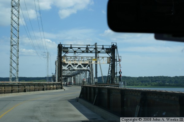
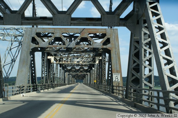
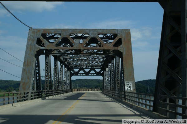
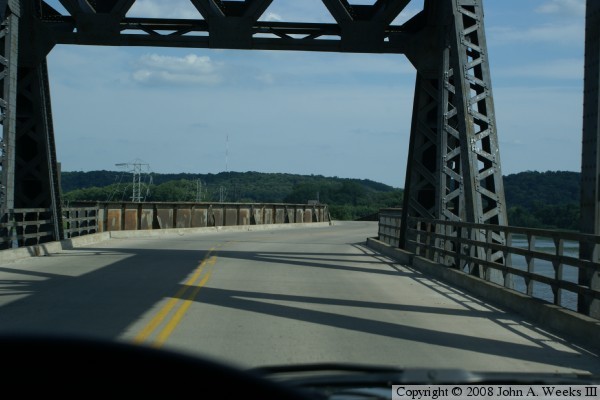
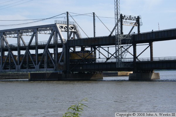
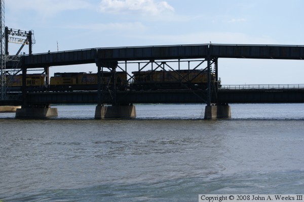
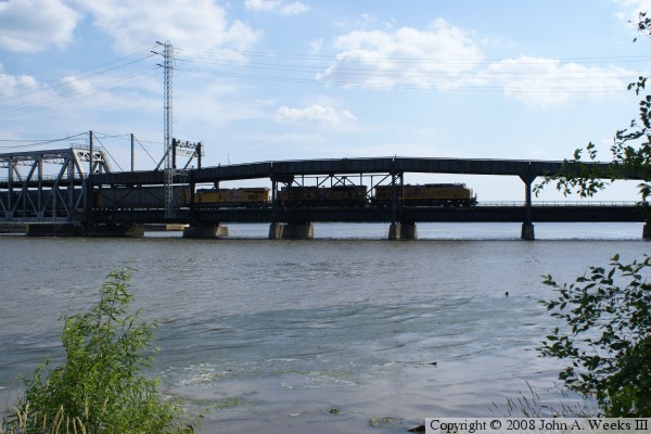
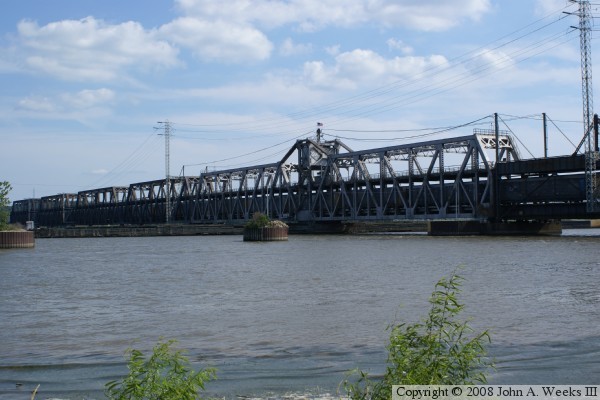
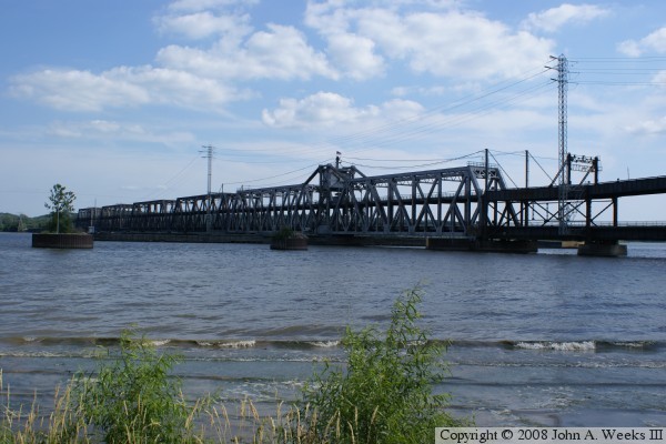
This is one of the last operating swing bridges remaining over the Mississippi River for automobile traffic. The bridge is a double deck design with rail on the lower level, and auto traffic on the upper level. The swing section is 525 feet long, one of the longest swing sections in the world, and the single longest double deck swing section ever built. In addition, the bridge has four 270 foot long through truss fixed spans.

The bridge is also known as the Santa Fe Swing Bridge due to the bridge having been built by the Santa Fe Railroad. The bridge is currently owned by the Burlington Northern Santa Fe Railroad. It is the route used by the Amtrak Southwest Chief to cross the great river. BNSF reports that this is one of the busiest bridges within the BNSF system, hosting over 70 trains per day.

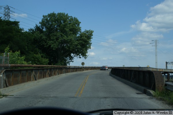
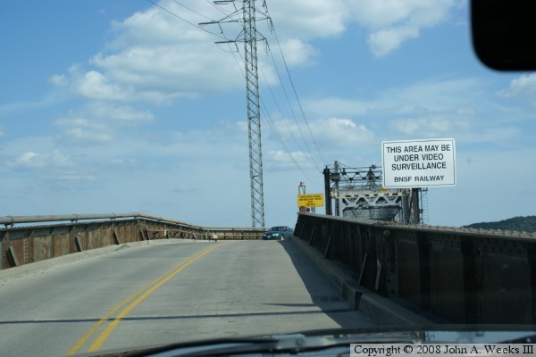
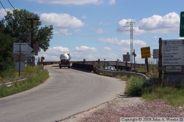
This is also one of the last remaining toll bridges over the Mississippi River. When I last crossed this bridge in 2005, the toll was $1 to enter Illinois, free to enter Iowa. Highway traffic that crosses the bridge have to negotiate tight S-curves at each end of the bridge. The toll booth is located on the bridge itself, just east of the swing span.

The rail deck was replaced in late 2005. The steel and ballast rail deck was removed. It was replaced with a wood deck which was not ballasted (ballast is the limestone rock used to build rail lines due to its draining characteristics). The fixed spans had to be raised 6 inches to accommodate the thicker wood deck.

An interesting feature of the bridge is that when the swing span is open, both sides of the pivot point may be used for navigation traffic. The upper group photos show a typical bridge crossing by car. The lower photos show a train crossing the bridge.

Fort Madison/Niota Toll Bridge

Made With Macintosh
Authored by John A. Weeks III, Copyright © 1996—2016, all rights reserved.
For further information, contact: john@johnweeks.com