Current Weather Conditions
John A. Weeks III
Monday, March 15, 2010, 7:14:39 AM CDT
Home 12 Easy Steps Random Topics About The Author Portal
Aviation Spacecraft Highways & Bridges Photo Tours Rail Fan

Google Search

 Maps  Groups
 Images  Search
  Home
  • 12 Easy Steps
  • Aviation
  • Spacecraft
  • Highways & Bridges
    » Bridge Photography
      - MSP River Bridges
      - Illinois River
      - Minnesota River
      - Mississippi River
        › Lake Itasca Area
        › Bemidji Area
        › Cass Lake - Ball Club
        › Grand Rapids Area
        › Blackberry - Crosby
        › Brainerd Lakes Area
        › Little Falls Area
        › St. Cloud Area
        › North Metro Area
        › Port Of Minneapolis
        › St. Anthony Falls Area
        › Mississippi Rvr Gorge
        › St. Paul Area
        › S St. Paul - Hastings
        › Red Wing - Winona
        › La Crosse Area
        › Lansing - Clinton
        › Quad Cities Area
        › Muscatine - Louisiana
          · Lock & Dam #16
          · Norbert F. Beckey Br
          · Lock & Dam #17
          · Keithsburg RR Br
          · Lock & Dam #18
          · Great River Bridge
          · Burlington RR Br
          · Ft Madison/Niota Br
          · Des Moines Rpds Can
          · Lock & Dam #19
          · Keokuk Municipal Br
          · Keokuk-Hamilton Br
          · Lock & Dam #20
          · Quincy Rail Br
          · Quincy Bay Rail Br
          · Quinsippi Island Br
          · The Pier Restaurant
          · Quincy Bayview Br
          · Quincy Soldier's Mem
          · Lock & Dam #21
          · Wabash Bridge
          · Mark Twain Mem Br
          · Lock & Dam #22
          · Champ Clark Bridge
          · Louisiana RR Br
          · Lock & Dam #24
          · Lock & Dam #25
          · Sandy Slough Bridge
        › St. Louis Area
        › Chester - Cairo
        › Miss - Tenn - Ark
        › Ark - Miss - Louisiana
        › Louisiana Structures
      - Missouri River
      - St. Croix River
      - St. Louis River
      - Wisconsin River
      - Cable Stayed Bridges
      - McGilvray Road
      - I-35W Bridge Disaster
      - Miscellaneous Bridges
    » Road Geek Topics
  • Random Topics
  • Photo Tours
  • Rail Fan
  • About The Author
  • John's Portal
 
Site Search By JRank
Highways, Byways, And Bridge Photography
Lock & Dam #16
Mississippi River Lock & Dam
Illinois City, Illinois

Lock & Dam #16

• Structure: Lock & Dam #16.
• Location: River Mile 457.2.
• Dam Width: 3,475 Feet Overall, 1,315 Foot Main Structure.
• River Elevation (Pool): 546 Feet.
• River Elevation (Outflow): 538 Feet.
• Water Fall: 8 Feet.
• Annual Lock Traffic: 3,373 Vessels, 21,328,000 Tons (2005).
• Date Opened: July 10, 1937.
Illinois City is just upstream from Muscatine, Iowa. Access to the lock and dam is off of IL-92 on the east side of the river. The main structure consists of 4 large roller gates and 15 smaller Tainter gates. The lock is the standard 600 feet long by 110 feet wide upper Mississippi River lock. The structure also includes an uncompleted auxiliary lock, as do most of the Mississippi River lock structures.

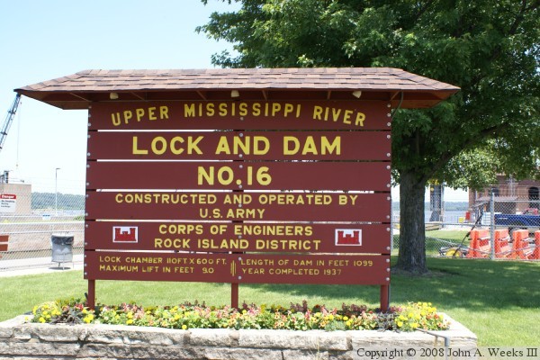
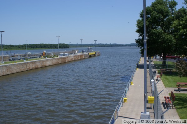
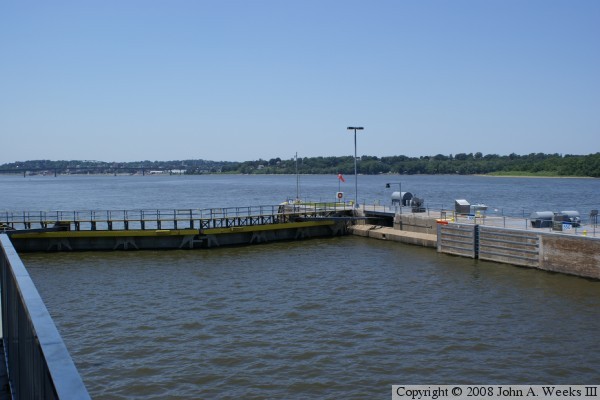
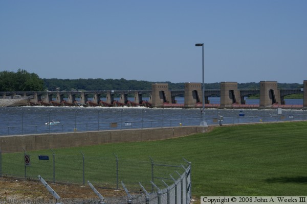
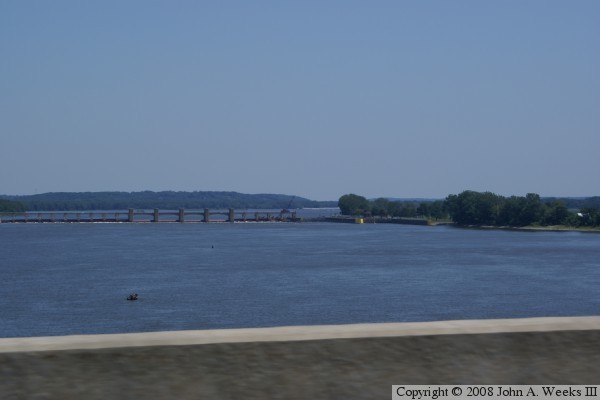
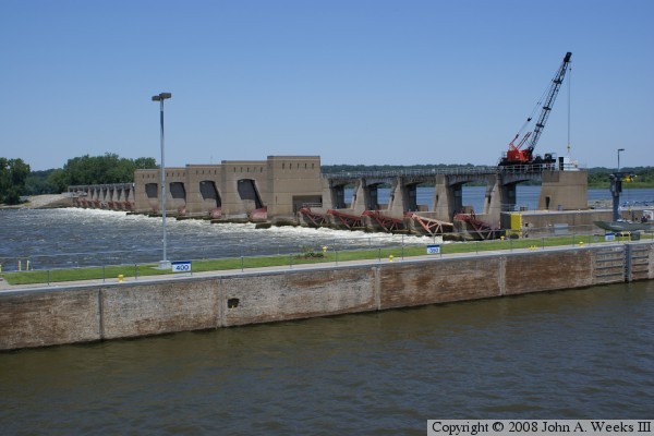
The large concrete dam structure blocks the main channel of the Mississippi River, and connects from the Illinois side to Hog Island. A earthen dike and overflow spillway crosses the remainder of the river from Hog Island to the City of Muscatine, Iowa.


Lock & Dam #16
Lock & Dam #16
Lock & Dam #16
Lock & Dam #16
Lock & Dam #16

Made With Macintosh
Authored by John A. Weeks III, Copyright © 1996—2010, all rights reserved.
For further information, contact: john@johnweeks.com