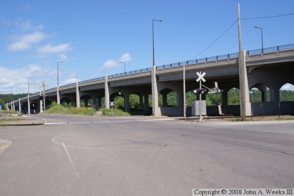
The southern of the two bridges has a number of spans of different lengths. Starting from the south, it crosses Avenue B, the BNSF Railroad mainline, an unimproved lot, the south channel of the river, the Cloquet Terminal Railroad (former Duluth & Northeastern Railroad tracks), and Saint Louis Avenue, before finally landing on Dunlap Island. The bridge soars to a height of nearly 40 feet over the water level in order to be high enough for the railroad lines and truck traffic to pass under the bridge.
The bridge is a prestressed concrete girder bridge. That is an interesting choice for this location. A plate steel bridge would have required only about half the number of piers, and might have been less expensive to build. But steel does not perform well in extreme cold, and Cloquet can get to minus 50 air temperature in the winter. In addition, steel requires periodic maintenance whereas concrete normally does not. Finally, the river is not open to navigation through Cloquet, so there is no need for a wide navigation channel.
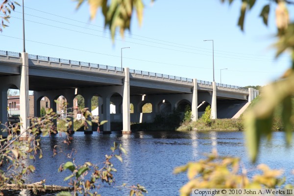
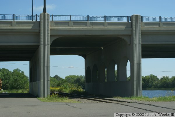
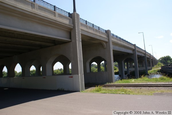
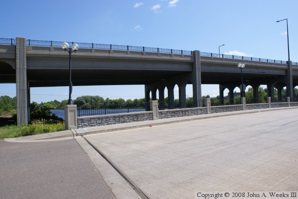
Given that this is both a recreational and historical area, once can expect an attractive looking bridge. In this case, we see various vertical lines and horizontal inserts cast into the concrete. The piers have arch-shaped openings below the deck, and the ends of the piers extend above the deck and form the anchors for the guardrails. A modern style street light was selected where the arm of the light is flat and sits at a perfect right angle from the support pole. The railings consist of a standard height concrete guardrail, topped off by a wrought-iron railings. These upper rails are not only very attractive looking, they act as protection for bicyclist.
One feature that is not decorative are the large concrete barriers at the bottom of the piers next to the railroad tracks. These barriers are designed to protect the bridge in the event of a train derailment. Another interesting feature is that the spans over the railroad tracks are much shorter than the rest of the spans. In both cases, the tracks are next to a city street. Crossing both the tracks and the street would have resulted in very long spans, longer than what engineers may have been comfortable with using concrete girders.
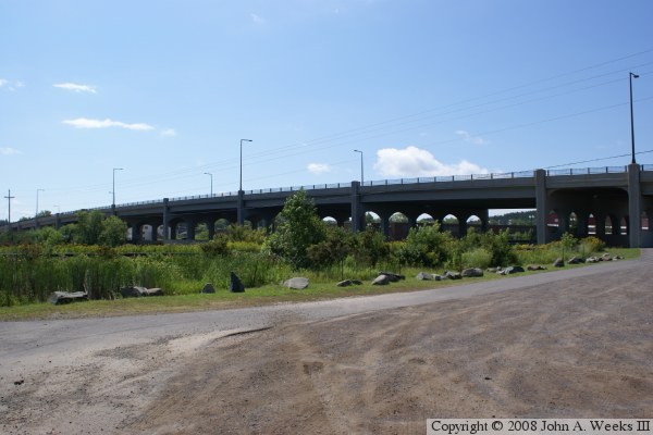
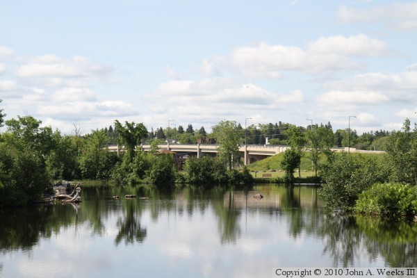
The photo above is looking southwest towards the downstream east face of the MN-33 Bridge over the south channel of the Saint Louis River. The vantage point is an access road on the north side of the river that leads to the power substation at the Knife Falls Dam. This view is looking across the north channel of the river as well as Dunlap Island. The photo below is looking northwest through the trees towards the river spans of the MN-33 Bridge from the south river bank.