If the Old River area is the most interesting spot on the Mississippi
River, then Saint Anthony Falls has to be the second most interesting
part of the great river. Here, the forces of nature meet the forces
of man every day in a drama that has resulted in Minneapolis rising
from a remote wilderness post to being one of the most important cities
in the United States in a matter of only a few years.
The falls results from the geography of the land between the Twin Cities.
The ground is covered with a thin layer of rock covering a deep layer of
soft sandstone. The water cannot cut the rock, but it does wear away
the sandstone. Once the rock layer is under cut, it falls into the river,
causing the cusp of the falls to slowly migrate north. 10,000 years ago,
the falls was located near the MSP Airport. When Father Hennepin discovered
the falls, it was near the University, and was over 100 feet tall.
Prior to the steam engine and electric motor becoming common, industry
depended on water power. Saint Anthony falls was one of the best natural
sources of water power in the nation, featuring nearly 50,000 horsepower
of energy. As a result, the water was channeled into canals and routed
to mills as far as four blocks away from the river. The milling industry
went from zero to world class in the late 1800's. Just as the steam engine
and electric motor came on the scene, allowing mills to locate anywhere,
the falls was converted to hydro power.
This human activity caused significant damage to the falls.
While the falls once moved a foot each year, the falls was moving 10 to
20 feet a year at its peak. Then a diversion tunnel collapsed, and the
falls nearly crumbled into the resulting whirlpool. Since the unique
geography that created the falls ends just north of downtown Minneapolis,
allowing the falls to migrate much further north would mean that the falls
would peter out into pile of rock and an impassible rapids.
The result is that the US Army Corps of Engineering moved in to stabilize
the falls. They built a large apron to cap the rock layer, built a large
spillway for the main channel to prevent further erosion, and stabilized
the area around the power plant. Later, the boat lock was installed as
part of the 9-foot navigation channel, and the mill diversion channels
were blocked off. That is what we see today. We have lost the natural
fall of water over a rock ledge, but we have preserved the falls where
it is for generations to come.
Update—Lock & Dam #1, as well as both the Upper and Lower Saint
Anthony Falls Locks & Dams, were closed twice during 2012 due to high
water flows following unusually large rainfalls in central Minnesota.
The first closing was to recreational users on May 28 and May 30 for
commercial users. The locks were reopened on June 8. They were closed
again on June 22 for recreational use and June 24 for commercial use,
then reopened on June 28. The US Army Corps of Engineers closes the locks
to recreational users when the flow hits 30,000 cubic feet per second, and
closes to commercial traffic at 40,000 cubic feet per second.
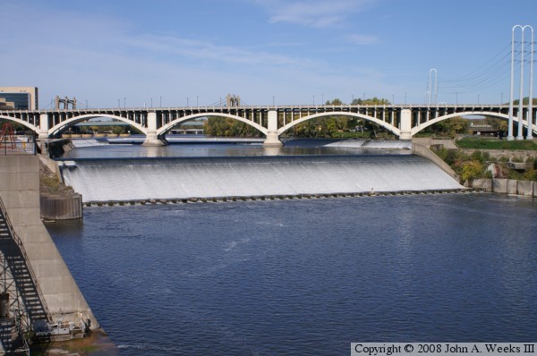
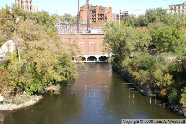
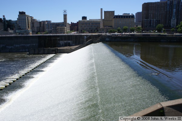
The photo above is the main spillway, which falls about 40 feet. It
has concrete teeth at the bottom, called grinders, to break up any
debris the comes over the falls and to calm the flow of water. A
secondary fall of about 10 feet is just upstream under the Third Avenue
Bridge.
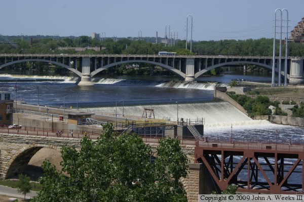
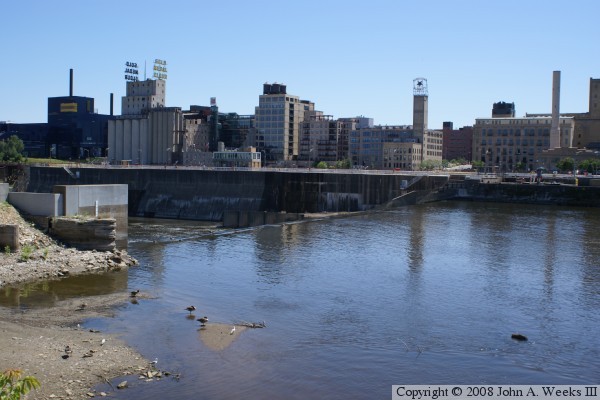
The photo above is another view of the dam spillways. This view is from
the Endless Bridge at the Guthrie Theater. The photo below is an overview
of the lock and dam structure as seen from the observation deck on the east
side of the Third Avenue Bridge.
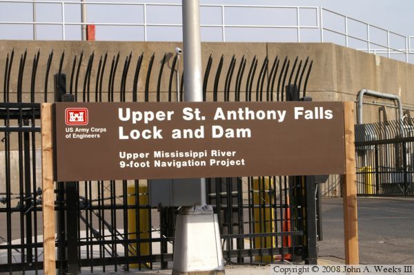
Photo above is the project sign. I generally take photos of signs so I can
tell later where the photos were taken. In the case of the locks and dams,
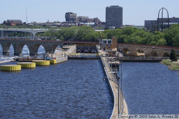
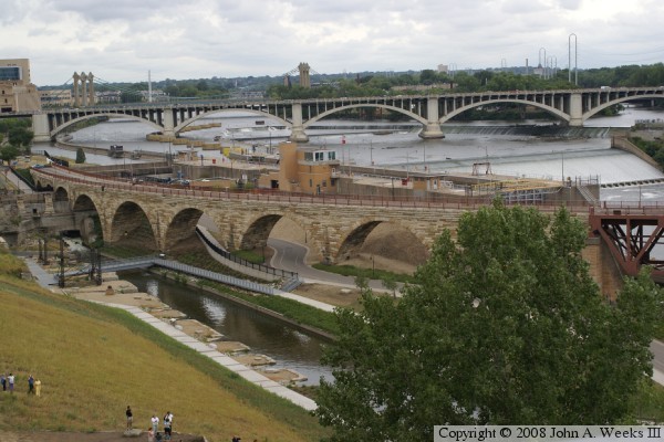
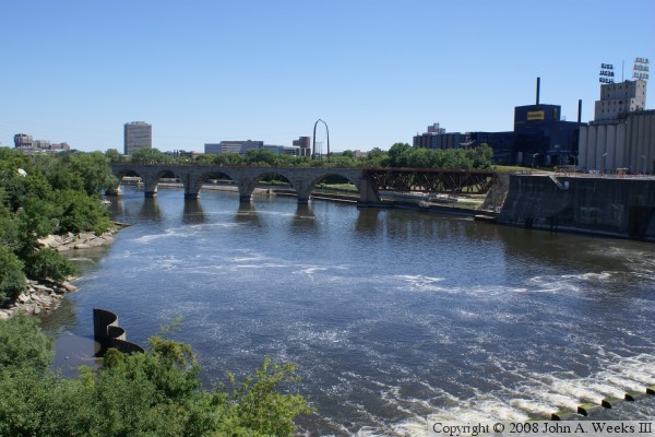
the sign photos act like a title page. Below is a overview of the upper
falls area taken from the Endless Bridge at the Guthrie Theater. The
Stone Arch Bridge is in the foreground, with the mill ruins park at the
lower left. The lock is behind the Stone Arch bridge, with the main falls
to the right of the lock. The Third Avenue Bridge crosses the aprons above
the falls with seven large concrete arches. In the distance, you can see
the Hennepin Avenue suspension bridge.
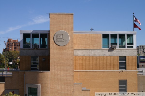
Above is the building that houses the administration, control, equipment,
and pumps for the lock system. The lock lifts and lowers boats up to 50
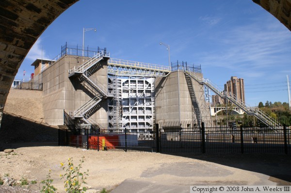
feet. Below is the lock with the doors closed. This lock was closed
form August 1, 2007 to October 5, 2007 following the I-35W bridge collapse.
The river navigation channel was blocked by debris, and it took upwards of 2
months to recover the victims and clean up the site.
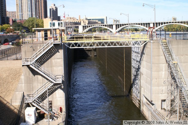
Above is the lock with the doors open. Notice the walkway that spans
the entrance of the lock, yet another bridge crossing a channel of the
Mississippi River. The photo below shows Hennepin Island, an old spillway
used in case of flood waters, and the Saint Anthony Falls Laboratory.
This area has been converted into a park that opened to the public in
late spring of 2007. A pedestrian bridge was installed across the power
plant intake channel to provide access to this area.
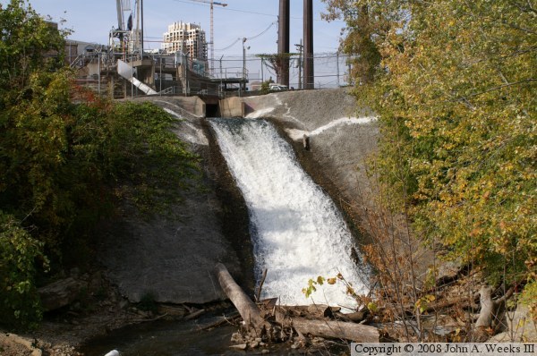
Above is the powerplant. It produces 12-megawatts of power. It has
capacity of produce almost double that. A study is underway to see how
the amount of power produced by the falls can be increased. Below is
the output channel from the Saint Anthony Falls Laboratory, as seen
from Father Hennepin Park.
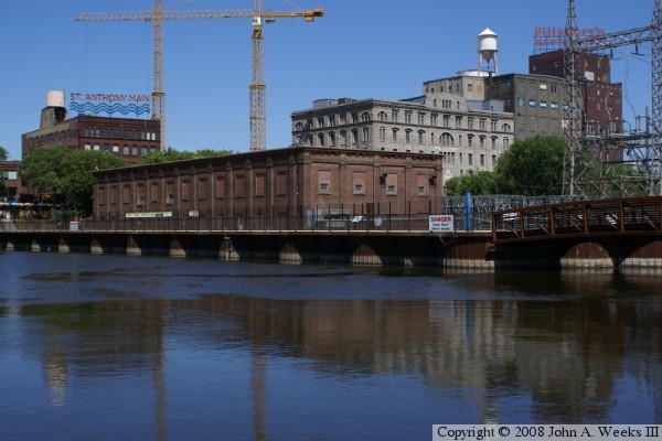
The photo above is the Main Street Power Substation. The walkway
in front of the building allows people to cross over to Hennepin to
visit Water Power Park. The bridge on the far right side of the photo
crosses the intake canal for the Hennepin Island power plant. In the
background, once can see the historic Pillsbury A mill. That mill was
powered by water from the Mississippi river that was diverted through
a series of underground tunnels.
Below is the main cascade of the upper Saint Anthony falls. The falls
tumble over two smaller cascades just upstream. The total drop is 49
feet.
Above is a view of the falls looking towards the Minneapolis milling
district. The mills have long since shut down, and the area is
redeveloping into condos, lofts, hotel space, office space, and
civic space. The Mill City Museum is located in the burned out
remains of the Washburn mill. The museum tells the story of how
Minneapolis grew to be a large and important city through milling
in the later half of the 19th century.
The photo below is looking downstream from the main falls. The
outlet of the lock system is to the far right, and the stone arch
bridge is located just downstream of the lock.
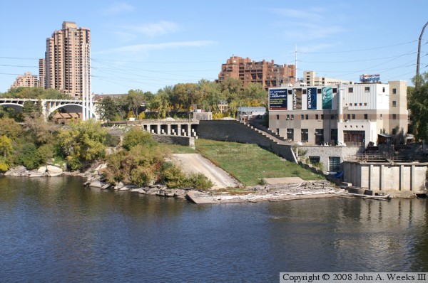
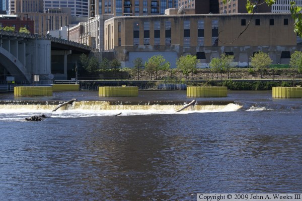
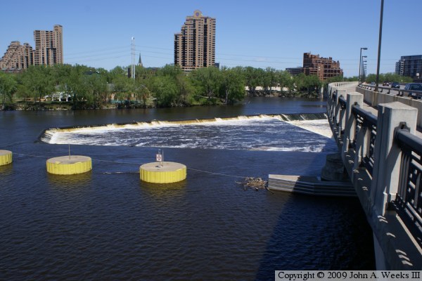
The US Army Corps of Engineers has built a series of aprons above the
main falls to protect the rock ledges to prevent any further erosion in
the falls area. These two photos are views of the water flowing over
these aprons. The photo above is from Nicollet Island looking towards
downtown Minneapolis. The photo below is from the observation deck on
the west side of the Third Avenue Bridge looking north towards the old
Main Street area.