
When the 6 foot navigation channel was built, a canal was dug along the west side of the island. That canal fed a lock (which still exists as the auxiliary lock). A dike was built between the river side of the lock and the island. That dike was needed because the water level in the canal was higher than the water level of the river. The boat traffic required that the ferry cable be removed.
A short time later, Congress approved the 9 foot navigation channel. The plan was to build a new lock and dam to raise the water level 9 feet above the rapids in the main river channel. That is the current Lock & Dam #14. One result of this project is that the water was now the same level on each side of the island. A far more important result was that the higher water level flooded most of the development on Smith's Island. The US Government ended up buying out all the land owners. To help equalize the water level, a small channel was cut across the dike just above the 6 foot lock. This cut off access to Smith's Island.
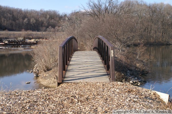
Fast forward 60 years, and the US Army Corps Of Engineering is running a major project to make all of the lock and dam structures more available for use by the general public. A plan was developed to open Smith's Island to the public. The key part was installing this pedestrian bridge, and developing a trail on the island. That work was completed in 2002.
Visitors to Smith's Island will find plants, animals, and birds that are not common to that part of Iowa. The relatively constant water level allows trees to thrive that are much more common further north along the river. The island is also a popular stop over spot for migrating birds. Unusual and rare birds are spotted here every year.
