| Highways, Byways, And Bridge Photography |
Northern Pacific Bridge #9
Historic Northern Pacific Railroad Mississippi River Crossing
Minneapolis, MN
|
• Structure ID: |
94246. |
|
• Location: |
River Mile 853.0. |
|
• River Elevation: |
725 Feet. |
|
• Highway: |
Dinkytown Trail (Bicycle And Pedestrian Path). |
|
• Bridge Type: |
Steel Deck Truss. |
|
• Length: |
952 Feet, 245 Foot Longest Span. |
|
• Width: |
1 Traffic Lane. |
|
• Navigation Channel Width: |
160 Feet. |
|
• Height Above Water: |
88 Feet. |
|
• Date Built: |
Opened 1922, Rebuilt 1955 And 1999. |
Northern Pacific Bridge #9 is an abandoned railroad bridge that has found
new life as a bicycle path. While the rails to trails concept has been
around for a number of years, converting a large river bridge for trail
usage was a novel idea in the late 1990s. With large numbers of university
students walking and riding bicycles, this project has been a major success.
The only drawback is that there is no tourist parking available anywhere
within reasonable walking distance of the bridge.
The first Northern Pacific Railroad bridge near this location was built
in 1885. That bridge and the rail line to the east formed the southern
boundary of the University of Minnesota campus. The bridge was rebuilt
in 1917 to handle the larger locomotives and heavier trains.
At that time, the Northern Pacific Railroad operated a large number of trains
through the University of Minnesota campus with the trains operating at street
level. This was not only very dangerous, but the trains caused dirt, noise,
and blocked streets and walking paths for long periods of time. In 1922, the
railroad and the university developed a plan to solve this problem by
running Northern Pacific trains through a trench that would be built through
the campus area. At that time, the old bridge was removed and the new
Bridge #9 was constructed to connect the trench to the west bank river
bluffs. Bridge #10 then carried the line over 20th Avenue South.
Bridge #9 was rebuilt again in 1955 as trains became heavier and longer
following the conversion to diesel-electric locomotives. The next major
event was the merger of the Northern Pacific with the Great Northern and the
Chicago, Burlington, Quincy in 1970. As a result of the merger, the Burlington
Northern owned more Mississippi River bridges than were needed. The BN
continued to operate trains over this Mississippi River crossing until 1981.
Bridge #10 was removed shortly after the line was abandoned, but the river
bridge remained intact. Bridge #9 was opened again in 2000 after being
retrofit as a pedestrian bridge and bicycle trail.
The bridge is just short of 1,000 feet long. The river spans consist of three
shorter piers supporting two long trusses. The track was installed on top
of the trusses rather than through the trusses as might be expected.
Taller piers on each side of the river support several deck plate girder
spans. This configuration gives the bridge its unusual profile shape
with tall thick spans in the middle and thin spans on the ends.
Bridge #9 was closed between August 1, 2007 and August 21, 2007 while the
recovery operation was ongoing at the site of the I-35W bridge collapse
disaster. Construction work on the east bank of the river has resulted in the
east end of this bridge remaining closed after the rest of the bridge was
reopened. The bridge was fully reopened in early 2008. When Bridge #9
was reopened, it was the best location to view the I-35W disaster recovery
work until the 10th Avenue Bridge was reopened. The bridge was also the
best vantage point to watch the NTSB work to reconstruct the bridge after
the disaster.
As part of the construction of the new I-35W bridge, a culvert was included
to allow a future bicycle trail to be routed from downtown Minneapolis to
Bridge #9. This would be a significant link in the regional trail system.
Future plans include building the last section of the East River Parkway
and a new road called Granary Parkway to connect existing trails with
Bridge #9 and the trail system that heads into Ramsey County and Saint Paul.
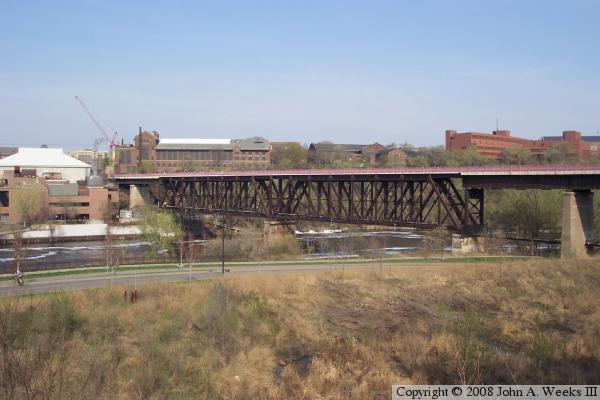
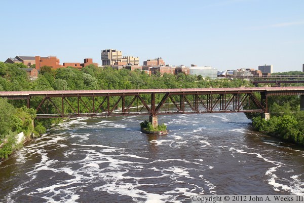
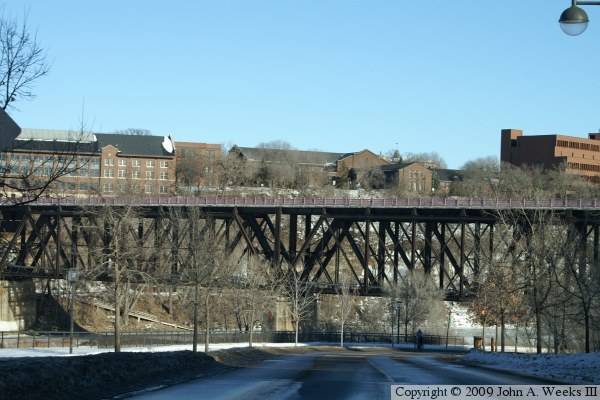
The photo above is an early spring view from the bluffs on the southwest side
of the structure looking east across the Mississippi River towards the
University of Minnesota campus.

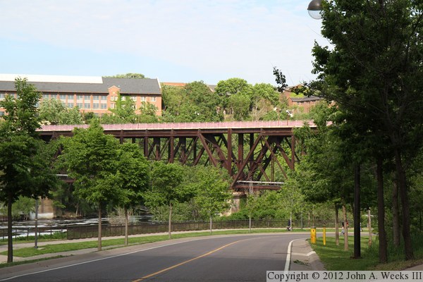
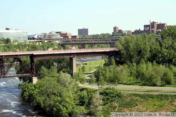
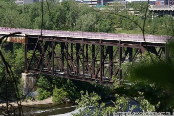
The photo above is a view of Northern Pacific Bridge #9 looking through the
trees on the east river bank on the University of Minnesota campus. The
photo below is looking southeast towards the truss spans from the West River
Parkway, a scenic drive built along the west side of the Mississippi River
through much of Minneapolis.
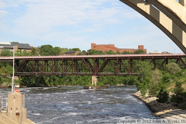
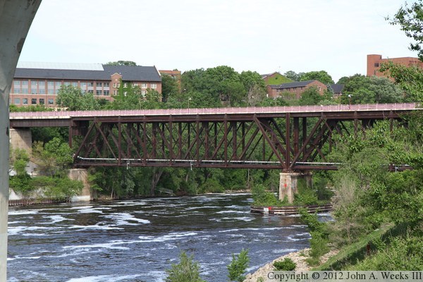
These two photos are looking southeast though the arches of the 10th Avenue
Bridge on the west river bank. The photo above is a wider view of the
river spans as seen from the observation deck for the new I-35W Saint Anthony
Falls Bridge. Teh photo below is taken from directly under the 10th Avenue
Bridge.

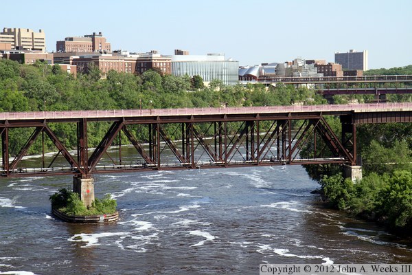
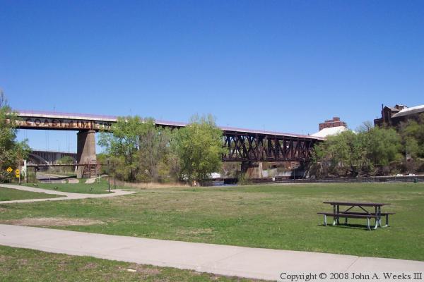
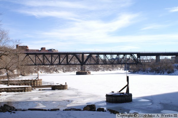
These two photos are wide views showing the entire bridge including the
deck plate girder approach spans. Both photos are taken from the deck of
the 10th Avenue Bridge located just upstream of the University of Minnesota.
The photo above is from the south side of the river with West River Parkway
on the right side of the scene. The photo below is from the north side of
the river. The large building complex in the background is the University
Hospital.


These two photos are additional views from the deck of the 10th Avenue Bridge,
but are closer views focused on the two large deck truss spans. The building
on the far left edge of the photo above is the old Mine Technology lab, which
has been rebuilt into the Education Building. This building is where the
taconite process was developed, which has become a major industry on the Iron
Range. The old steamship docs are located on the far left side of the photo
below, which was once the northern terminus of river traffic prior to the two
locks being built at Saint Anthony Falls.

The photo above is a close view of the mid-river pier, while the photo
below is the truss span over the river navigation channel. Both views are
from the deck of the 10th Avenue Bridge. The Washington Avenue Bridge is
visible in the background of the photo below.
These two photos are views of the deck plate girder spans on the southwest
end of the Northern Pacific Bridge #9. The photo above is looking east
from the south end of the 10th Avenue Bridge deck. The core area of the
University of Minnesota campus is located on the far side of the river. The
photo below is looking southeast from high above the Mississippi River on
the deck of the 10th Avenue Bridge. The Washington Avenue Bridge is in
the background with its distinctive enclosed walkway on its upper level.

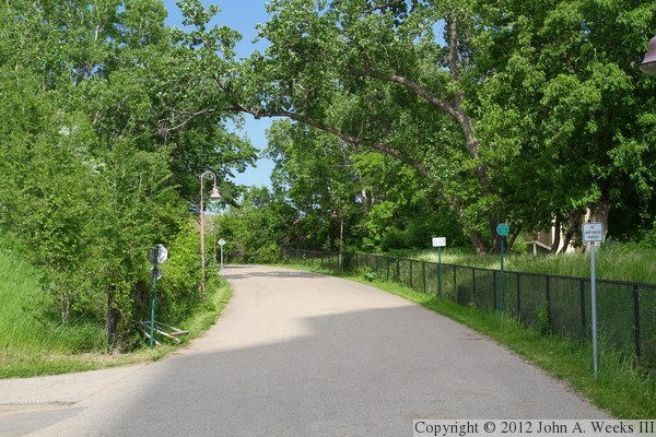
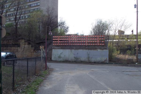
The photo above is the west abutment for Northern Pacific Bridge #10, which
once carried the railroad tracks over 20th Avenue. The photo below is the
path running along the former railroad right of way towards the south end
of Bridge #9.

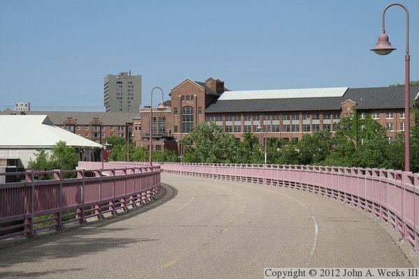
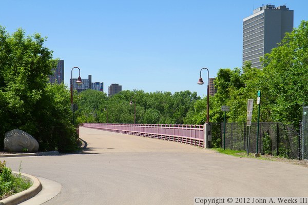
The photo above is the southern end of Northern Pacific Bridge #9. The photo
below is the view looking northeast down the length of the bridge deck. The
beautifully refurbished Education Building is located on the far side of the
Mississippi River.
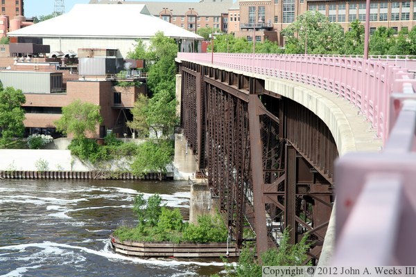
The photo above is looking north along the upstream face of the Northern
Pacific Bridge #9. The photo below is another view looking north down
the length of the bridge deck. The building on the riverfront in the photo
above is the central heating plant, while the building with the large white
roof is a coal storage facility.
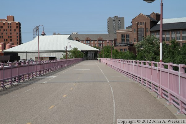
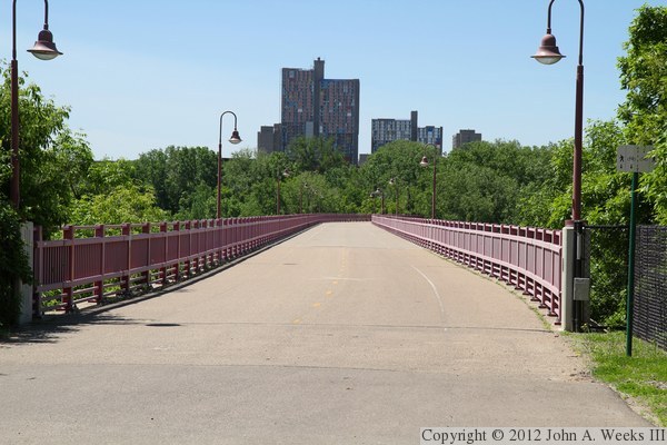
These two photos are views of the north end of Northern Pacific Bridge #9.
The photo above is the north entrance as seen from the coffee shop at the
Education Science Building, while the photo below is looking south down the
length of the bridge deck. The tall buildings in the distance are part of
Riverside Plaza. These buildings were developed as the modern city
of the future in the early 1970s, but they quickly became a concrete ghetto.
They were called the ‘Crack Stack’ in the 90s and early 2000s,
but the area has improved greatly by 2010 with additional police driving
the gangs away, an influx of people from northern Africa who take better
care of the neighborhood, and an influx of federal stimulus loans to
renovate the complex.

The photo above is a road sign marking the trail. The photo below is another
view looking through the trees from the east side of the river towards the
downstream face of the bridge. This photo is very similar to a photo near
the top of this page, except that it is a few years older.
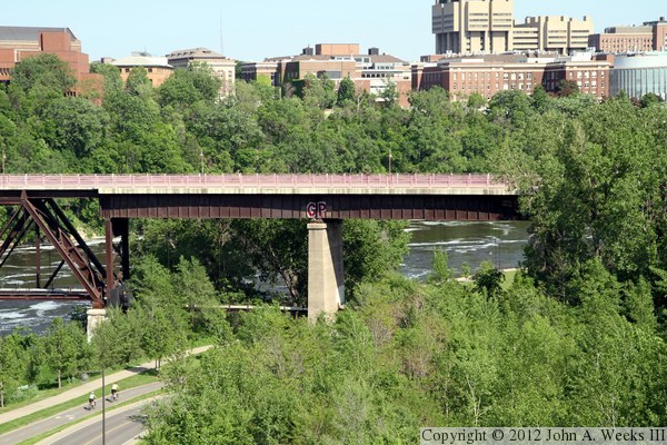
The photo above
is a view of the bridge from Bohemian Flats along the west bank of the
Mississippi River. Note that the North Coast Limited logo is still visible
on the deck plate girder section. The photo below is a view of the bridge
from the West River Parkway. The University of Minnesota East Bank Campus
is located on the far side of the river.
These two photos are views of the Northern Pacific Bridge #9 as seen from
the East River Flats area from a vantage point under the 10th Avenue Bridge.
The photo above is a wide-angle view, while the photo below is a close-up
view of the mid-river pier. From these views, it is apparent that the bridge
was built as two Warren Truss spans with the rail deck built on top. There
are deck plate girder spans on either side of the two trusses.


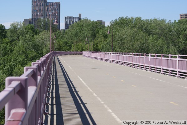
The photo above is the bridge deck at the south end of the structure. The
building on the far side of the river is the Education Sciences Building
on the University of Minnesota campus. The photo below is the bridge deck
at the north end of the structure. The tall buildings in the distance are
the Riverside Towers, a housing project in the Cedar-Riverside neighborhood.


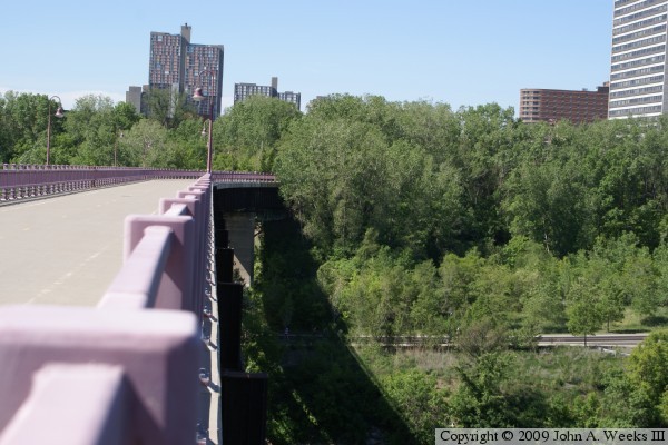
The photo above is the transition between the bridge approach and the
actual bridge structure on the north end of the river crossing. The
photo below is a view from mid-structure. The bridge makes a curve at
the south end of the crossing, and actually exits towards the west. The
decorative railings and concrete deck were added in the 1999 remodel.
The photo above is a look along the west face of the historic bridge. The
river gorge is about 90 feet deep at this location. The bridge crosses
the river flats and the West River Parkway on the south side of the river.
The photo below is the abutment from Northern Pacific Bridge #10, which once
crossed the Mississippi River next to Bridge #9. Bridge #10 was abandoned in
1981, and was removed shortly afterwards.
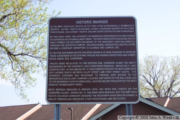
The photo above is the historical marker on the west bank of the river near
the west end of Bridge #9. There is a similar marker on the east end of the
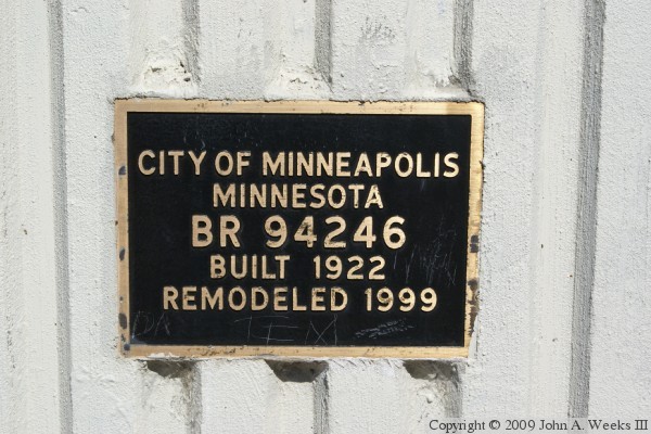
structure. The photo below is the bridge plate. This bridge plate was
attached to the bridge when it was converted for pedestrian and bicycle use.
|
