Current Weather Conditions
John A. Weeks III
Saturday, April 20, 2024, 12:03:02 AM CDT
Home Photo Tours Rail Fan 12 Easy Steps
Aviation Spacecraft Highways & Bridges About The Author
 
Google Search
Maps   Groups   Images   Search
 
  Home
  • 12 Easy Steps
  • Aviation
  • Spacecraft
  • Highways & Bridges
    » Bridge Photography
      - MSP River Bridges
      - C & D Canal
      - Illinois River
      - Minnehaha Creek
      - Minnesota River
      - Mississippi River
      - Missouri River
      - St. Croix River
      - St. Louis River
      - Wisconsin River
      - Best Miss River Photos
      - Cable Stayed Bridges
      - McGilvray Road Bridges
      - I-35W Bridge Disaster
        › Materials For Media
        › View: The Guthrie
        › View: From Bridge #9
        › View: From 10th Ave
        › Police Security Zone
        › Bridge Collapse Myths
        › Conspiracy Theories
        › Investigation Update
        › The Final Verdict
        › Rememberance Garden
        › Garden Night Views
        › I-35W Bridge (Old)
        › I-35W Bridge (New)
        › Detour: MN-280 NB
        › Detour: MN-280 SB
        › Detour: 10th Ave NB
        › Detour: 10th Ave SB
        › Project 50% Done
        › Project 80% Done
        › Project 98% Done
        › Project 99% Done
        › Bridge Photo Tour
        › Winter Bridge Views
        › The Bridge Up Close
        › Observation Locations
        › Bridge Walking Tour
        › The Bridge At Night
        › Light Show Review
        › The Bridge In Pink
        › Homecoming Colors
        › Orange On Halloween
        › Veterans Day 2011
        › St. Patrick's Day
        › Workers Memorial Day
        › Memorial Day 2012
        › Pride Festival 2012
        › The Bridge In Gold
        › Christmas 2012
        › Unity Day 2014
        › World Polio Day
        › Prince Tribute
        › Crossing Northbound
        › Crossing Southbound
      - Miscellaneous Bridges
      - Madison County Bridges
      - Hist Br Weekend 2013
    » Road Geek Topics
  • Photo Tours
  • Rail Fan
  • About The Author
 
Site Search By JRank
Highways, Byways, And Bridge Photography

I-35W Bridge Collapse
Materials Prepared For The Media


The busy Interstate 35W bridge over the Mississippi River in downtown Minneapolis, Minnesota, collapsed at the peak of rush hour on Wednesday, August 1, 2007. As a result of the large number of phone calls and E-mail that I received, I have prepared a few items for the media to use.

Note—these materials are covered by copyright and may not be used without written permission.

Go to John's Photos.
Go to the Close-Up Photos.
Go to the Aerial Photos.
Return to the I-35W Bridge Disaster page.

Spring 2005 Photos

Click the thumbnail or text link to see the full-sized camera original of each photo.

I-35W Bridge Photo By John Weeks Photo from under the I-35W structure.
I-35W Bridge Photo By John Weeks Profile shot of I-35W structure.
I-35W Bridge Photo By John Weeks Photo of the deck of the I-35W bridge.
I-35W Bridge Photo By John Weeks 
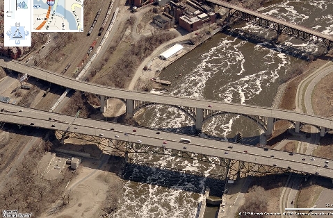
Photo of I-35W bridge under the arch of the 1929 10th Avenue Bridge.

Return To Top


Close-Up Photos Of The Bridge Structure

Click the thumbnail or text link to see the full-sized camera original of each photo.

I-35W Bridge Photo By John Weeks Close-up of the south end west side main bridge pier.
I-35W Bridge Photo By John Weeks November 2006 view of the south end east side bridge structure, where the collapse is thought to have started.

Return To Top


Aerial Photos From Virtual Earth

I-35W Bridge Looking North
Photo Of Area Near I-35W Bridge

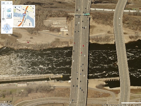
I-35W Bridge Looking West
Photo Of Area Near I-35W Bridge

This view is looking west, which is up river. The 10th Avenue concrete arch bridge in the front, then the I-35W steel truss bridge, and then the Lower Saint Anthony Falls Lock & Dam (part of the 9-foot navigation channel). A 3rd bridge is visible in the East photo. That is the Northern Pacific Railroad Bridge #9, which has since been converted into a bicycle path across the Mississippi River.

The Red Cross building is that parking lot where slider bar covers the picture. The building next to the slider bar is the former Minnegasco gas plant, now Centerpoint Energy. Just off the left side is the former US Army Math research building, now a U of M building. The road under the bridge is the west river parkway.

On the right side, the building just above the bridge is a U of M physics lab, which formerly housed the Tandem Accelerator experiment and nuclear research labs. To the right of the photos starts the student housing area for the U of M campus.

The large flat area to the right of the dam is the site of another twin cities disaster. This was a Northern States Power Company power plant for decades. The building was undercut by water, but nobody noticed. The building unexpectedly collapsed in the late 1980's. The building was removed, and this flat piece of dirt is all that is left. Several groups are still trying to get hydropower back into the lower dam area. The long concrete box next to the rushing water is the boat lock. It raises boats and barges 24 feet. The lock just upstream raises boats another 48 feet.

I-35W Bridge Looking South
Photo Of Area Near I-35W Bridge

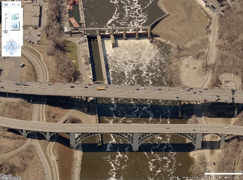
I-35W Bridge Looking East
Photo Of Area Near I-35W Bridge

Note—these aerial photos are clipped from the Virtual Earth software
available at http://maps.live.com, a service of Microsoft.

Return To Top

Made With Macintosh
Authored by John A. Weeks III, Copyright © 1996—2016, all rights reserved.
For further information, contact: john@johnweeks.com