| Highways, Byways, And Bridge Photography |
Wisconsin Central Bridge Ruins
Historic Saint Croix River Railroad Crossing
Somerset, WI
|
• Structure ID: |
N/A. |
|
• Location: |
River Mile 28.5. |
|
• River Elevation: |
676 Feet. |
|
• Railroad: |
Wisconsin Central Railroad. |
|
• Daily Traffic Count: |
0 Trains Per Day, Bridge Has Been Removed. |
|
• Bridge Type: |
Steel Deck Truss w/Through Truss Main Span. |
|
• Length: |
2,339 Feet. |
|
• Width: |
1 Track. |
|
• Navigation Channel Width: |
Non-Navigable. |
|
• Height Above Water: |
85 Feet. |
|
• Date Built: |
1884. |
The Wisconsin Central bridge over the Saint Croix river was built in 1884 by
the Union Bridge & Iron Works. The Wisconsin Central was pushing west,
and this bridge was the last link to connect Milwaukee and Chicago to Saint
Paul. The bridge features a number of very well crafted cut-stone piers.
There were nine 160-foot deck truss spans, one 160-foot pin-connected though
truss span, and 25 plate girder spans, each 30-feet long.
From an operational standpoint, this bridge was a huge problem. The Saint
Croix river valley is about 220 feet deep, but the bridge was only 85 feet
tall. That meant that trains had to descend into the valley, cross the
bridge, then climb out some 130 feet. This often required trains to include
extra engines along with helper engines pushing at the back. The Wisconsin
Central decided to build a new high bridge that would cross the valley
at the 200 foot level, eliminating the grades. The new Arcola High Bridge
opened in 1910. As a result, this bridge was removed on February 28, 1916.
There are several remains of the bridge that still exist 100 years after
it was abandoned. The most visible are the stone piers marching in a line
across the Saint Croix river. The railroad grade on the east side of the
river is a township road, but the final quarter mile leading to the river
is private property. The railroad grade on the west side of the river
is filled with tree debris and is mostly a tree-choked linear swamp. The
bridge abutment on the Minnesota side of the river still exists and is
in good shape. It can be reached by following bird-watching trails
established by the Minnesota DNR.

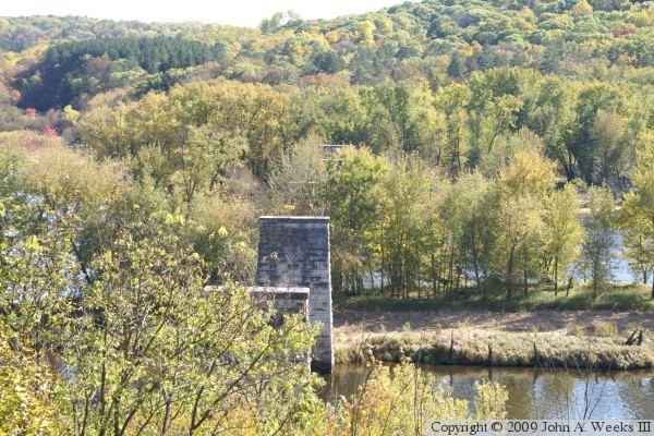
These two photos are looking east from the bluffs on the Minnesota side
of the Saint Croix River. In the photo above, 5 bridge piers are visible.
There may have been as many as 10 piers supporting the bridge. The piers
over the eastern channel are hidden by trees. The photo below is a closer
view of the two piers over the western river channel.
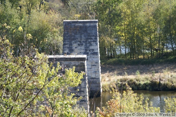
The photo above is a closer view of the 3 piers over the island between
the two river channels. This island did not exist when the bridge was
built, so there were no trees near the bridge when it was in operation.
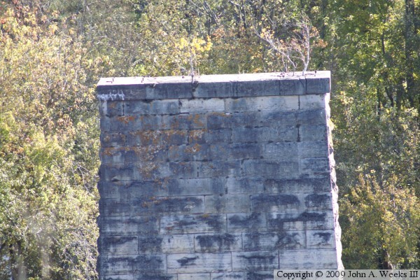
The photo below is a close view of the top of one of the piers. Note
that bolts are still visible at the top of the pier, and that small trees
are growing out of the cracks between the stones.
These two photos are views of the abutment on the Minnesota side of the
former river crossing. The abutment has two steps where the truss span
once rested. The abutment drops off about 100 feet below the second
step. The stonework is littered with tree and leave debris, but otherwise
appears to be in good condition.


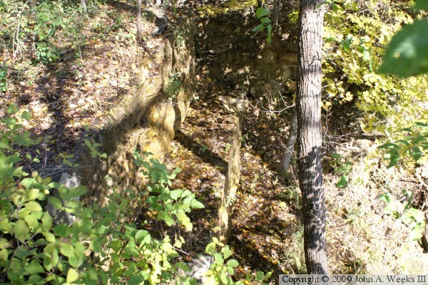
These two photos are more views of the abutment on the Minnesota side of
the bridge ruins. In the photo above, a large birch tree has sprouted
on the north side of the abutment. Some of the roots of the tree are on
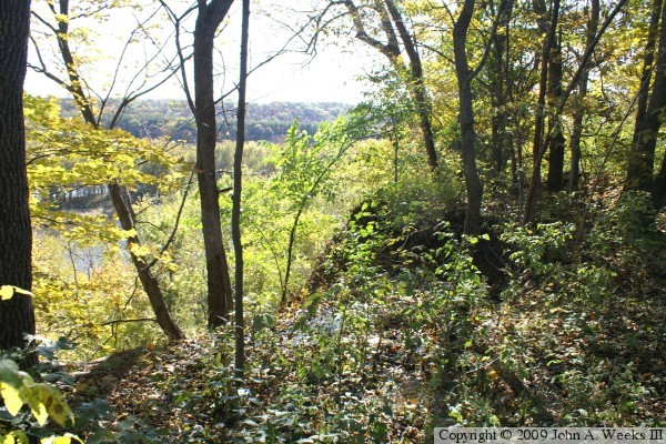
top of the abutment, which is a convenient source of water for the tree.
The photo below is looking southeast across the Saint Croix valley through
the gap in the trees in front of the bridge abutment.
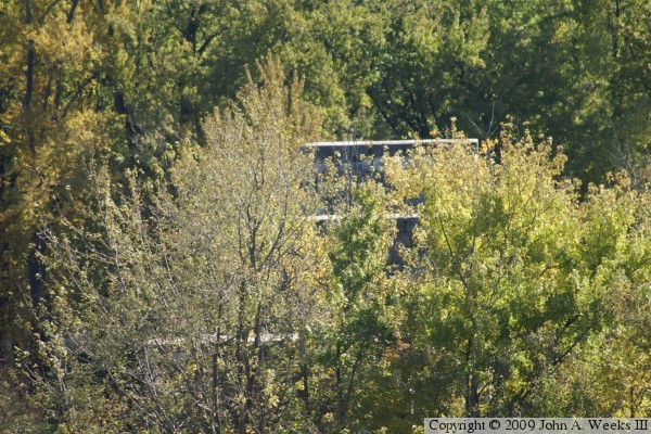
The photo above is the first view of the bridge ruins as you approach
the site on the trail that runs along the bluffs. The debris makes it
hard to see the abutment. Even after noticing that it is a structure,
it was not clear at first that this was the bridge site. The piers
over the river are not easily visible due to the trees and islands in
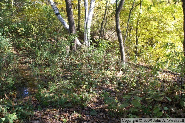
the river channel. Due to 100 years of accumulated debris, the drainage
along the railroad bed is clogged. As a result, the rail line has turned
into a small creek. Water accumulates in front of the abutment, and the
abutment now acts like a small waterfall. The photo below is a close
view of the top of the abutment. Water has eroded a gap on the south
side of the capstone.

There is a small wooden bridge on the trail on the south side of the railroad
bed crossing a drainage ditch. The trail along the bluffs is very well
defined in this area. It appears to be maintained by the Minnesota DNR.
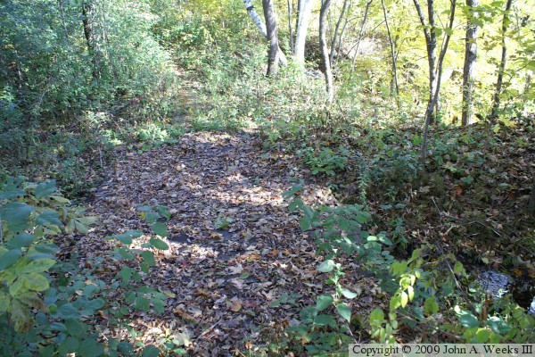
The photo below is looking west from the bridge abutment along the former
railroad bed. The railroad is cut about 20 feet into the top of the bluff
at this location. The roadbed has filled in with debris, and it is now a
linear swamp that is choked with trees.

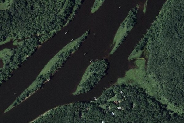
The photo above is an aerial view clipped from an Internet mapping service.
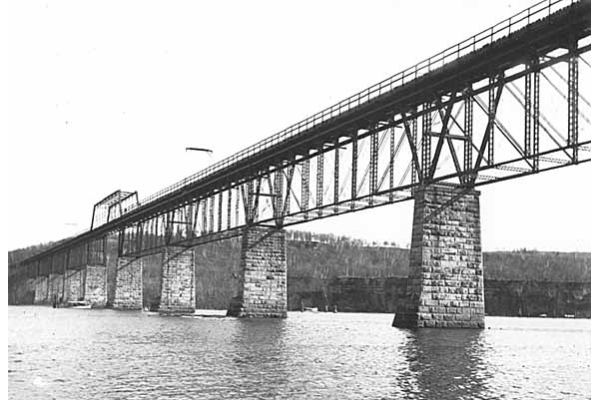
The photo below is a public domain image that dates back to the first
decade of the 1900s.
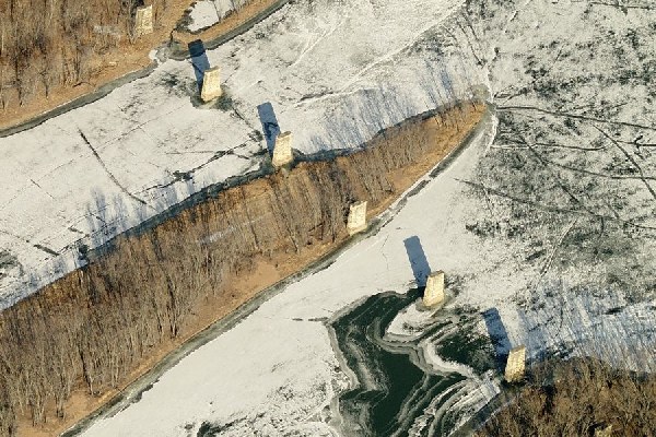
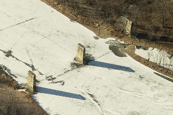
These two photos are clipped from an Internet mapping service. The photo
above includes 7 bridge piers, while the photo below shows 3 piers from the
western of the two river channels. Note that there is a large island in
river that does not appear in the period photo above.
|
