Current Weather Conditions
John A. Weeks III
Tuesday, April 16, 2024, 7:03:59 AM CDT
Home Photo Tours Rail Fan 12 Easy Steps
Aviation Spacecraft Highways & Bridges About The Author
 
Google Search
Maps   Groups   Images   Search
 
  Home
  • 12 Easy Steps
  • Aviation
  • Spacecraft
  • Highways & Bridges
    » Bridge Photography
      - MSP River Bridges
      - C & D Canal
      - Illinois River
      - Minnehaha Creek
      - Minnesota River
      - Mississippi River
      - Missouri River
      - St. Croix River
      - St. Louis River
        › St. Louis Headwaters
        › Upper St. Louis River
        › Forbes - US-53 Area
        › Up Mid St. Louis River
        › Lw Mid St. Louis River
        › Fond du Lac Reservatn
          · BNSF RR Brookston
          · Brookston Bridge
          · US-2 Bridge
        › Cloquet - Scanlon
        › Jay Cooke State Park
        › Twin Ports Harbor
      - Wisconsin River
      - Best Miss River Photos
      - Cable Stayed Bridges
      - McGilvray Road Bridges
      - I-35W Bridge Disaster
      - Miscellaneous Bridges
      - Madison County Bridges
      - Hist Br Weekend 2013
    » Road Geek Topics
  • Photo Tours
  • Rail Fan
  • About The Author
 
Site Search By JRank
Highways, Byways, And Bridge Photography
US-2 Bridge
US-2 Saint Louis River Highway Crossing
Brookston, MN

US-2 Bridge

• Structure ID: NBI 69121
• Location: River Mile 50.5
• River Elevation: 1,209 Feet
• Highways: US-2
• Daily Traffic Count: 4,300 (2004)
• Bridge Type: Prestressed Concrete Girder, Concrete Deck
• Bridge Length: 848 Feet, 140 Foot Longest Span
• Bridge Width: 48 Feet, 2 Lanes
• Navigation Channel Width: Non-Navigable
• Height Above Water: 46 Feet
• Date Built: 2002
This impressively large bridge crosses the Saint Louis River and the BNSF Railroad mainline tracks. The tracks are on the far side of the river in these photos. When first designated to be a US highway, US-2 actually followed the current CSAH-8 on the north side of the river. US-2 was rebuilt on a new alignment and paved prior to 1940 on the south side of the river. This is actually the second time that US-2 crosses the Saint Louis River. The other crossing is on the US-2 Richard I. Bong Memorial Bridge over the harbor between Duluth and Superior.

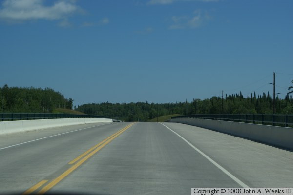
While this bridge is a fairly routine prestressed concrete girder bridge, it does have a few decorative elements. First, the piers have lines and indents that enhance their shape and style. Next, there are a series of parallel lines on the outside of the guardrails. Finally, the bridge has a very nice guardrail configuration. In addition to the standard solid and slanted concrete guardrails, a set of elegant steel railings have been installed on top of the concrete guardrails. The result is both functional as well as looking great.

Note that the east end of the bridge is very tall. The reason is a large rock outcropping that was buried for eons until the glaciers came through. When the glacial lakes started to drain, one lake carved a channel that ran on the west side of this rock, which today carries the Saint Louis River. A second lake created a channel that is used by the Cloquet River, which once ran on the east side of this rock in a second parallel river channel. The two glacial rivers met just south of the US-2 bridge. After the glacial period was over, the Cloquet River eventually cut a new outlet and joined the Saint Louis River about a mile upstream of the US-2 bridge. The result is that the east channel is no longer used, and is a wetland area today. But the rock still stands, with US-2 cutting across the center of the rock, the Saint Louis River on on the west side of the rock, and the new river bridge anchored firmly to the rock.

The photo above is looking northwest towards the downriver south side of the US-2 Bridge over the Saint Louis River. The vantage point is the east bank of the river at a DNR maintained public water access parking area.


US-2 Bridge
The photo above is a closer view of the spans over the Saint Louis River, while the photo below is looking almost directly west across the river. Both photos are again from the public water access on the east bank of the river. The BNSF Railroad tracks are on the far side of the river in this photo, running under the span next to the west bridge abutment.

US-2 Bridge
US-2 Bridge
These two photos are the first of a four photo set showing a typical river crossing heading eastbound towards Duluth. In the photo above, we are on the grade leading up to the bridge, while in the photo below, we are just about to enter the west end of the structure.

US-2 Bridge
US-2 Bridge
These two photos complete our eastbound crossing of the US-2 Bridge. In the photo above, we are climbing the uphill grade on the west end of the bridge, while in the photo below, we have reached the peak of the hump in the bridge deck near the east end of the structure.

US-2 Bridge

Made With Macintosh
Authored by John A. Weeks III, Copyright © 1996—2016, all rights reserved.
For further information, contact: john@johnweeks.com