Current Weather Conditions
John A. Weeks III
Saturday, April 20, 2024, 3:58:19 AM CDT
Home Photo Tours Rail Fan 12 Easy Steps
Aviation Spacecraft Highways & Bridges About The Author
 
Google Search
Maps   Groups   Images   Search
 
  Home
  • 12 Easy Steps
  • Aviation
  • Spacecraft
  • Highways & Bridges
    » Bridge Photography
      - MSP River Bridges
      - C & D Canal
      - Illinois River
      - Minnehaha Creek
      - Minnesota River
      - Mississippi River
        › Lake Itasca Area
        › Bemidji Area
        › Cass Lake - Ball Club
        › Grand Rapids Area
        › Blackberry - Crosby
        › Brainerd Lakes Area
        › Little Falls Area
        › St. Cloud Area
        › North Metro Area
        › Port Of Minneapolis
        › St. Anthony Falls Area
        › Mississippi Rvr Gorge
        › St. Paul Area
        › S St. Paul - Hastings
        › Red Wing - Winona
        › La Crosse Area
          · Lock & Dam #7
          · Dresbach Bridge
          · Round Lake Bridge
          · French Slough Bridge
          · Rest Area Bridge
          · Black River Channel
          · Hiawatha Islands Br
          · Clinton Street Bridge
          · Fisherman's Bridge
          · CP RR La Crosse
          · CP RR East Channel
          · CP RR French Slough
          · CP RR Black Rr Br
          · Pettibone Park Br
          · The Miss River Br
          · West Channel Bridge
          · Isle La Plume Foot Br
          · Niedbalski Bridge
          · Green Island Bridge
          · Goose Island Bridge
        › Lansing - Clinton
        › Quad Cities Area
        › Muscatine - Louisiana
        › St. Louis Area
        › Chester - Cairo
        › Miss - Tenn - Ark
        › Ark - Miss - Louisiana
        › Louisiana Structures
      - Missouri River
      - St. Croix River
      - St. Louis River
      - Wisconsin River
      - Best Miss River Photos
      - Cable Stayed Bridges
      - McGilvray Road Bridges
      - I-35W Bridge Disaster
      - Miscellaneous Bridges
      - Madison County Bridges
      - Hist Br Weekend 2013
    » Road Geek Topics
  • Photo Tours
  • Rail Fan
  • About The Author
 
Site Search By JRank
Highways, Byways, And Bridge Photography
Dresbach Bridge
I-90 Mississippi River Crossing At La Crosse
La Crosse, Wisconsin

Dresbach Bridge

• Structure ID: NBI B32004500000000 (WI), 9320 (MN).
• Location: River Mile 701.8.
• River Elevation: 631 Feet.
• Highway: I-90.
• Daily Traffic Count: 26,000 (2004).
• Bridge Type: Steel Girder, Concrete Deck.
• Length: 2,490 Feet Overall, 450 Foot Main Span.
• Width: 58 Feet.
• Navigation Channel Width: 411 Feet.
• Height Above Water: 62 Feet.
• Date Built: Opened October 1968.
The Dresbach Bridge is very ordinary and nondescript for such a major Mississippi River crossing. Of all the places that a signature bridge could have been built, this would have been the place.

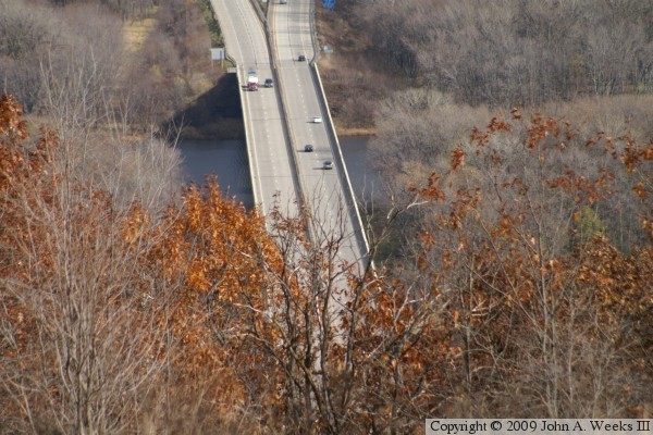
The river crossing at La Crosse is nothing short of amazing. The Black River joins the Mississippi River just south of this crossing. The result is a large number of channels, sloughs, wetlands, and lakes. The river itself is over 3 miles wide, and I-90 has several smaller bridges leading up to this span over the main channel. The I-90 bridge is the start of one of the most scenic sections of the Great River Road between La Crosse and Winona. The only other part of the Great River Road that can rival this section is the Palisades area just north of Alton, IL.

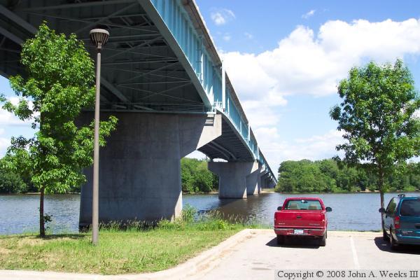
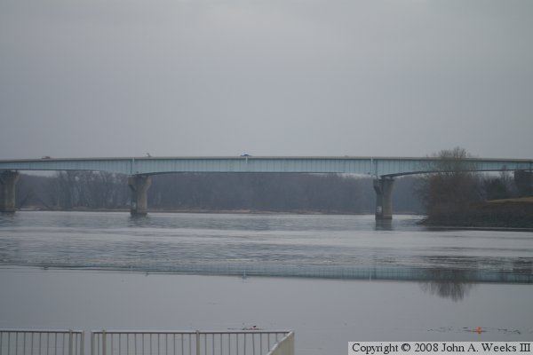
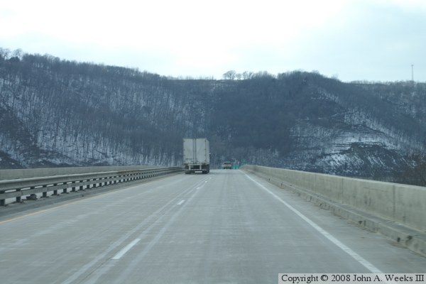
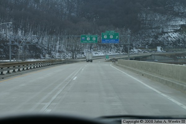
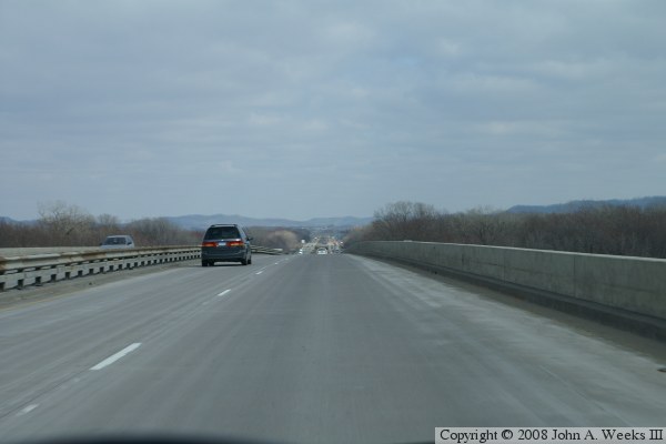
The Dresbach Bridge has a number of problems. First, it is a very narrow bridge for being a major freeway river crossing. The outside shoulders are only 3-1/2 feet wide, and the inside shoulders are only 2 feet wide. There is no room for a stalled vehicle to park, nor is there room for emergency vehicles to reach the scene of accidents. Second, the bridge has a very sharp corner on the Minnesota end of the crossing. Third, there are a number of very busy exit and entrance ramps near this sharp corner, one that routes US-14 and US-61 into the city, and another that serves a very popular rest area and riverside park. Finally, the bridge is built with a non-redundant design. That is, if any one of the major structural steel members fails, the entire bridge is likely to collapse. That is not good, rather, a bridge should be able to survive the loss of any one beam or brace.

MN-DOT has been leading a study of alternatives to upgrade the Dresbach Bridge. All of the alternatives feature a wider bridge and extensive interchange work on the west end of the river crossing. One alternative suggests a twin bridge, another widening the existing bridge, while yet another suggests a new cable stayed bridge. Price estimates are in the $50-million to $100-million range. The desire to replace bridge picked up speed following the I-35W bridge disaster, which brought the problem of fracture-critical bridges to the forefront.

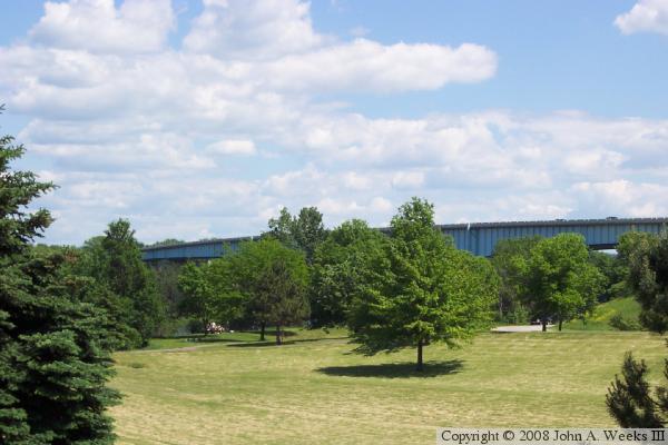
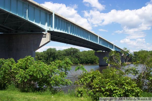
The photo at the top of the page is taken from the boat landing on the Minnesota side of the river, just below the highway rest area and just south of the bridge. The photo below was taken from the edge of the river near the rest area on the north side of the bridge. There is a lot of vegetation in this area, so you have to sneak photos in where ever you can.


Dresbach Bridge
Dresbach Bridge
The photo above is another view from the boat landing parking lot under the west end of the bridge. Notice how far the bridge continues after reaching the opposite shore. The bridge crosses a narrow island, and then crosses the east channel of the Mississippi before returning to land. The photo below is a view from the rest area parking lot. It points out that the bridge deck sits at tree top level.

Dresbach Bridge
Dresbach Bridge
The photo above is a view from the Great River Overlook located on Houston County Highway #1 just north of La Crescent, Minnesota. The bluff is very steep at this location, which hides the west end of the bridge from view. The photo below is a view of the main span was taken from the parking lot at the US Army Corps of Engineers Lock & Dam #7, which is just north of the rest area. Photo was taken on a typical overcast winter day. The water looks very cold, but it did not freeze below the dam for several miles during the winter of 2006 and 2007. The water was frozen above the dam.

Dresbach Bridge
Dresbach Bridge
These two photos are part of a three photo set showing a typical bridge crossing heading westbound towards Minnesota on Interstate I-90. In the photo above, we are just entering the Dresbach bridge. Note that it is a single span with only a guard rail between the two sets of lanes. The photo photo below shows the westbound climb towards the peak of the bridge. While the profile views of the bridge do not show that much of a hump, it really feels like a large grade in a moving vehicle.

Dresbach Bridge
Dresbach Bridge
The photo above is the third photo of a three photo set showing a typical crossing of the Dresbach Bridge heading westbound towards Minnesota. In this photo, we are about to exit the bridge and make the turn to the north to follow the west bank of the Mississippi River. Note that the steep bluff forces the sharp curve and the rocks leave no room for additional construction. The photo below is a view from an eastbound crossing. The bluffs are about 4 miles in to the east on the far east side of La Crosse.

Dresbach Bridge

Made With Macintosh
Authored by John A. Weeks III, Copyright © 1996—2016, all rights reserved.
For further information, contact: john@johnweeks.com