Current Weather Conditions
John A. Weeks III
Friday, March 29, 2024, 1:39:51 AM CDT
Home Photo Tours Rail Fan 12 Easy Steps
Aviation Spacecraft Highways & Bridges About The Author
 
Google Search
Maps   Groups   Images   Search
 
  Home
  • 12 Easy Steps
  • Aviation
  • Spacecraft
  • Highways & Bridges
    » Bridge Photography
      - MSP River Bridges
      - C & D Canal
      - Illinois River
      - Minnehaha Creek
      - Minnesota River
      - Mississippi River
      - Missouri River
        › Fort Peck Area
        › Eastern Montana
        › Western North Dakota
        › Central North Dakota
        › South Dakota Interior
        › Nebraska - S Dakota
          · Fort Randall Dam
          · Chief Standing Bear
          · Gavins Point Dam
          · Yankton Discovery
          · Meridian Highway Br
          · Newcastle-Vermillion
          · Ponca Pipeline Br
        › Nebraska - Iowa (N)
        › Omaha Area
        › Nebraska - Iowa (S)
        › Nebraska - Missouri
        › Kansas - Missouri
        › Kansas City Area
        › West Central Missouri
        › East Central Missouri
        › St. Louis Area
      - St. Croix River
      - St. Louis River
      - Wisconsin River
      - Best Miss River Photos
      - Cable Stayed Bridges
      - McGilvray Road Bridges
      - I-35W Bridge Disaster
      - Miscellaneous Bridges
      - Madison County Bridges
      - Hist Br Weekend 2013
    » Road Geek Topics
  • Photo Tours
  • Rail Fan
  • About The Author
 
Site Search By JRank
Highways, Byways, And Bridge Photography
Meridian Highway Bridge
US-81 Missouri River Highway Crossing
Yankton, SD

Meridian Highway Bridge

• Structure ID: NBI 000000068122210 (SD)
• Location: River Mile 806 (Approximate)
• River Elevation: 1,161 Feet
• Highway: US-81
• Daily Traffic Count: 6,490 (2006)
• Bridge Type: Two Level Steel Truss w/Lift Span
• Length: 3,029 Feet, 250 Foot Lift Span
• Width: 18 Feet, 1 Lanes Per Level
• Navigation Channel Width: Non-Navigable
• Height Above Water: ???
• Date Built: Opened October 11, 1924, Dedicated October 16, 1924
The Meridian Highway Bridge dates back to 1915, when a group of Yankton businessmen organized a private bridge company to build a bridge across the Missouri River. While they did raise some money, World War I interrupted the project. The bridge project was picked up again in 1919 by the Yankton area Chamber of Commerce. They selected D. B. Gurney (famous of the Gurney Seed Catalog Company) as president of the bridge authority. They held a groundbreaking on February 21, 1921. The project was built in small pieces. When money was available, a new section would be ordered. Work would continue until the money ran out, and it would be on hold until more shares were sold. The main span was first operated on July 30, 1924. The bridge was finally completed and dedicated in October, 1924.

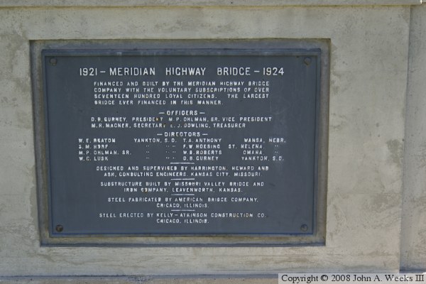
The name Meridian was selected because the bridge is located near the 6th meridian line of 100 degrees west longitude. At the time, it was hoped that an international highway would be built along the 6th meridian from Mexico City to Winnipeg, running through Yankton. Some references state that the bridge was the last link in the Pan American Highway. As it stands, there is no official route for the Pan American Highway in the US or Canada. There are many unofficial routes, with the routes through Denver and through Minneapolis being the most popular. The Pan American Highway Association suggests a route from Wichita, Kansas, heading north on US-81 through Yankton, and to Watertown, South Dakota. At Watertown, the route would pick up Interstate I-29 to Canada.

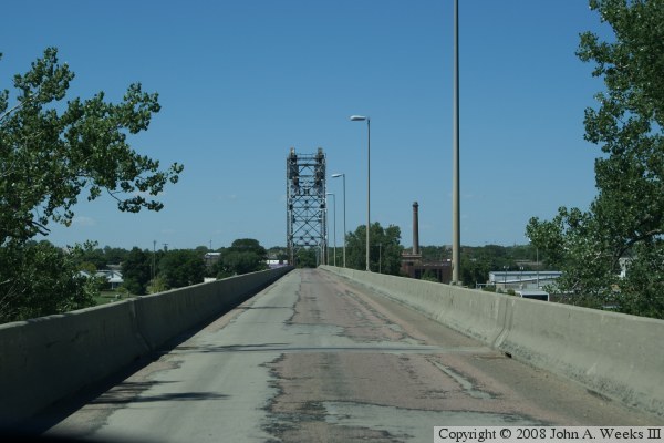
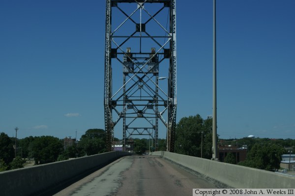
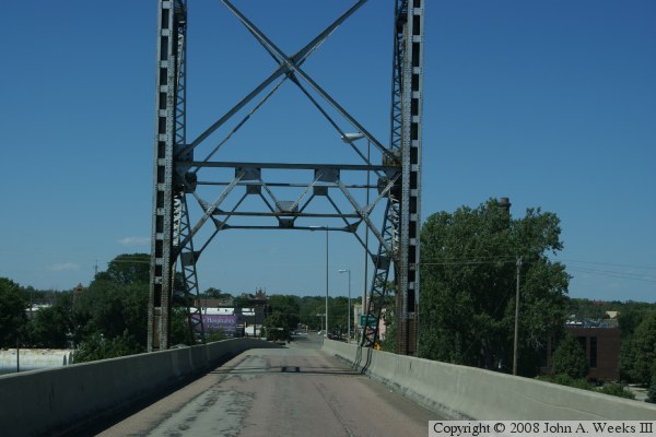
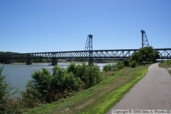
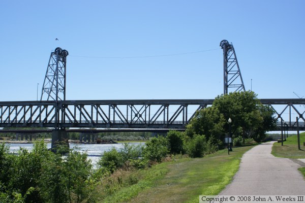
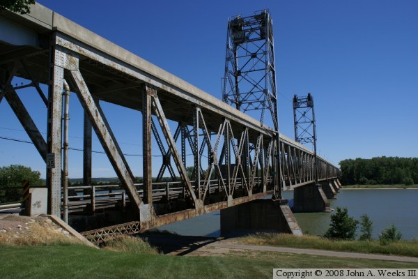
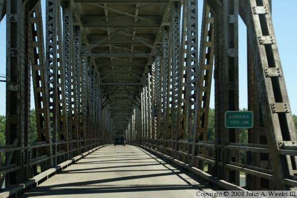
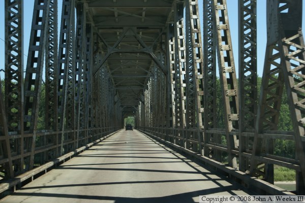
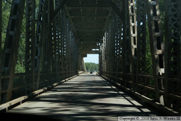
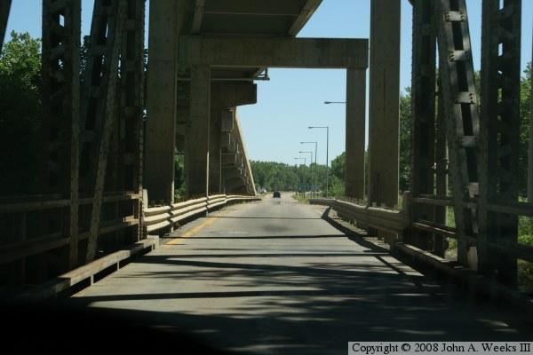
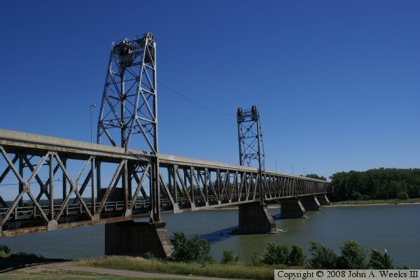
The bridge is a two-level lift bridge. This is a rather rare configuration. When built, the lower level had railroad tracks, and the upper level was for vehicle and wagon traffic. It was hoped that a railroad could be attracted from the south by having the bridge already in place. The railroad never materialized, so when the bridge was refurbished in 1953, it was converted to two one-way paths. The bottom level was one-way heading south into Nebraska, while the upper level was one-way heading north into Yankton.

The bridge is 3,029 feet overall. That is from the start of the ramp that goes to the upper level to where the ramp ends on the other end. The metal structure is 1,668 feet long, including the 250 foot lift span. Different sources report different lengths depending on where they measure from. The tolls were removed in 1953, and the lift mechanism was removed in 1983.

The first vehicle to officially cross the bridge was driven by Mrs. D. B. Gurney and her husband, along with a few other local residents, on October 5, 1924. After they crossed, they learned that their son, Chandler Gurney, had crashed his car through the temporary barricade in order to claim the honor of crossing the bridge before his parents. At 12:01 AM on December 1, 1953, Mrs. D. B. Gurney crossed the bridge and paid the final toll of 50 cents.

While the bridge is not adequate for current traffic levels, it is in sound condition. It will always need some level of maintenance work. In fact, the bridge was closed for much of June, 2008, to allow crews to install some plate doublers to reinforce some rusted gusset plates. The plan is to use the bridge as part of a regional trail.

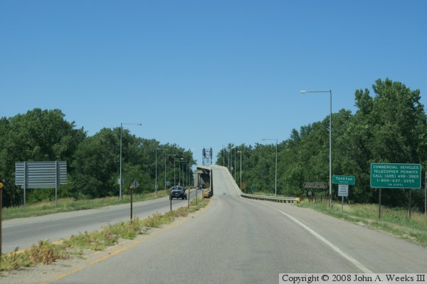
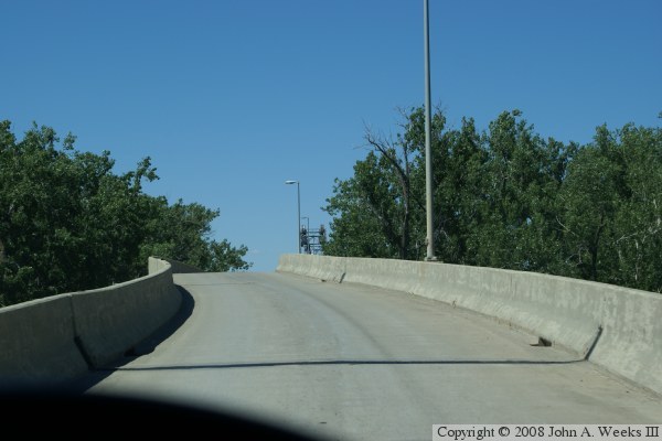
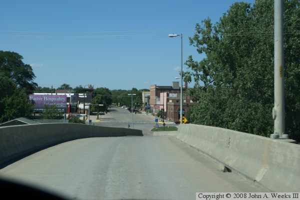
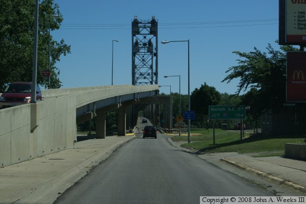
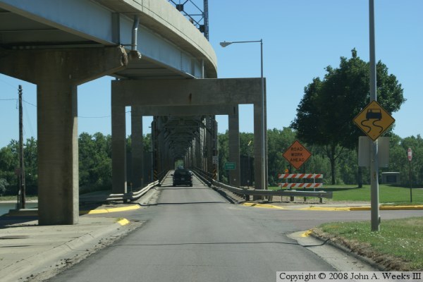
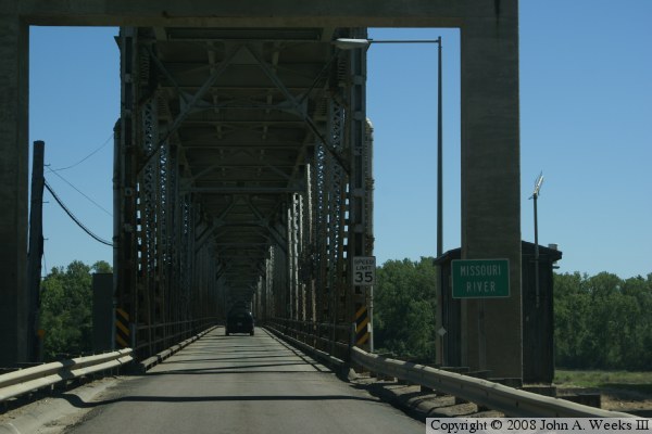
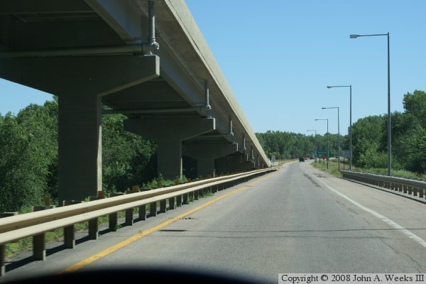
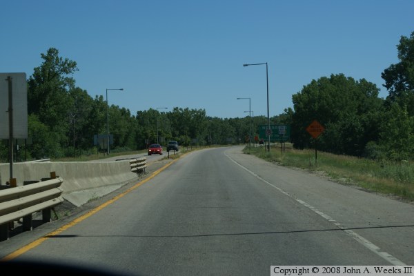
The next 7 photos below are shots taken during a bridge crossing traveling north. The northbound traffic uses the upper deck, and notice the jog in the lane to get lined up with the narrow roadway on the upper deck.


Meridian Highway Bridge
The 7 photos above are views of a bridge crossing while traveling north. The next 3 photos below are views of the bridge taken from the small park that is located along the Yankton river front.

Meridian Highway Bridge
The 3 photos above are photos taken from the river front park near the Meridian Bridge. Note that while the towers for the lift bridge are still in place, the mechanism and lifting cables have long since been removed, and the bridge does not operate.

The next 9 photos show a typical river crossing traveling from Yankton on the north to Nebraska on the south. This crossing uses the lower level, and the lanes do not have the jog that we saw in the upper lane. The bridge is narrow and long, so the trip is very much like traveling through a tunnel.


Meridian Highway Bridge
The previous 9 photos are views of a typical crossing from Yankton traveling south across the bridge using the lower level. The photo below is a view of a monument near the bridge that holds the bridge manufacture’s plate.

Meridian Highway Bridge

Made With Macintosh
Authored by John A. Weeks III, Copyright © 1996—2016, all rights reserved.
For further information, contact: john@johnweeks.com