Current Weather Conditions
John A. Weeks III
Saturday, April 20, 2024, 6:27:53 AM CDT
Home Photo Tours Rail Fan 12 Easy Steps
Aviation Spacecraft Highways & Bridges About The Author
 
Google Search
Maps   Groups   Images   Search
 
  Home
  • 12 Easy Steps
  • Aviation
  • Spacecraft
  • Highways & Bridges
    » Bridge Photography
      - MSP River Bridges
      - C & D Canal
      - Illinois River
      - Minnehaha Creek
      - Minnesota River
      - Mississippi River
      - Missouri River
      - St. Croix River
      - St. Louis River
        › St. Louis Headwaters
          · N Shore Mining RR
          · ATV Trail Bridge
          · Skibo Mill Site
          · Skibo Bridge
          · Skibo Lookout Road
          · NF-790 Trail Bridge
          · Moose Line Road Br
        › Upper St. Louis River
        › Forbes - US-53 Area
        › Up Mid St. Louis River
        › Lw Mid St. Louis River
        › Fond du Lac Reservatn
        › Cloquet - Scanlon
        › Jay Cooke State Park
        › Twin Ports Harbor
      - Wisconsin River
      - Best Miss River Photos
      - Cable Stayed Bridges
      - McGilvray Road Bridges
      - I-35W Bridge Disaster
      - Miscellaneous Bridges
      - Madison County Bridges
      - Hist Br Weekend 2013
    » Road Geek Topics
  • Photo Tours
  • Rail Fan
  • About The Author
 
Site Search By JRank
Highways, Byways, And Bridge Photography
NF-790 Trail Bridge
NF-790 Saint Louis River Trail Crossing
Hoyt Lakes, MN

NF-790 Trail Bridge

• Structure ID: N/A
• Location: River Mile 168.6
• River Elevation: 1,482 Feet
• Trail: NF-790 ATV Trail
• Daily Traffic Count: N/A
• Bridge Type: Steel Girder, Wood Deck
• Bridge Length: 44 Feet, 44 Foot Longest Span
• Bridge Width: 11 Feet
• Navigation Channel Width: Non-Navigable
• Height Above Water: 8 Feet
• Date Built: ???
NF-790 is a unimproved logging trail that loops off of and back onto Moose Line Road in the southeastern part of the Superior National Forest. The bridge is located at a former logging dam. The road was built to service the dam. At the current time, the northern section of the road is passable by 4 wheel drive vehicles when it is dry. The southern section is closed to motorized vehicles other than ATVs. The bridge is mostly designed for ATV traffic. There is a large gate installed about 400 feet north of the bridge, with opening at each end wide enough for an ATV to pass through.

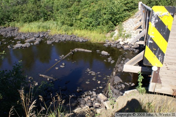
A logging dam was typically built by making a square wooden crib, which was placed in the river and filled with rocks. Boards could be placed between two cribs to make a sluice gate. The dam would store up water for a few weeks, and then open to allow a slug of water and a group of logs to head down river. The slug of water would carry the logs over rapids and through shallow spots. To make the logs easy to handle, they would be pulled (or skidded) using teams of ox or horses. The animals would pull groups of logs onto the ice during the winter. In spring, the ice would melt, dumping the logs into the water ready to be sent downriver.

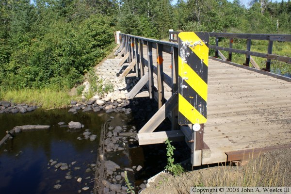
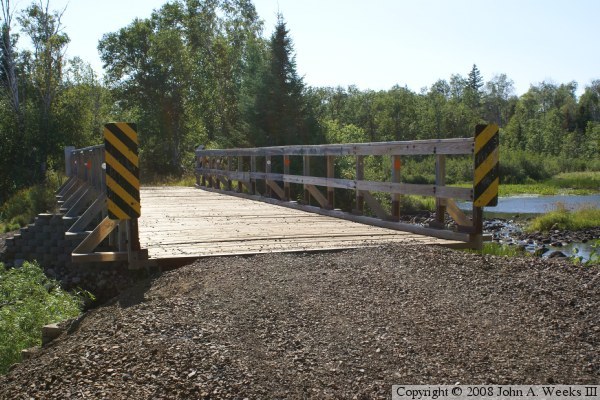
The bridge is built with steel girder beams strung between the abutments. A wood deck is then put down and attached to the girders. Every so often, a much longer deck board is installed. That longer deck board is used to cross-brace the railings giving them some side to side support.

It appears that the ATV bridge is relatively new. I suspect that the old logging dam supported a bigger bridge that allowed for vehicle traffic. Over time, that bridge would have rotted and became unsafe. At some recent time, the bridge and dam were removed, the rocks were used to build up the embankment, and this trail bridge was installed. If anyone knows more of this story, please let me know.

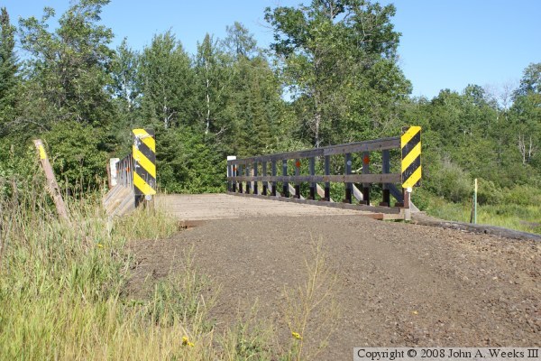
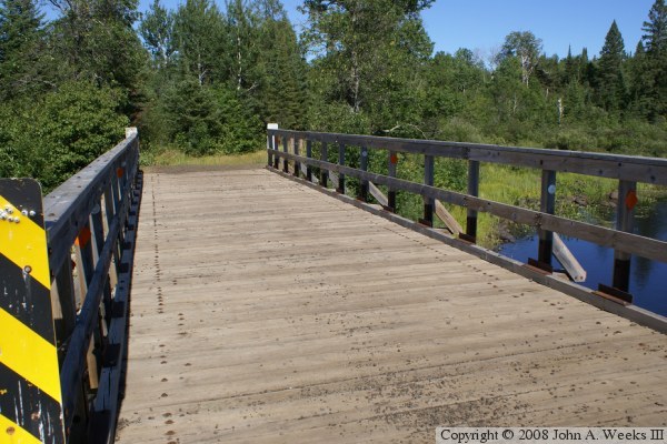
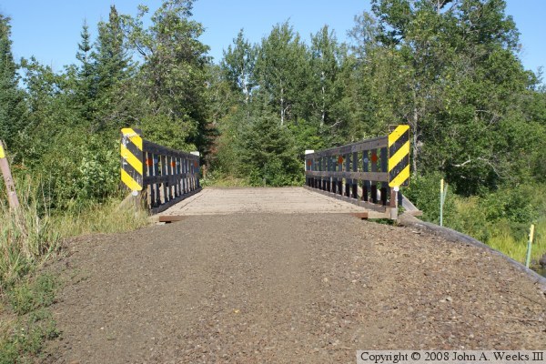
The photo above is looking east down the length of the bridge deck from the center of the ATV Trail. The photo below is a similar view looking east from the north side of the ATV trail. The trail is built on top of an old logging dam, resulting in the trail being well above the water level.


NF-790 Trail Bridge
NF-790 Trail Bridge
The photo above is looking east along the downstream north face of the NF-790 Trail Bridge. The photo below is a view of the remains of the gate structure of the old logging dam.

NF-790 Trail Bridge
NF-790 Trail Bridge
The photo above is a close view of the bridge deck and railings, also looking to the east. The photo above is looking west towards the bridge into the bright afternoon sun.

NF-790 Trail Bridge

Made With Macintosh
Authored by John A. Weeks III, Copyright © 1996—2016, all rights reserved.
For further information, contact: john@johnweeks.com