|
John A. Weeks III
Sunday, July 12, 2026, 1:58:40 AM CDT |
|||
| Home | Photo Tours | Rail Fan | 12 Easy Steps |
| Aviation | Spacecraft | Highways & Bridges | About The Author |
|
|
|
|||||||||||||||||
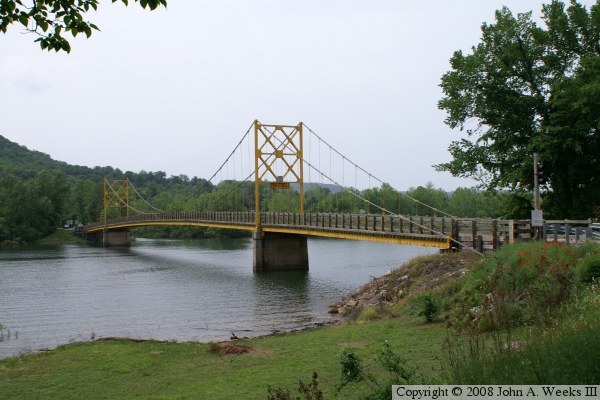
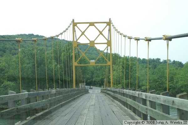
AR-187 White River Highway Crossing Beaver, AR
The last remaining suspension bridge in Arkansas is this one-lane bridge
over the White River at the small hamlet of Beaver, Arkansas. In this
area, the river has just passed over the huge Beaver Dam, and is now
flowing into the reservoir that backs up behind Table Rock Dam near
Branson. Beaver is located east of Bentonville and Rogers, and just
northwest of Eureka Springs in the heart of the Arkansas Ozarks.
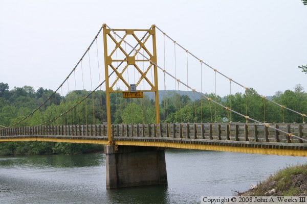
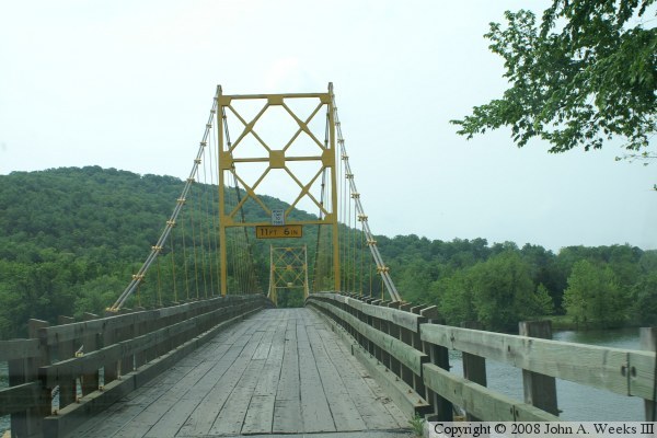
This bridge is nicknamed the Little Golden Gate Bridge. The Arkansas
state highway department calls the bridge intolerable to be left in
place. They proposed rebuilding highway 187 in this area, complete with
a modern bridge. The locals waged a 3 year campaign to save their
historic suspension bridge. The bridge has a wooden deck and wooden
guard rails. Only one car at a time can cross. There are stoplights
on each end to control traffic. Even at 5 miles per hour, the bridge
makes a rumbling noise as you cross.
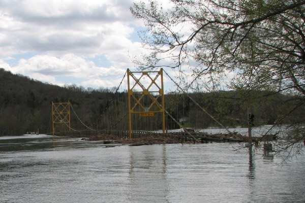
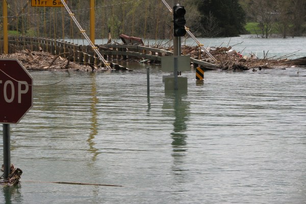
The spring of 2008 has seen a record amount of rain through the central
part of the US, and especially in Missouri and Arkansas. Water backed
up behind Table Rock Dam bringing the lake to a record high level. Then
Beaver Lake hit its flood level and the diversion gates had to be opened.
All that water ended up in this section of the White River. The water level
is approximately 20 feet above normal. Signs and the bridge stop lights
are submerged. A large amount of debris has accumulated under and behind
the bridge. The state says that the bridge is most likely damaged, and
it may not be able to save the structure even after the water level goes
back down. Note that these two photos were taken by my brother, Loren
Weeks.
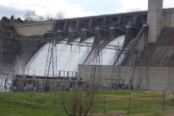
This is the first major flood in this area since the very early 1980s.
The reason is a series of major dams, such as the Beaver Dam located
just up river, that serve to control floods. The photo above shows the dam
from the summer of 2007, when the water level was well below the flood
stage. The two photos below show the Beaver Dam on April 12, 2008, when
the flood gates were opened to 9.5 feet. The flood gates have only been
open 6 times before, only 3 times prior to 2008, and never open more
than 5.5 feet. This happened after the lake rose 2 feet overnight and
threatened to overtop the dam. At the peak, 1-million gallons of water
per second went over the spillway, enough to fill 7,500 tanker trucks
full of water each minute.
The photo directly below was taken by photographer Rob McFarlin. You can see more of Rob's amazing camera work at his website and the collections that he posts on Flickr. The bottom photo was taken by Loren Weeks. 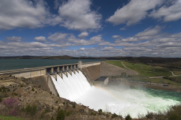
|
|
|
Authored by John A. Weeks III, Copyright © 1996—2016, all rights reserved. For further information, contact: john@johnweeks.com
|