Current Weather Conditions
John A. Weeks III
Saturday, May 4, 2024, 5:37:22 AM CDT
Home Photo Tours Rail Fan 12 Easy Steps
Aviation Spacecraft Highways & Bridges About The Author
 
Google Search
Maps   Groups   Images   Search
 
  Home
  • 12 Easy Steps
  • Aviation
  • Spacecraft
  • Highways & Bridges
    » Bridge Photography
      - MSP River Bridges
      - C & D Canal
      - Illinois River
      - Minnehaha Creek
      - Minnesota River
      - Mississippi River
      - Missouri River
        › Fort Peck Area
        › Eastern Montana
        › Western North Dakota
        › Central North Dakota
          · Garrison Dam
          · Washburn Bridge
          · Grant Marsh Bridge
          · Missouri R High Br
          · Liberty Memorial Old
          · Liberty Memorial Br
          · Bismarck Expy Br
        › South Dakota Interior
        › Nebraska - S Dakota
        › Nebraska - Iowa (N)
        › Omaha Area
        › Nebraska - Iowa (S)
        › Nebraska - Missouri
        › Kansas - Missouri
        › Kansas City Area
        › West Central Missouri
        › East Central Missouri
        › St. Louis Area
      - St. Croix River
      - St. Louis River
      - Wisconsin River
      - Best Miss River Photos
      - Cable Stayed Bridges
      - McGilvray Road Bridges
      - I-35W Bridge Disaster
      - Miscellaneous Bridges
      - Madison County Bridges
      - Hist Br Weekend 2013
    » Road Geek Topics
  • Photo Tours
  • Rail Fan
  • About The Author
 
Site Search By JRank
Highways, Byways, And Bridge Photography
Washburn Bridge
ND-200A Missouri River Highway Crossing
Washburn, ND

ND-200A Bridge

• Structure ID: NBI 0200924623
• Location: River Mile ???
• River Elevation: 1,655 Feet
• Highway: ND-200A
• Daily Traffic Count: 1,430 (2000)
• Bridge Type: Steel Girder, Concrete Deck
• Length: 1,500 Feet
• Width: 36 Feet, 2 Lanes
• Navigation Channel Width: Non-Navigable
• Height Above Water: 30 Feet
• Date Built: 1971
The big news in Washburn is that it was a major stop for the Lewis & Clark Expedition. They arrived on October 25, 1804, and decided to stay for the winter. In doing so, they established Fort Mandan. Today, the fort has been reconstructed, along with the establishment of a Lewis & Clark Interpretive Center.

The area around Fort Mandan, which would become Washburn, was visited by trappers and traders, and the first settlement was established in the mid-1800s. The city gained an economic advantage when steamship travel came to town with Washburn being the northernmost point on the river that as navigable. Steamships gave way to the railroad. A ferry boat across the river was established in May of 1952, and ran until 1962, when shifting currents in the river made navigation impossible. This was the last ferry boat to operation in the state of North Dakota.

In the early 1970s, everything changed for the sleepy little town of Washburn. Coal had been discovered. Energy companies began major strip mining operations. Other energy companies discovered that they could make electricity more economically by building the power plants next to the coal fields, and sending the power to market over transmission lines. The Coal Creek Station was later built in this area, the largest power plant in the state.

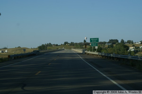
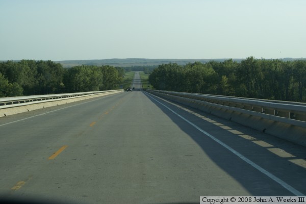
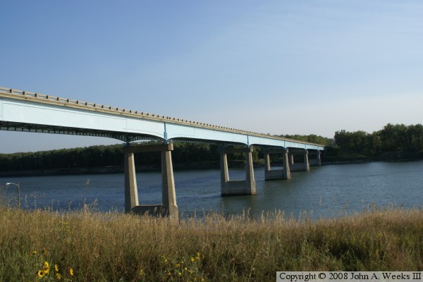
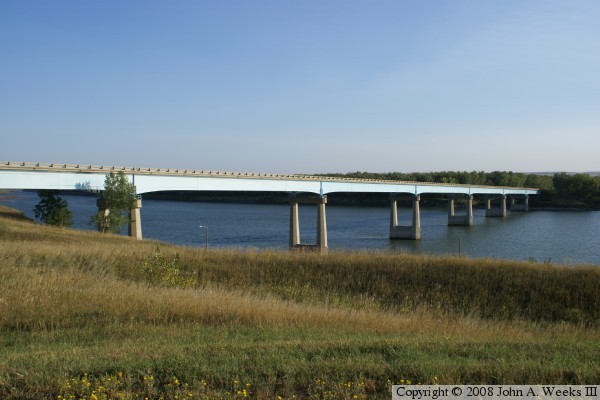
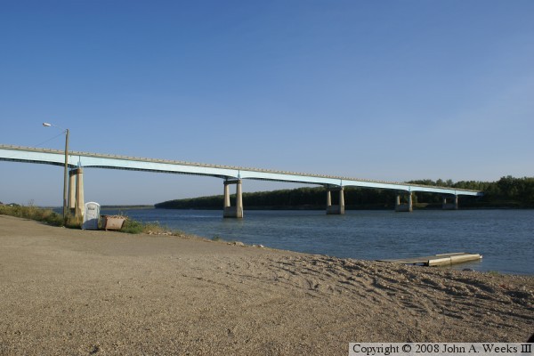
With the economic boom came the need for better transportation, and that included building a bridge across the Missouri River. The result is a 1,500 foot long steel girder bridge with a concrete deck. The bridge, which opened in 1971, looks very much like the US-85 Lewis & Clark Bridge near Williston, which opened 2 years later. The only real difference between the two bridges is that the Washburn Bridge is higher above the water due to the height of the bluffs along the river at that location.


ND-200A Bridge
ND-200A Bridge
ND-200A Bridge
ND-200A Bridge

Made With Macintosh
Authored by John A. Weeks III, Copyright © 1996—2016, all rights reserved.
For further information, contact: john@johnweeks.com