Current Weather Conditions
John A. Weeks III
Sunday, September 24, 2023, 7:43:53 AM CDT
Home Photo Tours Rail Fan 12 Easy Steps
Aviation Spacecraft Highways & Bridges About The Author
 
Google Search
Maps   Groups   Images   Search
 
  Home
  • 12 Easy Steps
  • Aviation
  • Spacecraft
  • Highways & Bridges
    » Bridge Photography
      - MSP River Bridges
      - C & D Canal
      - Illinois River
      - Minnehaha Creek
      - Minnesota River
      - Mississippi River
      - Missouri River
      - St. Croix River
      - St. Louis River
        › St. Louis Headwaters
        › Upper St. Louis River
          · CSAH-100 Bridge
          · Fort Victory Bridge
          · Evergreen Road Br
          · Vermilion Trail Br
          · Lost Lake Road Br
          · Bodas Road Bridge
        › Forbes - US-53 Area
        › Up Mid St. Louis River
        › Lw Mid St. Louis River
        › Fond du Lac Reservatn
        › Cloquet - Scanlon
        › Jay Cooke State Park
        › Twin Ports Harbor
      - Wisconsin River
      - Best Miss River Photos
      - Cable Stayed Bridges
      - McGilvray Road Bridges
      - I-35W Bridge Disaster
      - Miscellaneous Bridges
      - Madison County Bridges
      - Hist Br Weekend 2013
    » Road Geek Topics
  • Photo Tours
  • Rail Fan
  • About The Author
 
Site Search By JRank
Highways, Byways, And Bridge Photography
Evergreen Road Bridge
Saint Louis River Highway Crossing
Pineville, MN

Evergreen Road Bridge

• Structure ID: NBI: 69531
• Location: River Mile 152.4
• River Elevation: 1,345 Feet
• Highways: Biwabik Township Road 551
• Daily Traffic Count: 100 (1985)
• Bridge Type: Prestressed Concrete Girder, Concrete Deck
• Bridge Length: 147 Feet, 49 Foot Longest Span
• Bridge Width: 37 Feet, 2 Lanes
• Navigation Channel Width: Non-Navigable
• Height Above Water: 14 Feet
• Date Built: 1985
Evergreen Road is located in a small lakes region just south of the eastern extent of the Iron Range. It is used primarily by a handful of local property owners and some sportsmen. Overall traffic of about 100 cars a day reflects the remoteness of the bridge, and the fact that the road doesn't connect two larger traffic centers. Despite the low traffic, the road is in good condition, and the bridge is very modern compared to what one might expect.

The bridge itself is a relatively new prestressed concrete girder bridge. This is very typical of the modern rural bridge design that is suggested by MN-DOT. It is low on maintenance, requires little in the way of inspections, and it should last virtually forever with a little care. These are all ideal features for a bridge located in a smaller rural township that may not have a lot of money to spend on infrastructure.

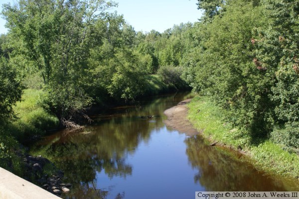
There is a large amount of brush and vegetation growing along the side of this bridge. That makes it difficult to take any type of profile photo of the structure. In addition to being inconvenient for photography, it is also a maintenance issue. The leaves can keep the concrete damp, which leads to deterioration, especially during freeze and thaw cycles. The local highway crew should take a bit of time and trim back this brush at least 10 feet from the bridge.

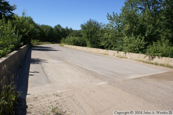
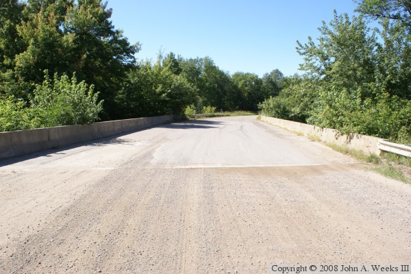
The photo above is looking west down the middle of the bridge deck. The road takes a turn to the northwest just beyond the river crossing. The photo below is a view looking northwest across the bridge deck from the southeast corner of the structure. The greenery growing along the edge of the bridge is apparent in this photo.


Evergreen Road Bridge
The photo above is looking upstream to the north from the deck of the Evergreen Road Bridge. The photo below is the bridge plate.

Evergreen Road Bridge

Made With Macintosh
Authored by John A. Weeks III, Copyright © 1996—2016, all rights reserved.
For further information, contact: john@johnweeks.com