Current Weather Conditions
John A. Weeks III
Thursday, March 28, 2024, 3:43:10 AM CDT
Home Photo Tours Rail Fan 12 Easy Steps
Aviation Spacecraft Highways & Bridges About The Author
 
Google Search
Maps   Groups   Images   Search
 
  Home
  • 12 Easy Steps
  • Aviation
  • Spacecraft
  • Highways & Bridges
    » Bridge Photography
      - MSP River Bridges
      - C & D Canal
      - Illinois River
      - Minnehaha Creek
        › Minnetonka
        › Hopkins & SLP West
        › SLP East & Edina
        › Minnehaha Pkwy West
        › Minnehaha Pkwy Cntrl
        › Minnehaha Pkwy East
        › Minnehaha Falls Area
          · Minnehaha Pkwy (#1)
          · Low Head Dam
          · Hiawatha Ave Bridge
          · Milwaukee Rd RR Br
          · Minnehaha Ave
          · Upper Falls Br
          · Minnehaha Falls
          · Lower Falls Br
          · Deer Pen Bridge
          · Lower Glen Br #3
          · Old Soldiers Home Br
          · Godfrey Mill Site
          · Lower Glen Br #2
          · Lower Glen Br #1
      - Minnesota River
      - Mississippi River
      - Missouri River
      - St. Croix River
      - St. Louis River
      - Wisconsin River
      - Best Miss River Photos
      - Cable Stayed Bridges
      - McGilvray Road Bridges
      - I-35W Bridge Disaster
      - Miscellaneous Bridges
      - Madison County Bridges
      - Hist Br Weekend 2013
    » Road Geek Topics
  • Photo Tours
  • Rail Fan
  • About The Author
 
Site Search By JRank
Highways, Byways, And Bridge Photography
Upper Falls Bridge
Minnehaha Creek Footbridge Crossing
Minneapolis, MN

Upper Falls Bridge

• Structure ID: NBI 93833.
• Location: River Mile 0.
• River Elevation: 798 Feet.
• Structure Type: Pedestrian Bridge.
• Construction: Concrete Slab.
• Length: 94 Feet.
• Width: 18 Feet.
• Height Above Water: ??? Feet.
• Date Built: 1939.
Story to be completed. Notes - Bridge is listed as 1939. It looks too new for that. It has either been rebuilt or replaced since then. Possibly built in 1994 when the park was refurbished.

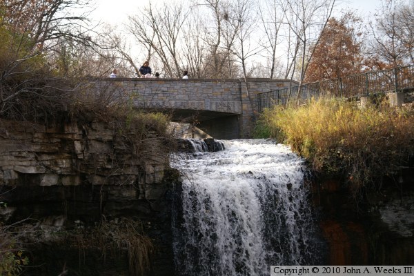
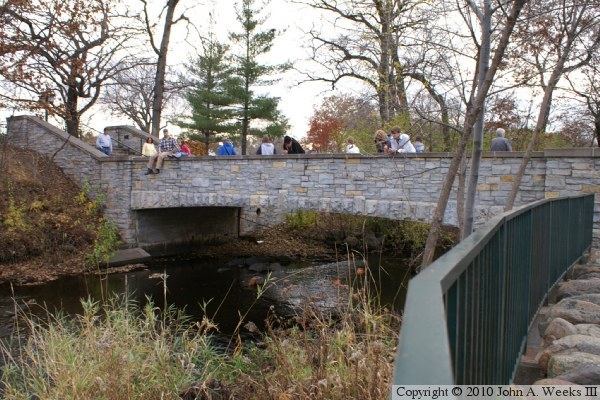
The photo above is a view of the downstream east face of the Upper Falls Bridge as seen from the trail on the north side of the Minnehaha Creek. The photo below is the same face of the Upper Falls Bridge as seen from a walkway leading to the base of the falls.


Upper Falls Bridge
Upper Falls Bridge
The photo above is the downstream east face of the Upper Falls Bridge as seen from the trail on the north side of the creek. The photo below is a similar view of the upstream west face of the structure from the same trail.

Upper Falls Bridge
Upper Falls Bridge
The photo above is looking north down the length of the bridge deck. The falls is to the right of the bridge in this view. The photo below is looking south down the length of the bridge deck.

Upper Falls Bridge

Made With Macintosh
Authored by John A. Weeks III, Copyright © 1996—2016, all rights reserved.
For further information, contact: john@johnweeks.com