Current Weather Conditions
John A. Weeks III
Friday, March 31, 2023, 1:30:37 AM CDT
Home Photo Tours Rail Fan 12 Easy Steps
Aviation Spacecraft Highways & Bridges About The Author
 
Google Search
Maps   Groups   Images   Search
 
  Home
  • 12 Easy Steps
  • Aviation
  • Spacecraft
  • Highways & Bridges
    » Bridge Photography
      - MSP River Bridges
      - C & D Canal
      - Illinois River
      - Minnehaha Creek
      - Minnesota River
        › Ortonville - Odessa
        › Correll - Wegdahl
        › Granite Fls - Rdwd Fls
        › Morton - Judson
        › Mankato - Jordan
        › MSP West Metro
          · M&StL Bridge
          · MN-41 Bridge (New)
          · MN-41 Bridge (Old)
          · MN-41 Backchannel
          · MN-41 Back Ch (Old)
          · MN-41 Bridge
          · Chaska Trestle
          · Chaska Swing Bridge
          · Holmes St Ped Bridge
          · MN-101 Bridge
          · Lewis Street Bridge
        › MSP South Metro
      - Mississippi River
      - Missouri River
      - St. Croix River
      - St. Louis River
      - Wisconsin River
      - Best Miss River Photos
      - Cable Stayed Bridges
      - McGilvray Road Bridges
      - I-35W Bridge Disaster
      - Miscellaneous Bridges
      - Madison County Bridges
      - Hist Br Weekend 2013
    » Road Geek Topics
  • Photo Tours
  • Rail Fan
  • About The Author
 
Site Search By JRank
Highways, Byways, And Bridge Photography
MN-101 Bridge
MN-101 Minnesota River Crossing
Shakopee, MN

MN-101 Bridge

• Structure ID: NBI: 10007.
• Location: River Mile 26.9.
• River Elevation: 693 Feet.
• Highway: MN-101.
• Daily Traffic Count: 21,200 (2004).
• Bridge Type: Steel Girder, Concrete Deck.
• Length: 310 Feet.
• Width: 47 Feet, 2 Lanes.
• Navigation Channel Width: Non-Navigable.
• Height Above Water: ???.
• Date Built: 1982.
This bridge crosses a backchannel of the Minnesota River as part of the highway river crossing at Shakopee. The crossing consists of a main channel bridge, a 4,000 foot long causeway, and this backchannel bridge.

This causeway, as well as the MN-41 causeway (upstream) and the old Bloomington Ferry Bridge (downstream) are very quick to flood in high water. The new Bloomington Ferry Bridge was built above the 100 year flood line to prevent it from flooding in the future. MN-DOT is looking at building a new freeway style river crossing over the Minnesota River between this bridge and the MN-41 causeway to prevent traffic from being blocked by future floods.

This section of road has been marked with several different designations over the years. It was US-169 until the Bloomington Ferry Bridge opened in 1996. From there, it was MN-101. MN-101 in Scott County was later turned back to county maintenance, so MN-101 ended at the county line. That means that the upper part of the causeway and the backchannel bridge in Carver County are part of MN-101, but the main channel crossing in Scott County is designated CSAH-101 (County State Aid Highway). The NBI, however, calls this section of road US-969D.

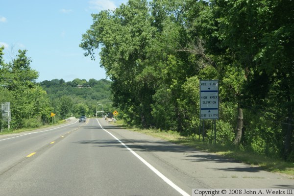
The photo above is the approach to the bridge heading northbound. The photo below is the causeway heading northbound towards the bridge. The vegetation and trees on each side of the road hide the fact that there is water on both sides of the causeway. The highway sign in the photo below shows the depth of the river water during the floods of 1965 and 1993.


MN-101 Bridge
MN-101 Bridge
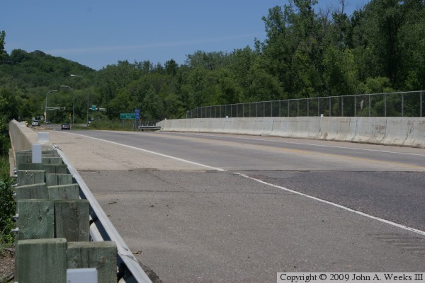
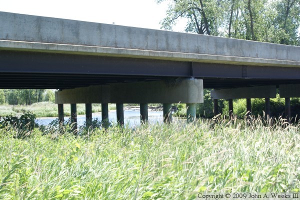
The photo above is a view of the bridge deck as seen from the southwest corner of the structure. The photo below is a view of the west face of the structure.

MN-101 Bridge
MN-101 Bridge
The photo above is a view from floodplain northwest of the structure. The photo below is a closer view of the river channel. Note that the bridge pier in the background consists of two separate piers, while the pier in the foreground is all one piece.

MN-101 Bridge

Made With Macintosh
Authored by John A. Weeks III, Copyright © 1996—2016, all rights reserved.
For further information, contact: john@johnweeks.com