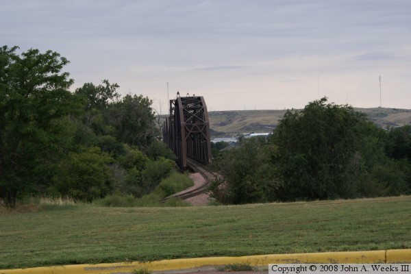
The western part of South Dakota was opened up in the early 1900s. The C&NW announced plans to built a railroad from Pierre to Rapid City. In order to build to the west, vast quantities of steel and building materials would need to be moved across the river. To solve this problem, a temporary railroad trestle was built across the Missouri. The trestle was started on September 20, 1905, and the first train across the temporary bridge crossed on December 14, 1905. The 170 miles of track to Rapid City was competed in June 1907.
The permanent bridge in Pierre was started soon after the temporary bridge was competed. The first work was to assemble caissons for digging the foundations for the bridge piers. The piers on the east end were started first. Large steel rings were assembled, and timber walls were built on top. A roof was built on the caisson. The river ice was then chipped away, allowing the caissons to sink. Air was pumped into the caissons, pushing the water out, and allowing workers to dig at the bottom of the river. Once the caissons were at bedrock, the granite blocks were laid in place. Gradually, the piers were up to water level. From there, the piers tapered back at a 60 degree angle until they were 23 feet above water level. The taper would function as a ice breaker.
Once piers #1 and #2 were in place, pilings were driven into the riverbed to form a scaffolding between the piers. This scaffold would be used to support the construction of the first through truss section. Once the truss was finished, the scaffolding and piles would be removed. The first steel on the first truss was erected in January 1907. Workers reported that the winter of 1906/1907 was a bitter cold winter, but it actually helped the bridge project because it allowed building a very thick ice road at the bridge project, which allowed the construction to run faster.
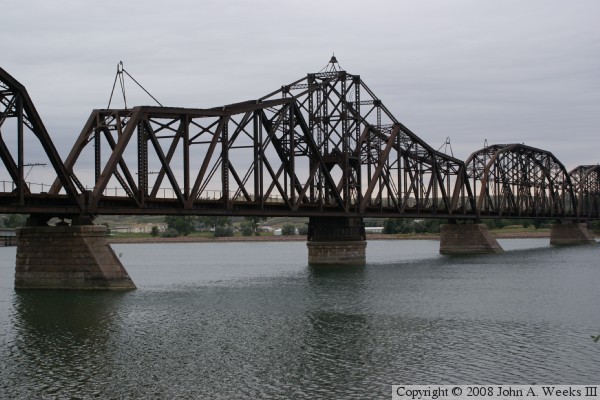
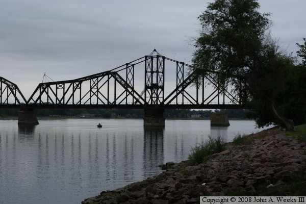
As adjacent sets of piers were completed, the falsework and truss sections would be built. The exception was pier #3, which was built as a circular column. This pier would support the bearing for the swing span. A 445 foot long swing span would be built, which allowed a navigation channel of up to 210 feet to be available when the bridge was opened. The round pier #3 was not made of a shape that would break ice. To protect this pier, a small ice breaker pier was installed 500 feet up river. This is known as pier #3-A. It is visible in some of the photos below. This pier had the secondary task of preventing a boat or barge from hitting the swing span when it was in the open position.
As spring of 1907 arrived, the unusually thick ice on the river started to break up. A massive ice jam formed behind the temporary bridge. This ice threatened to destroy the work in progress and flood the city. Railroad workers used explosives to blow the temporary bridge on March 11. This allowed the ice to move down river. They sacrificed the temporary bridge to save the project. This set back the project since the temporary bridge had to be rebuilt before construction could continue.
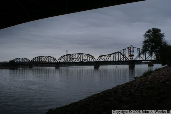
The bridge was finally completed in the fall of 1907. The first train crossed the new Pierre Railroad Bridge on October 14, 1907. Steamboat traffic declined after the turn of the century. As a result, the swing span rarely operated. The last time it was known to have been opened was in 1932. Beyond that, the bridge is little changed since it was built. The trestles at each end have been replaced by fill. The bridge even survived the completion of the Big Bend Dam, which caused water levels to increase less than 4 feet in this area.
The C&NW railroad abandoned South Dakota in 1986 and later merged into the Union Pacific Railroad. The line was purchased by the Dakota, Minnesota, and Eastern Railroad. The DM&E was somewhat of a sleepy short-line railroad. Then massive amounts of coal were discovered in eastern Wyoming. In the late 1990s, the DM&E started to gear up to become a major coal hauler. They revamped the rail line, beefed up bridges, and developed plans to up grade the railroad route. Much of this work was completed in the mid 2000s. In late 2007, the Canadian Pacific announced that they had a deal to purchase the DM&E. As a result, the coal hauling will shift to the CP logo.