The Chesapeake City Bridge is a tall steel tied arch bridge. A tied arch
has a horizontal frame member that connects the bottom ends of the arch. It
prevents the arch from spreading outwards. This means that the main bridge
piers only have to support the weight of the arch, and don't have hold the
arch together to prevent it from spreading out wider. This allows the main
bridge piers to be built much lighter than on a non-tied arch.
The Chesapeake City Bridge was built shortly after the Saint Georges Bridge.
They share a very similar design. In fact, it is hard to tell them apart
without looking at the scenery near the bridges. While the Saint Georges
Bridge was built with 4 traffic lanes, the Chesapeake City Bridge carries
only two lanes of traffic. The bridge does have a sidewalk, which the Saint
Georges Bridge does not.
The original bridge at this location was a wooden swing bridge. This crossed
the canal when the canal still used locks. Two locks were located in
Chesapeake City. The canal was expanded and converted to sea level operation
in the 1920s, so the swing bridge was removed. It was replaced with a steel
lift bridge in 1927. The lift bridges on the C&D Canal were bottlenecks
for ships. Each lift bridge was stuck several times. In fact, the lift bridge
at Chesapeake City was struck and destroyed by the tanker Franz Klasen on
July 28, 1942. Since the war was on at that time, the bridge was not
replaced right away. In fact, the new high-level bridge did not open
until 1949. The new bridge was refurbished in 1978. Despite that being
over 30 years ago, the arch span still looks to be in excellent condition.
The Chesapeake City Bridge is the only bridge on the C&D Canal located
in the state of Maryland. The remaining bridges are located east of the
state line in Delaware. The bridge carries highway MD-213. This was once
US-213, but the route was downgraded to a state highway in the 1970s. Nearby
highway US-301 is a much more direct route south from the C&D Canal to
the Chesapeake Bay Bridge.
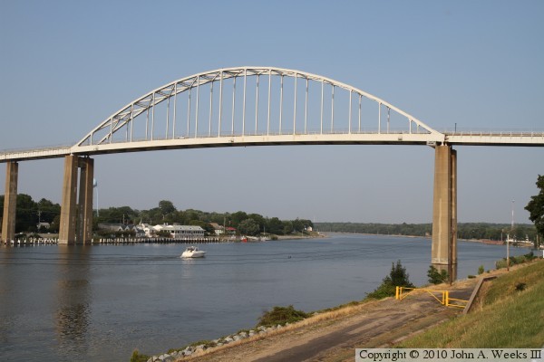
The photo above is a view looking east towards the west face of the MD-213
Chesapeake City Bridge. The city is located on the north side of the canal
just beyond the bridge. The C&D Canal Museum is located on the south
side of the canal about one-half mile beyond the bridge.
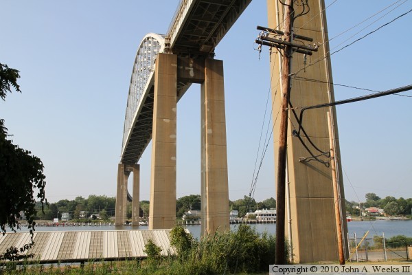
The photo above is a closer view of the west face of the Chesapeake City
Bridge. A small pleasure boat is passing under the bridge heading eastbound
on the canal. The photo below is the west face of the approach spans on
the north side of the channel, as seen from the south bank of the canal.
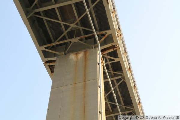
The photo above is a view of the main bridge span from a location just to
the west of one of the piers on the south bank of the canal. Note that the
approach spans on the far side of the canal curve a bit to the east. The
photo below is a close view of the underside of the bridge deck where it
meets the south main bridge pier.
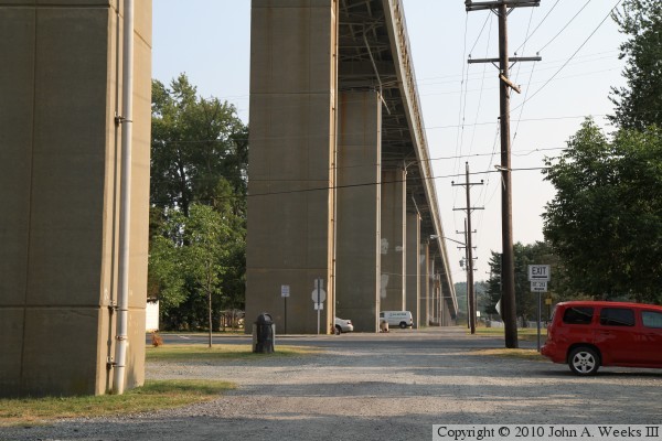
The photo above is looking south along the west face of the approach spans
on the south side of the canal. The photo above is looking directly up
towards the bottom of the bridge deck where it meets one of the bridge
support piers.
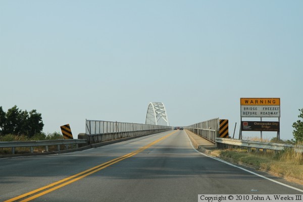
These two photos are the first of an eight photo set showing a typical
southbound bridge crossing. In the photo above, we are approaching the
north end of the structure. Note the US Army Corps of Engineers sign with
the bridge name. The photo below is climbing the approach spans. The curve
in the approach spans is apparent in this photo.
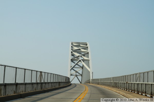
These two photos continue our southbound bridge crossing. In the photo above,
we are rounding the curve in the approach spans. The photo below is just
entering the main arch span.
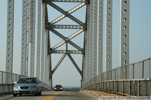
These two photos continue our southbound bridge crossing. The photo above
is a view from mid-span under the main bridge arch. The photo below is
exiting the main arch span.
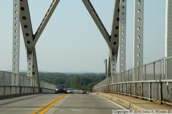
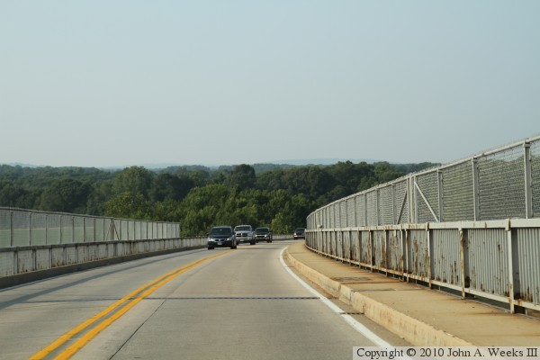
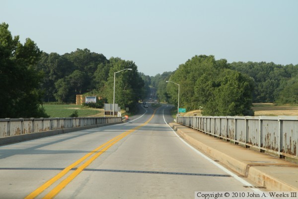
These two photos are the final two of an eight photo set showing a typical
southbound bridge crossing. The photo above is heading down the approach
span. It is apparent that there is a modest curve in the approach spans
south of the canal, too. The photo below is existing the south end of
the Chesapeake City Bridge.