Current Weather Conditions
John A. Weeks III
Saturday, July 27, 2024, 1:51:34 AM CDT
Home Photo Tours Rail Fan 12 Easy Steps
Aviation Spacecraft Highways & Bridges About The Author
 
Google Search
Maps   Groups   Images   Search
 
  Home
  • 12 Easy Steps
  • Aviation
  • Spacecraft
  • Highways & Bridges
    » Bridge Photography
      - MSP River Bridges
      - C & D Canal
        › C & D Canal Structures
          · C & D Canal
          · Chesapeake City Br
          · Summit Bridge
          · Pipeline Bridge
          · Conrail Bridge
          · Roth Bridge
          · Saint Georges Bridge
          · Reedy Point Bridge
      - Illinois River
      - Minnehaha Creek
      - Minnesota River
      - Mississippi River
      - Missouri River
      - St. Croix River
      - St. Louis River
      - Wisconsin River
      - Best Miss River Photos
      - Cable Stayed Bridges
      - McGilvray Road Bridges
      - I-35W Bridge Disaster
      - Miscellaneous Bridges
      - Madison County Bridges
      - Hist Br Weekend 2013
    » Road Geek Topics
  • Photo Tours
  • Rail Fan
  • About The Author
 
Site Search By JRank
Highways, Byways, And Bridge Photography
Saint Georges Bridge
US-13 Chesapeake & Delaware Canal Crossing
Saint Georges, DE

Saint Georges Bridge

• Structure ID: NBI: 1495034.
• Location: 4.8 Miles West Of Reedy Point.
• Canal Elevation: 0 Feet (Sea Level).
• Highway: US-13.
• Daily Traffic Count: 9,008 (2006).
• Bridge Type: Steel Tied Arch, Steel Girder Approach Spans.
• Length: 4,209 Feet, 540 Foot Longest Span.
• Width: 2 Traffic Lanes Plus 2 Bicycle Lanes, 50 Feet.
• Navigation Channel Width: 400 Feet.
• Height Above Water: 136 Feet.
• Date Built: 1942, Reconstructed 1991.
The village of Saint Georges is divided by the C&D Canal. A bridge has been located across the canal at this location for many years. I have not tracked down when the first bridge was built. The recent history of this crossing started in 1927 when the canal was converted to sea level operation. The channel was cut deeper and wider. A vertical lift bridge was installed at Saint Georges. This bridge increasingly became a navigation obstacle as ships became larger and larger. The bridge was hit several times, and it was toppled in the early 1940s by a collision with a German ship.

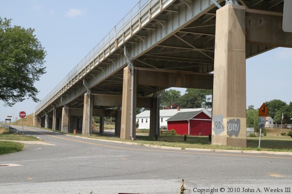
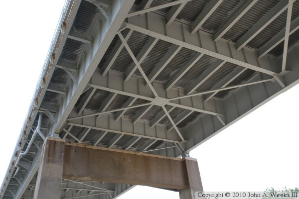
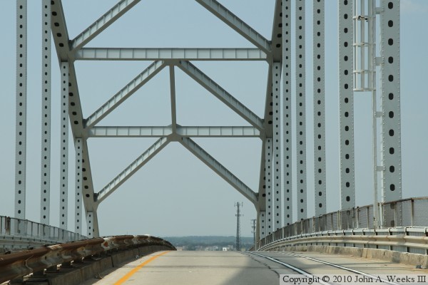
After the lift bridge was damaged, it was decided to replace it with a high level bridge. The bridge design was a tied arch with the deck suspended under the arch by steel beams. Since the bridge was 133 feet above the water and the ground was only slightly above sea level, the bridge required 41 steel girder approach spans. The new bridge opened in 1942.

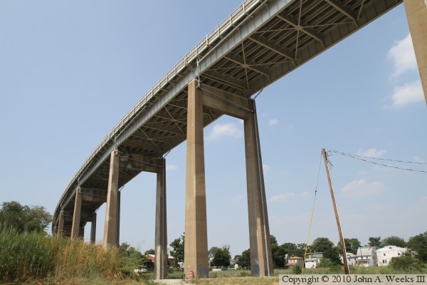
While the goal of the new Saint Georges Bridge was to make the bridge wide enough to keep the piers out of the canal, Congress authorized a project in 1954 to widened the canal to 450 feet. This project was started in the 1960s and finished in the mid-1970s. As a result, the main span piers for the Saint Georges Bridge are again standing in the canal.

As traffic increased over the years, the Saint Georges Bridge became a bottleneck, especially on weekends with traffic heading to the beaches. Eventually the deck deteriorated to the point where truck traffic had to be prohibited. Trucks were routed to the nearby Summit Bridge. The Delaware DOT had for years been trying to get an Interstate highway built between Wilmington and Dover, but they were unsuccessful in getting the project approved. The state decided to build the highway on their own. Known as DE-1, it features a large cabled stayed structure located just west of the Saint Georges Bridge.

When the new C&D Canal Bridge, now known as the Roth Bridge, opened in 1995, the plan was to move US-13 traffic to the new bridge, and then demolish the old bridge. Local opposition prevented the Saint Georges Bridge from being dismantled. Instead, Delaware DOT refurbished the Saint Georges Bridge between 1998 and 2001. Deteriorating steel was replaced and a new concrete deck was installed.

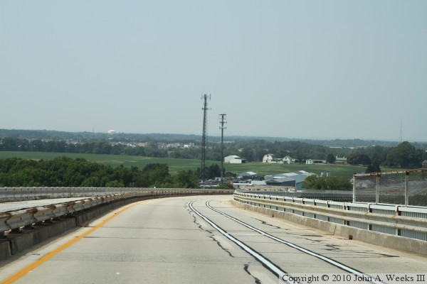
Problems were again found on the structure of the Saint Georges bridge in 2008. The US Army Corps of Engineers closed the outside lanes on the bridge as a safety measure and placed weight limits on the structure. It was decided in 2009 to repair the bridge. The bridge work was carried out between January and July of 2010. The resulting structure is now marked for two lanes of traffic, one in each direction towards the center of the bridge deck, and wide bicycle lanes towards the outside of the bridge deck.

Heavy traffic is still banned from the Saint Georges Bridge. To encourage trucks to avoid the bridge, Delaware DOT has opened interchanges on each side of the canal on DE-1 allowing the Roth Bridge to be used free of tolls despite DE-1 being a tollway.

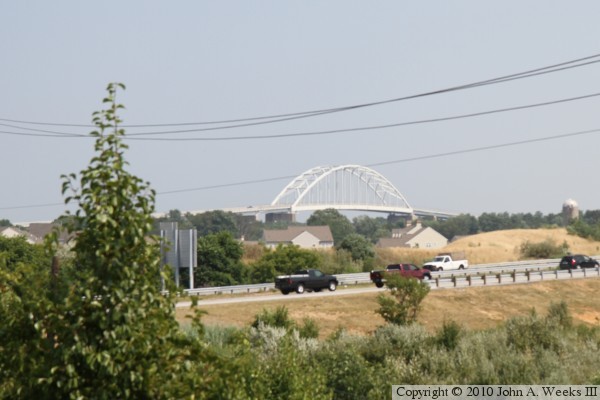
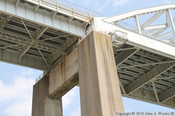
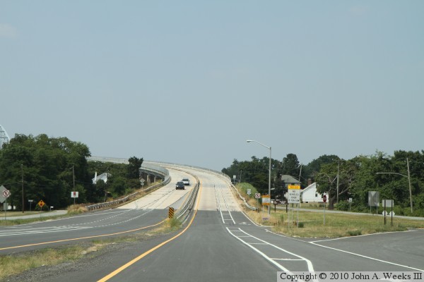
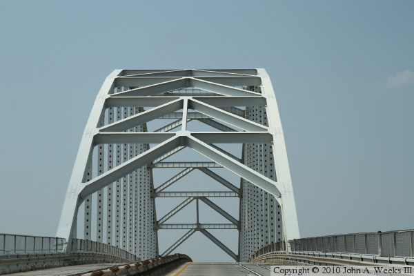
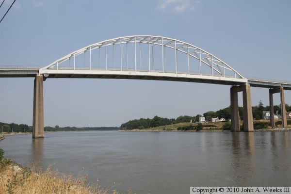
The photo above is a view looking east down the channel of the C&D Canal towards the west face of the main bridge arch structure. The photo below is a view looking southeast towards the Saint Georges Bridge from the overpass where Kirkwood Saint Georges Road crosses highway DE-1.


Saint Georges Bridge
The photo above is looking east towards the Saint Georges Bridge from the north bank of the C&D Canal. The south approach spans are visible in this photo. The photo below is looking south across the C&D Canal channel from directly below the Saint Georges Bridge.

Saint Georges Bridge
These two photos are views of the west face of the approach spans on the north side of the canal. The photo above is the north bridge abutment and some of the lower approach spans. The photo below is some of the taller approach spans leading to the bridge arch structure.

Saint Georges Bridge
These two photos are views of the underside of the bridge deck. The photo above is the top of the north main bridge pier. It supports both the arch structure and one of the tall approach spans. The photo below is the underside of one of the approach spans.

Saint Georges Bridge
These two photos are the first of an eight photo set showing a typical bridge crossing headed northbound. In the photo above, we are approaching the grade leading to the south end of the bridge. We have just entered the south end of the bridge in the photo below.

Saint Georges Bridge
These two photos continue our northbound bridge crossing. In the photo above, we are climbing the approach spans, which in the photo below, we are approaching the arch structure.

Saint Georges Bridge
These two photos continue our northbound bridge crossing. We are passing through the arch structure in the photo above, while we have just exited the arch and are heading down the approach spans on the north side of the canal in the photo below.

Saint Georges Bridge
These two photos are the last of an eight photo set showing a typical bridge crossing heading northbound on highway US-13. In the photo above, we continue to descend the approach spans on the north side of the canal. We are approaching the intersection at the north end of the bridge in the photo below.

Saint Georges Bridge

Made With Macintosh
Authored by John A. Weeks III, Copyright © 1996—2016, all rights reserved.
For further information, contact: john@johnweeks.com