Runway 30-Left is the most heavily used runway at the Minneapolis
Saint Paul International Airport, one of the busiest airports in the
world. Runway 30-Left has historically been a critical runway since
its 10,000 foot length was the longest at MSP. The runway is situated
such that there is a steep slope leading from the southeast end of the
runway down to the Minnesota River. The airport needed to maintain a
set of strobe lights to assist aircraft who were landing in fog or other
types of bad weather. These lights needed to be located at a precise distance
from the end of the runway, and at a precise elevation. As it happened,
some of those lights needed to be placed directly above the Minnesota
river. A light bridge was the only way to place those lights at the
right distance from the runway and at the proper height above the river.
With the opening of the new north-south runway in 2006, the strobe
lights were moved to a location crossing I-494 just east of the
Mall Of America. At that time, the light structure bridge was
removed, and the support on the west side of the river was replaced
with a free-standing tower.
For most of its life, runway 30 Left was known as 29 Left. The Left
part means that it is the left runway of two parallel runways. The number
is the compass heading of the runway less the units digit. As a result,
runway 30 Left points towards the compass heading 300 degrees. So, why
did the compass heading of the runway change from 290 degrees to 300
degrees in the late 1990s? The runway did not change heading. Rather,
the magnetic north pole moved. In fact, it moved just enough that a
number of airport runways had to be updated in a similar manner.
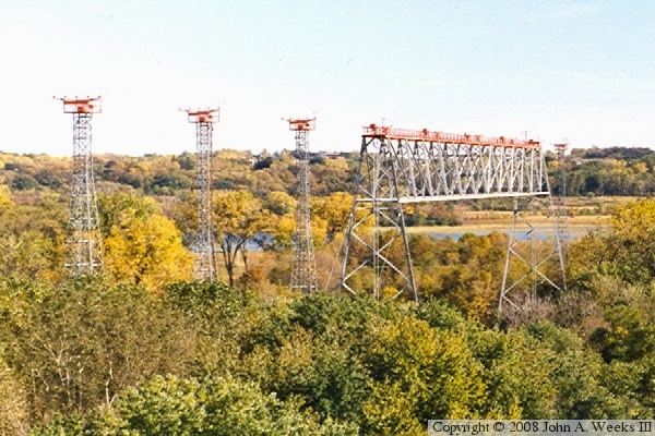
The photo above, taken during the fall colorama season in the late 1980s,
shows the light structure span across the Minnesota River.
The aerial photo above shows the location of the Runway 30-Left Light
Structure. The divided highway is Minnesota-5 on the east side of the
Minneapolis Saint Paul International Airport. The end of Runway 30-Left
is in the upper left side of the photo, while Fort Snelling State Park
is in the upper right corner. The photo below shows the base of the light
tower on the end of the structure nearest to the airport runway. These two
images were provided by the US Army Corps of Engineers.
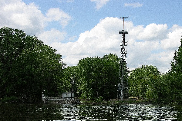
The photo above shows the post-2005 configuration from the river level. The
light tower has been removed, and additional freestanding light towers have
been installed. This photo was provided by the State of Minnesota DNR. The
final photo is a view of the new runway light towers as seen from an overlook
on the east side of the river valley using a telephoto lens.


