| Highways, Byways, And Bridge Photography |
Bloomington Ferry Trail Bridge
Minnesota River Bicycle Trail Crossing
Bloomington, MN to Shakopee, MN

|
• Structure ID: |
NBI: 27A41. |
|
• Location: |
River Mile 18.1. |
|
• River Elevation: |
692 Feet. |
|
• Highway: |
Bloomington Ferry Bicycle Trail. |
|
• Daily Traffic Count: |
0 (Bicycles And Pedestrians Only). |
|
• Bridge Type: |
Steel Plate Girder. |
|
• Length: |
448 Feet. |
|
• Width: |
???. |
|
• Navigation Channel Width: |
Non-Navigable. |
|
• Height Above Water: |
???. |
|
• Date Built: |
Opened 1998. |
This is the location of the old Bloomington Ferry Bridge. The old bridge
carried CSAH-18 over the Minnesota River. That bridge was closed when the
new Bloomington Ferry Bridge opened about a mile up stream. There was a
desire to reuse the old bridge as a regional trail bridge. It was found,
however, that the old bridge would require too much repair work to make it
safe to reopen. As a result, it was removed in the late 1990s. A new
steel plate girder pedestrian bridge was constructed in place of the old
bridge.
The old bridge had a sharp right hand turn and steep hill on the north end,
and a long approach road on the south end that hugged the river bank.
The old bridge is interesting in that it was a swing bridge, and it was
closed due to deterioration in 1976. The structure of that bridge was
removed, and new fixed span bridge was constructed on the existing swing
span piers.
The river often flooded and washed out the south approach road. The crossing
would be flooded out and closed for months at a time about one year out of
every three. Not only was this a major problem for traffic, but the floods
would damage the roadway. In some cases, the flood would cut away the
edge of river, causing the road to collapse into the river.
The new trail bridge features spans of 90 feet, 255 feet, and 90 feet.
The steel in the main span is 10 feet tall over the piers, and thins
out to be 5-1/2 feet tall over the center of the span. This is called
a formed-shape girder. This is one of the longest formed-shape steel
girder pedestrian bridges, and it pushed the limits of the technology
when it was built. The photo above gives an overview of the bridge
and its surroundings.
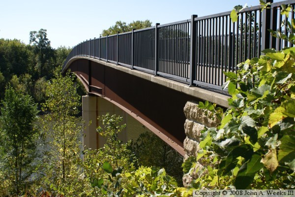
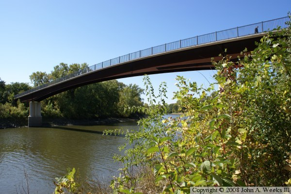
These two photos are from early fall of 2008. The photo above was taken
from the side of the north abutment. The cut stone facing on the pier
is visible. The photo below was taken from water level, and shows the
long main channel span.
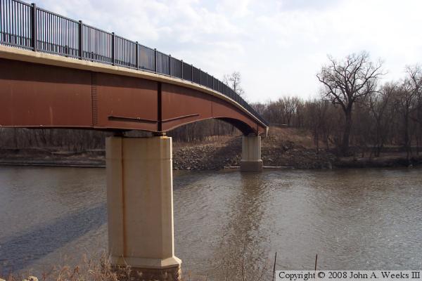
The photo above is a view of the bridge from early spring of 2006. Notice
the vast difference in the amount of brush and trees near the bridge. The
bridge was built very high in order for the abutments to be above the 100
year flood line.
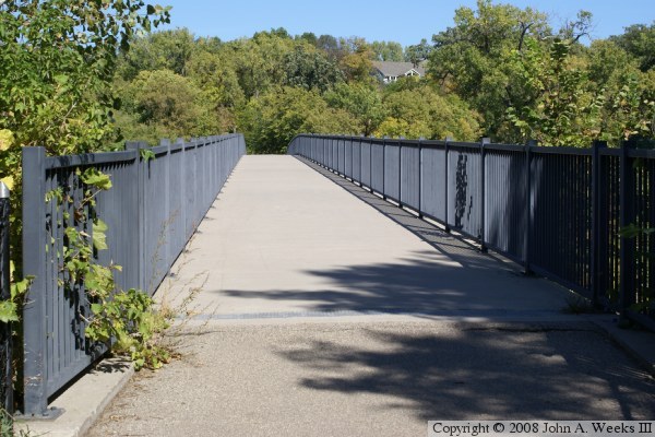
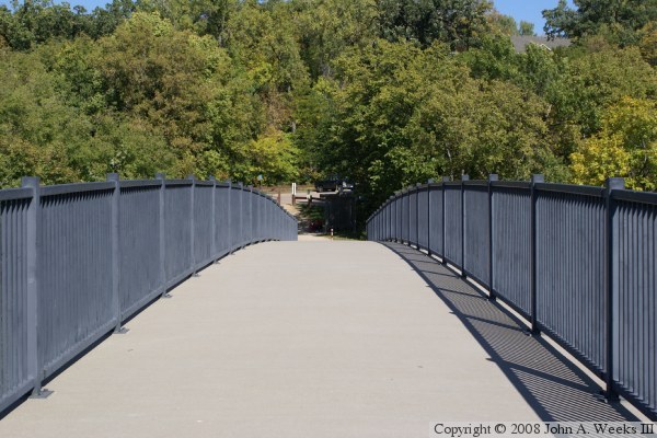
The photo below is the first of 3 photos that shows a typical bridge crossing
from south to north. In this photo, we are just entering the south end of
the bridge.

These two photos complete the bridge crossing while heading from south to
north towards Bloomington. In the photo above, we are directly over the
south bridge pier. In the photo below, we have reached the mid-point of
the main span and we are starting the downhill side of the bridge.

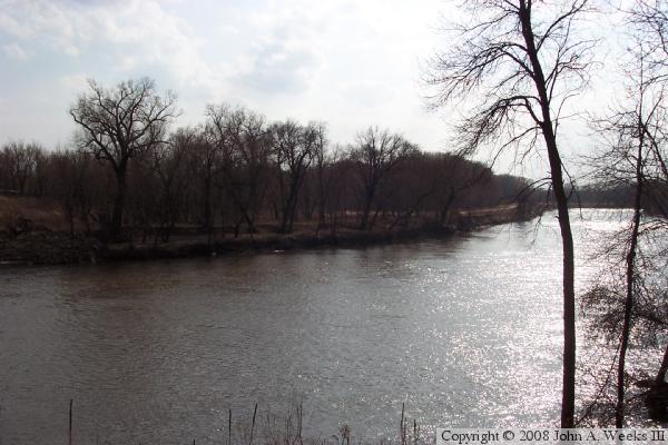
The photo above is an early fall view of the river looking upstream from
midway across the bridge. The photo below is also looking upstream of
the Minnesota River, but from a vantage point near the north end of the
bridge. The bicycle trail is visible along the far shoreline.
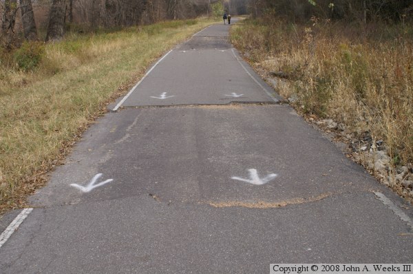
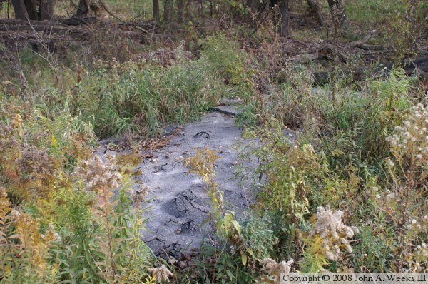
The photo above is a view of the bicycle trail that heads southwest from
the Bloomington Ferry Trail Bridge. The trail follows the path of the
former Scott County Highway 18. This area floods frequently. In past
years, it would often close the road for months at a time. In this photo,
we see large chunks of pavement have been lifted off of the trail by flood
waters. The photo below shows this section of pavement after it was
carried 20 feet from the trail and deposited in a drainage ditch.
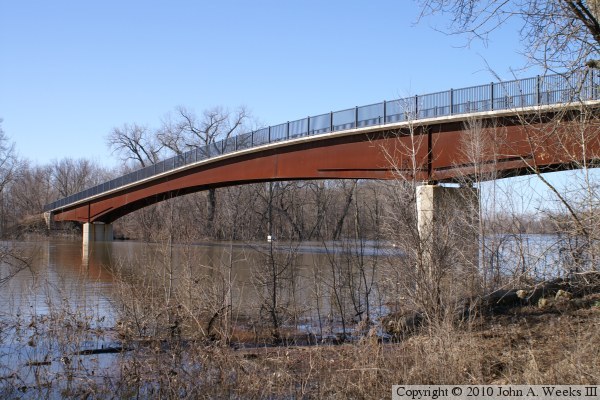
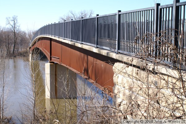
These two photos, and the four that follow, are views from the spring flood of
2010. These two photos are views of the downriver east side of the
Bloomington Ferry Trail Bridge. The photo above is a view from the north
shore of the river, while the photo below is a view from near the north
bridge abutment.

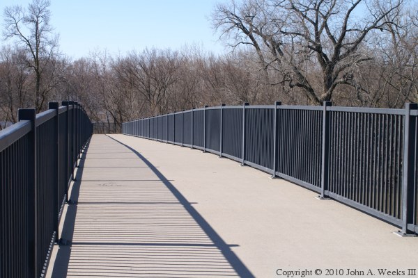
The photo above is an overview of the main Minnesota River channel crossing.
The photo below is a view of the bridge deck looking to the south from
mid-span. This was a very sunny March day. In fact, the weather was
unusually mild, causing the spring runoff to arrive about two weeks earlier
than what has typically been seen in the past.
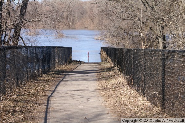
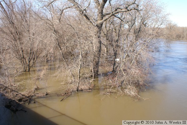
The photo above is the trail on the south side of the river as it disappears
under the flood water. The path connects to the old County Road 18
right-of-way. This frequent flooding of the highway lead to the construction
of the new Bloomington Ferry Bridge. The photo below is a view of the
riverbank on the south side of the main channel. This area is under several
feet of water, and the river itself is normally about ten feet below the
top of the riverbank. The high water is constrained by the bluffs on the
north and the Union Pacific railroad tracks along highways 13 and 101 on the
south, a distance of over a mile.
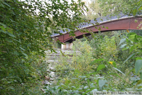
I visited the Bloomington Ferry Trail Bridge again in October of 2010 when
a rare autumn flood occurred on the Minnesota river after a very large rain
storm inundated southern Minnesota. As the photo above shows, the water was
very near to the top of the bridge piers. Since the water overflowed the
river banks, I could not get past the brush and trees to get a clear view of
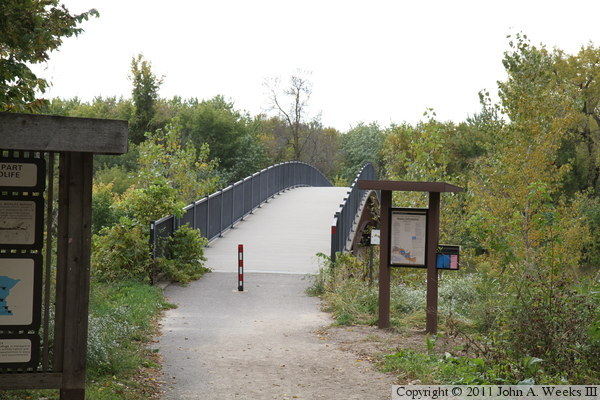
the structure. The photo below, looking south towards the north end of the
bridge, shows just how dense the greenery is around the bridge. Compare
this to the spring views above.
|


