Current Weather Conditions
John A. Weeks III
Thursday, May 2, 2024, 5:10:29 PM CDT
Home Photo Tours Rail Fan 12 Easy Steps
Aviation Spacecraft Highways & Bridges About The Author
 
Google Search
Maps   Groups   Images   Search
 
  Home
  • 12 Easy Steps
  • Aviation
  • Spacecraft
  • Highways & Bridges
    » Bridge Photography
      - MSP River Bridges
      - C & D Canal
      - Illinois River
      - Minnehaha Creek
      - Minnesota River
      - Mississippi River
        › Lake Itasca Area
        › Bemidji Area
        › Cass Lake - Ball Club
        › Grand Rapids Area
        › Blackberry - Crosby
        › Brainerd Lakes Area
        › Little Falls Area
        › St. Cloud Area
        › North Metro Area
        › Port Of Minneapolis
        › St. Anthony Falls Area
        › Mississippi Rvr Gorge
        › St. Paul Area
        › S St. Paul - Hastings
        › Red Wing - Winona
        › La Crosse Area
        › Lansing - Clinton
        › Quad Cities Area
        › Muscatine - Louisiana
        › St. Louis Area
        › Chester - Cairo
          · Chester Bridge
          · Texas-Illinois Pipeline
          · Bill Emerson Mem Br
          · Thebes Bridge
          · I-57 Bridge
          · US-60/US-62 Bridge
        › Miss - Tenn - Ark
        › Ark - Miss - Louisiana
        › Louisiana Structures
      - Missouri River
      - St. Croix River
      - St. Louis River
      - Wisconsin River
      - Best Miss River Photos
      - Cable Stayed Bridges
      - McGilvray Road Bridges
      - I-35W Bridge Disaster
      - Miscellaneous Bridges
      - Madison County Bridges
      - Hist Br Weekend 2013
    » Road Geek Topics
  • Photo Tours
  • Rail Fan
  • About The Author
 
Site Search By JRank
Highways, Byways, And Bridge Photography
Thebes Bridge
Mississippi River Rail Crossing At Thebes
Thebes, Illinois

Thebes Bridge

• Structure ID: NBI 000002991000920.
• Location: River Mile 43.7.
• River Elevation: 308 Feet.
• Railroads: Union Pacific, BNSF.
• Daily Traffic Count: 35 Trains Per Day (Estimated).
• Bridge Type: Steel Through Truss.
• Length: 3,959 Feet Overall, 651 Foot Longest Span.
• Width: 2 Tracks.
• Navigation Channel Width: 651 Feet Wide.
• Height Above Water: 104 Feet.
• Date Built: Opened April 18, 1905.
Thebes was a choke point for rail traffic heading south out of Chicago. The Cotton Belt operated a ferry service that took entire trains across the river. Despite the addition of a second ferry, the ferry service was not able to keep up with traffic demands. As a result, a group of five local railroads pooled their efforts to build a permanent bridge.

The Thebes rail bridge was designed by famous bridge builder Ralph Modjeski. The bridge was built very strong given that the structure was designed to carry two tracks, which could see two trains crossing the river at the same time. In addition, it was envisioned that auto traffic would become more popular. The bridge design included provisions to add a car deck at some point in the future. As it turns out, the auto deck was never added. Due to this extra strength, the Thebes rail bridge is known as the strongest bridge to span the Mississippi River.

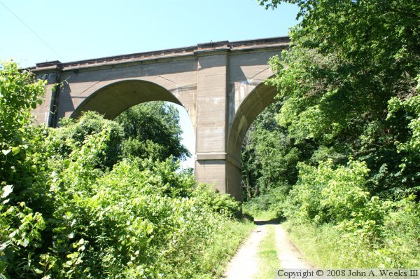
The bridge abutments are made out of reinforced concrete. While that is common today, this is a very early example of the use of this material. Some considered it risky when it was built. Nevertheless, the bridge is still standing some 100 years later despite being in daily use carrying ever longer and heavier trains.

While the new bridge streamlined rail traffic, the trains now had no reason to stop at Thebes. As a result, the town more or less dried up and blew away. Today, it is little more than a campground, a few seasonal houses, a few older historic homes, and one very nasty public housing complex.

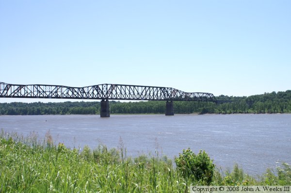
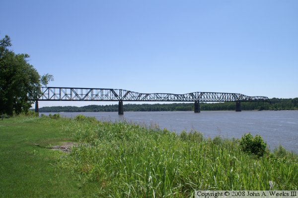
The photo above is the river spans of the Thebes bridge as seen from the east riverbank in the village of Thebes looking to the south.

Thebes Bridge

The photo above is the concrete viaduct approach spans on the east side of the Mississippi. The trail is passable by high clearance vehicles such as SUVs and pick-up trucks. The village of Thebes is located just beyond the bridge to the north. The photo below is looking southwest towards the west bank of the Mississippi River.

Thebes Bridge

Made With Macintosh
Authored by John A. Weeks III, Copyright © 1996—2016, all rights reserved.
For further information, contact: john@johnweeks.com