Current Weather Conditions
John A. Weeks III
Friday, May 17, 2024, 3:17:36 PM CDT
Home Photo Tours Rail Fan 12 Easy Steps
Aviation Spacecraft Highways & Bridges About The Author
 
Google Search
Maps   Groups   Images   Search
 
  Home
  • 12 Easy Steps
  • Aviation
  • Spacecraft
  • Highways & Bridges
    » Bridge Photography
      - MSP River Bridges
      - C & D Canal
      - Illinois River
      - Minnehaha Creek
      - Minnesota River
      - Mississippi River
        › Lake Itasca Area
        › Bemidji Area
        › Cass Lake - Ball Club
        › Grand Rapids Area
        › Blackberry - Crosby
        › Brainerd Lakes Area
        › Little Falls Area
        › St. Cloud Area
        › North Metro Area
        › Port Of Minneapolis
          · I-694 Bridge
          · North Miss Park Pier
          · Camden Bridge
          · CP RR Bridge
          · Lowry Ave Bridge
          · Lowry Bridge (Old)
          · NP RR Bridge
          · Broadway Avenue Br
          · Plymouth Bridge
          · Boom Island Foot Br
        › St. Anthony Falls Area
        › Mississippi Rvr Gorge
        › St. Paul Area
        › S St. Paul - Hastings
        › Red Wing - Winona
        › La Crosse Area
        › Lansing - Clinton
        › Quad Cities Area
        › Muscatine - Louisiana
        › St. Louis Area
        › Chester - Cairo
        › Miss - Tenn - Ark
        › Ark - Miss - Louisiana
        › Louisiana Structures
      - Missouri River
      - St. Croix River
      - St. Louis River
      - Wisconsin River
      - Best Miss River Photos
      - Cable Stayed Bridges
      - McGilvray Road Bridges
      - I-35W Bridge Disaster
      - Miscellaneous Bridges
      - Madison County Bridges
      - Hist Br Weekend 2013
    » Road Geek Topics
  • Photo Tours
  • Rail Fan
  • About The Author
 
Site Search By JRank
Highways, Byways, And Bridge Photography
North Mississippi Park Pier
Mississippi River Fishing Pier
Minneapolis, MN

North Mississippi Park Pier

• Structure ID: N/A.
• Location: River Mile 860.3.
• River Elevation: 804 Feet.
• Structure: North Mississippi Park Pier.
• Bridge Type: Reinforced Concrete.
• Length: 54 Feet (Estimated).
• Width: 12 Feet (Estimated).
• Navigation Channel Width: 200 Feet.
• Height Above Water: 7 Feet (Estimated).
• Date Built: 2008.
The North Mississippi Regional Park is situated between Interstate Highway I-94 and the Mississippi River in north Minneapolis and Brooklyn Park (a suburb to the north of Minneapolis). The trail system that runs through the park connects with the Anoka County trail system, and is planned to be extended east across the Mississippi River.

The park is jointly operated by the City of Minneapolis and the Three River Park District. These entities have invested significant money into the park in the mid and late 2000s, including construction of a visitors center.

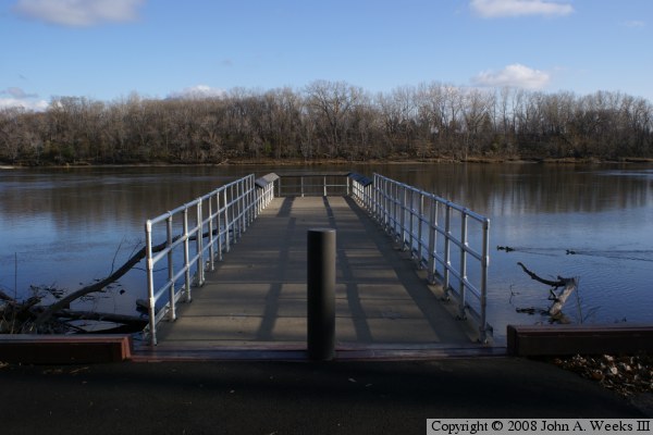
This author first found the park when looking for vantage points to photograph the I-694 bridge. In past years, there was a temporary boat dock that allowed one to walk out into the river to see the I-694 bridge. In 2008, that temporary dock was replaced with a permanent structure. The new pier is built much like a bridge. A set of pilings was sunk to create a permanent pier. A cap was placed on top of the two pilings. Concrete girders were then placed between the abutment at the shoreline to the pier cap. Once the girders were in placed and cross-braced, a concrete deck and railings were installed.

The photo above is a profile view of the fishing pier. Note that a retaining wall has been built to help prevent shoreline erosion.

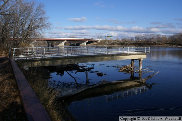
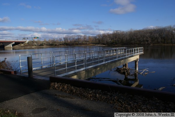
North Mississippi Park Pier
These two photos are additional views of the North Minneapolis Park fishing pier. In the upper photo, one can see that a boat landing has been developed on the east side of the river, which means that both ends of the I-694 bridge now have excellent access for photography.

North Mississippi Park Pier

Made With Macintosh
Authored by John A. Weeks III, Copyright © 1996—2016, all rights reserved.
For further information, contact: john@johnweeks.com