| Highways, Byways, And Bridge Photography |
Canadian Pacific Bridge
Canadian Pacific Railroad Mississippi River Crossing
Minneapolis, MN
|
• Structure ID: |
N/A. |
|
• Location: |
River Mile 857.6. |
|
• River Elevation: |
801 Feet. |
|
• Railroad: |
Canadian Pacific Railroad. |
|
• Daily Traffic Count: |
20 Trains Per Day (Estimated). |
|
• Bridge Type: |
Steel Deck Truss. |
|
• Length: |
904 Feet Overall, 90 Foot Longest Span. |
|
• Width: |
Single Track. |
|
• Navigation Channel Width: |
83 Feet. |
|
• Height Above Water: |
28 Feet. |
|
• Date Built: |
Opened May 1905. |
Opening in May of 1905, this bridge was built by the Minneapolis, Saint Paul,
and Sault Ste Marie Railroad. The bridge is critical since the railroad
has the huge Humbolt Yard just west of the Mississippi River where it
assembles trains headed west on the transcontinental line. The MSP&SSM
became the Soo Line Railroad. It subsequently merged into the Canadian
Pacific Railroad in the 1980s. The bridge is still sees a heavy volume of
railroad traffic given that it is now the mainline of the Canadian Pacific
Railroad through the Twin Cities.
The Canadian Pacific Bridge was the northernmost head of navigation on the
Mississippi River after the two locks opened at Saint Anthony Falls in 1963.
In 1977, the bridge was modified with the thinner center section to allow
navigation traffic to move upstream of this bridge. As a result, specially
made shallow draft tug boats and barges can travel a mile or two further
north. At the same time, the mid-channel piers were reinforced to survive
any potential river traffic accidents. This reinforcement was done by
driving sheet pile into the riverbed in an oval around the piers, and
then filling the enclosed ovals with concrete.
The City of Minneapolis master plan for developing the east and west
river parkways includes a plan to add a deck to the south side of this bridge
to support a bicycle and pedestrian trail. This would serve to allow
people using the parkways a place to cross the river without using one
of the busy highway bridges.
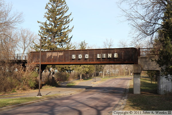
This bridge goes by several names. It can be called the Camden Railroad
Bridge, Camden Park Bridge, Soo Line Bridge, or the Canadian Pacific Bridge.
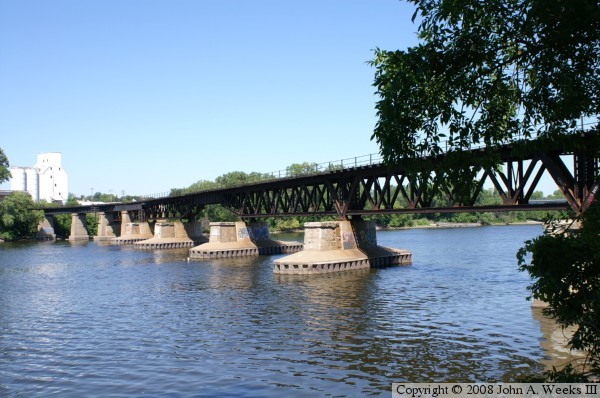
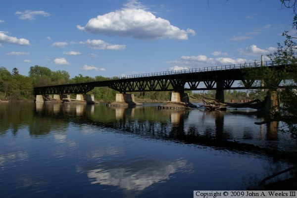
The photo above was taken from Saint Anthony Parkway on the east side of
the river. In this view, we can see the branch line that curves off the
rail bridge to the south on the far west end of the bridge. We can also
see where the piers have been built wider for a possible second parallel
railroad track. The photo below is another view from the east end of
the bridge taken from the edge of the Mississippi River.
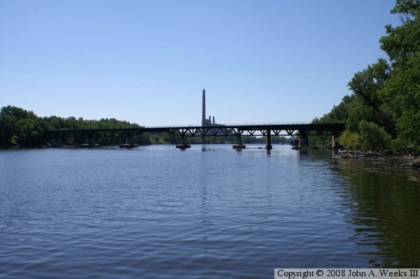
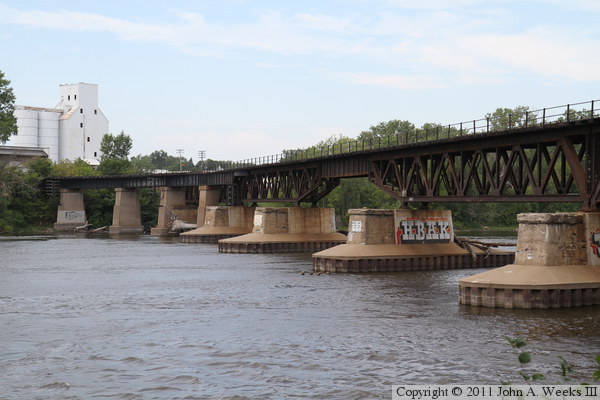
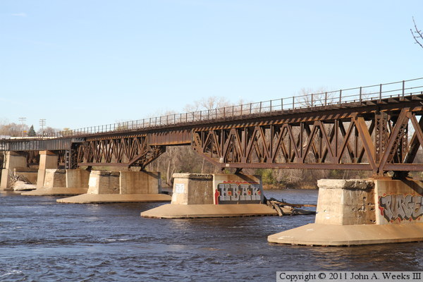
The photo above is a view of the Canadian Pacific Railroad Bridge looking
south from the boat landing at the North Mississippi Park. The park has
a fishing pier that extends into the river, which results in a photo that
looks like it was taken from mid-river. The photo below is a view from
the Port of Minneapolis. This is perhaps the best view of the modified
main channel span. The Port area is off limits to people who do not have
business with the Port, so please do not trespass. Rather, as for permission
before attempting to access this vantage point.
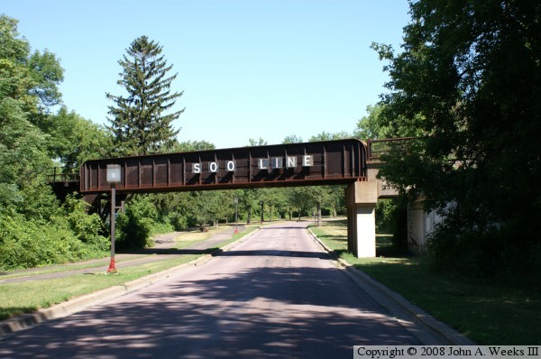
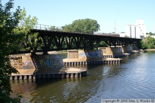
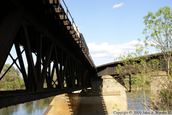
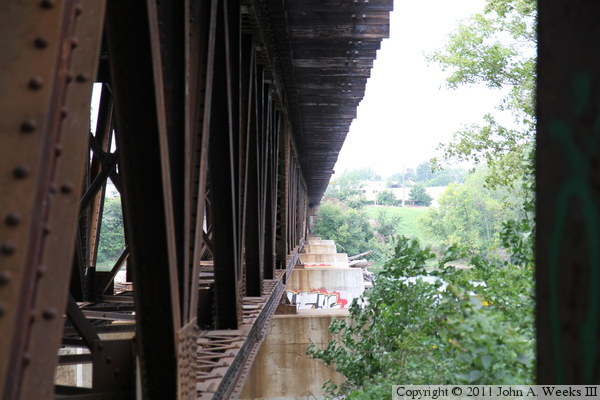
The photo above is the Canadian Pacific Railroad Bridge crossing Saint
Anthony Parkway just east of the Mississippi River. The bridge still
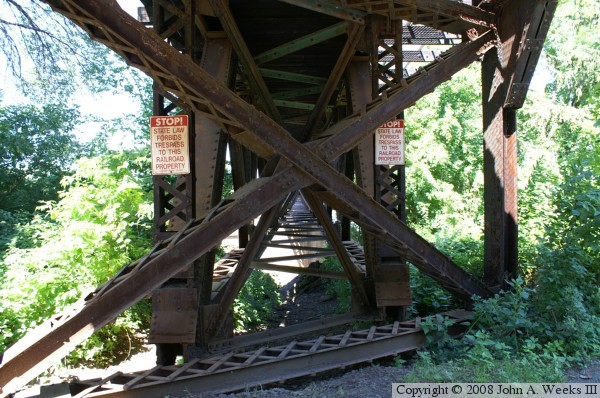
carries the Soo Line logo. The photo below is looking west into the
bridge truss work. For a bridge that looks so simple and clean from
the side, it sure is complex when you look close at the details.
These two photos are views from the riverbank on the west side of the
Mississippi River. The photo above is looking towards the east at the
north face of the bridge. The photo below is a similar view from a
slightly different angle.
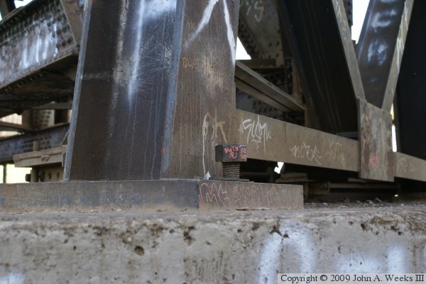
The photo above is a view of the structure at the west end of the bridge.
The photo below is a close view of the pier at the northwest corner of
the structure. Note that the bolt holding the bridge in place is loose,
and is at least an inch from being tight against the steel base plate.
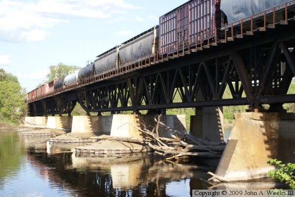
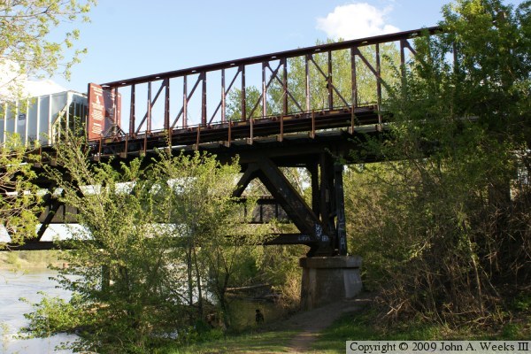
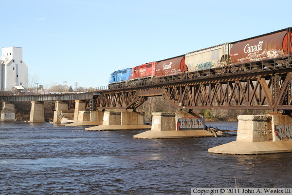
The photo above is a view of the structure under the bridge. The photo
below is another view from the water level looking towards the center
bridge span. The train on the bridge is a mixed freight train operated
by the Canadian Pacific.
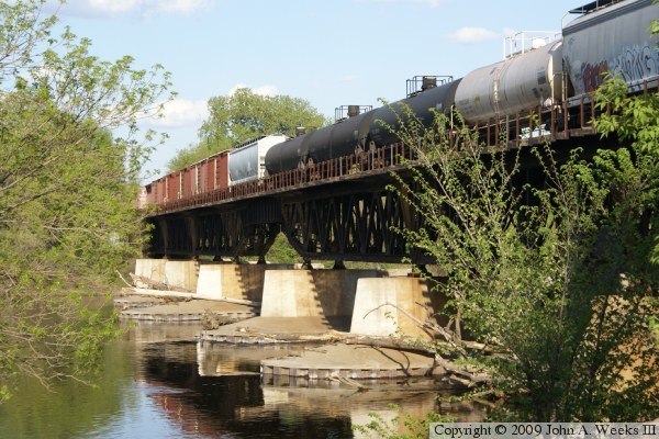
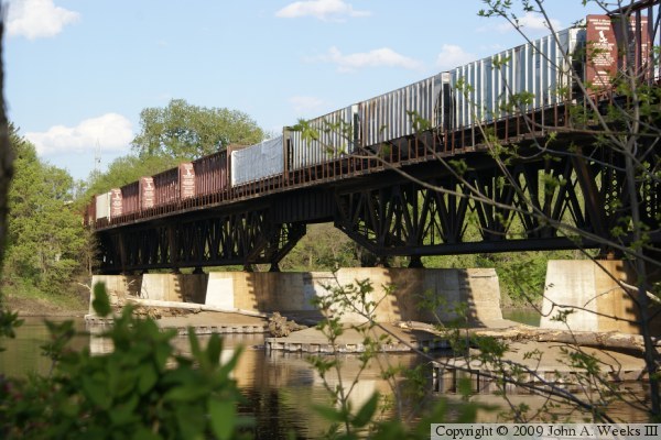
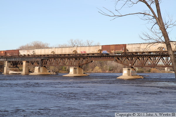
The photo above is a profile view of the bridge after the train seen
above has cleared the structure. The photo below is a close view of
the main span. Note the thinner bridge section that allows navigation
traffic to travel up-river.

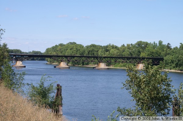
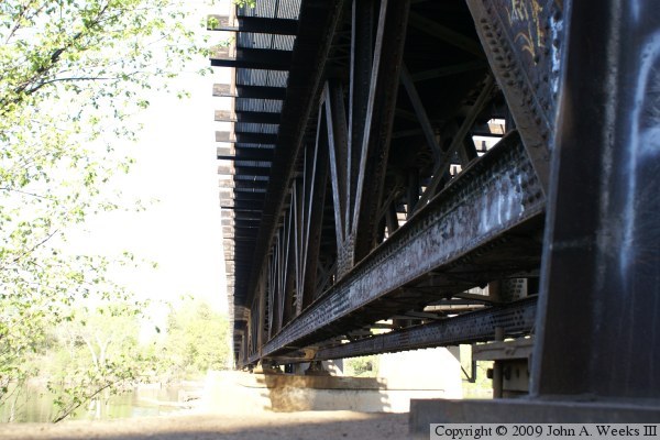
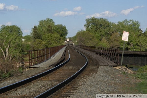
The photo above is looking east from the southwest corner of the bridge.
A rail line formerly branched off of the bridge to the south using the
span on the right side of the photo. This span no longer fully connects
to the main bridge. The tracks have been removed where that spur connects
to the west bank of the river, and a concrete factory has been built on
the railroad right-of-way. The photo below is a view looking east down
the length of the rail bridge and across the Mississippi River.

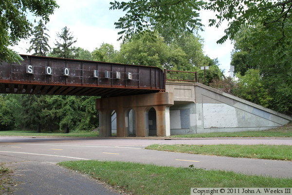
The photo above is a short deck plate girder bridge that carries the railroad
across Soo Avenue, an access road to the west bank of the Mississippi River.
The Camdem Bridge is visible in the background. This bridge is about 1,000
feet northwest of the Canadian Pacific Bridge over the Mississippi River.
It is actually two parallel spans, one of which is abandoned. There likely
was a third span at one time. The railroad once branched out into a rail
yard just south of this location, explaining the need for so many parallel
tracks on this bridge. The photo below is looking west across the Mississippi
River from the east riverbank.
The photo above is looking west along the north face of the bridge truss
structure. The photo below is a close view of the steel beams at the east
end of the bridge truss.

The photo above is a view of the pony plate girder span over Saint Anthony
Parkway at the east end of the Canadian Pacific Bridge as seen from the
trail that runs along the Mississippi River. The photo below is a view
of the navigation channel span through the trees from the east riverbank.

The photo above is another view of the pony plate girder span over Saint
Anthony Parkway, this time seen on a crisp cool autumn morning. The photo
below is a view of the truss spans as seen from the east bank of the
Mississippi River. The low angle of the late season sun offers perfect
lighting conditions for this bridge, bringing out the details in the
ironwork on the truss structure.
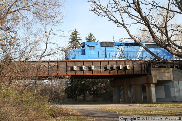
These two photos, and the two that follow, show a Canadian Pacific train
crossing the Mississippi River heading westbound. The photo above is the
lead locomotive crossing the pony plate girder span over Saint Anthony
Parkway. The photo below shows the lead locomotive this entering the
deck plate girder span over the river navigation channel.

In the photo above, the locomotives are nearing the west end of the bridge.
The photo below shows a series of hopper cars on the bridge as the train
continues to make its crossing westbound. The lead locomotive is owned
by CIT Equipment Leasing. It is marked with CEFX reporting marks and
carries road number 3164. It is painted in the blue and white scheme
typical of CIT locomotives. The locomotive is an EMD SD40-2, which
is a 3,000 horsepower diesel with a DC generator. It was built in July,
1976, for the Union Pacific Railroad where it carried road number 8062.
|
