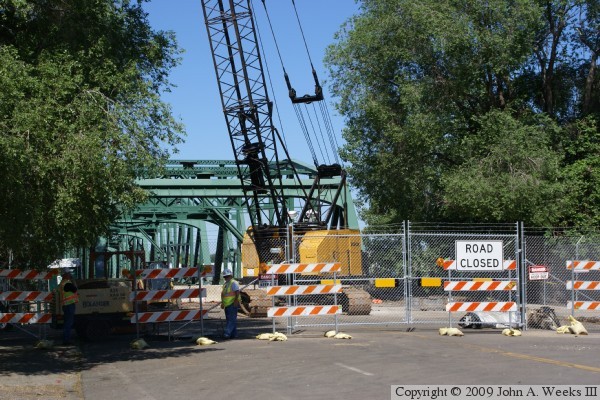
The 1958 era structure was demolished in the summer of 2009. This page features the 1958 era Lowry Avenue Bridge, the events leading to its closing, and photos from the demolition and removal of the bridge.
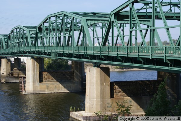
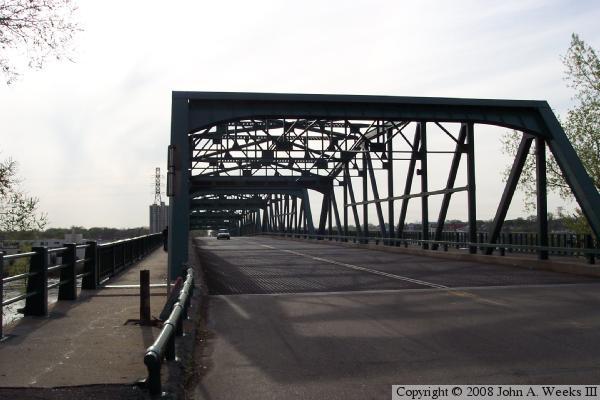
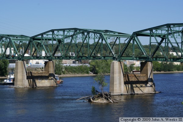
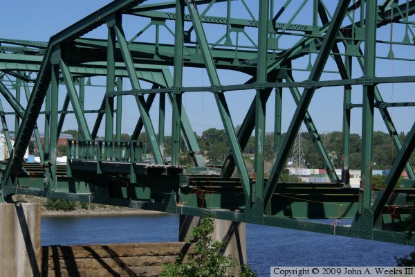
Until recently, the Lowry Avenue Bridge was hard to photograph. The west end is sandwiched between two industrial complexes, while the east end has a bunch of trees in the way. The City of Minneapolis started developing a riverside park in 2006 just south of the east entrance to the bridge. That provided a clearing to shoot the photo above. The park was completed in 2008, and features an overlook that has a very nice view of the Lowry Avenue Bridge.
The bridge was closed for a while in 2005 for painting. While doing the paint work, engineers found that one of the piers had shifted 11 inches. In fact, one segment of the bridge was potentially in danger of falling in the river. Divers were sent down to investigate the pier. The conclusion is that they don't know why it shifted, but they think that it is again stable and will not move any further. A new set of bearings had to be manufactured and installed to make the suspect span safe again.
An interesting note that was reported at the time is that crime on the east side of the Mississippi River dropped significantly while the Lowry Bridge was closed in 2005. The Marshall Terrace neighborhood reported a drop in crime of 41 percent, while the Bottineau neighborhood saw a 6 percent decrease in serious crime. At the same time, crime rose significantly on the west side of the river during the bridge closing. The McKinley and Hawthorne neighbors had one of their highest crime rates in history. Some offered the theory that the bridge closure provided a barrier to crime leaking across the river from the North Minneapolis neighborhoods. A Hennepin County Commissioner noted that this change in crime rates was typical of past bridge closings. Opponents of this theory suggested that it was racist in nature due to larger numbers of African Americans living in North Minneapolis, and that the crime numbers were a statistical fluke.
Between the pier problem and near constant repairs needed on the steel grate deck, MN-DOT wants to replace the bridge. So does the City of Minneapolis. The proposal now is to build a signature span using the cable stayed design. The bridge would be the anchor and focal point for a new urban redevelopment project on the west side of the river. The cable stayed bridge would cost in the $35-million range. The legislature has proposed $23 million during the 2007 session, but the state Governor is opposed to any spending for this project.
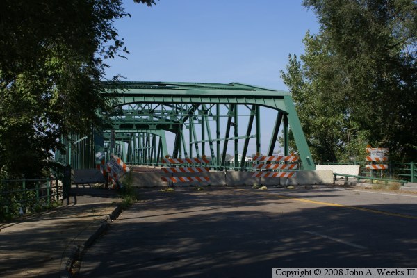
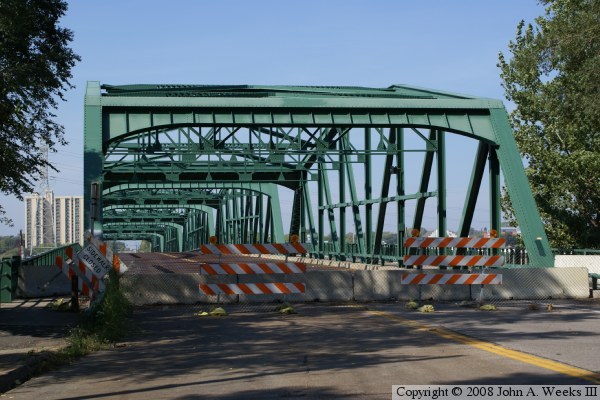
Update—after an especially warm spring day, MN-DOT inspectors discovered that one set of bridge bearings had once again reached its stop bracket. The stop bracket limits how far the bearing can slide, and it prevents the bridge from sliding off of the pier and falling into the water. Once the span hit the stop bracket, forces from the heating and cooling of the span apparently pushed the problem pier two inches further out of plumb. It also caused some bolts on the structure to shear off. As a result, MN-DOT closed the bridge at 10AM on Friday, April 25, 2008.
The 2008 legislative session pushed though a highway bonding bill. The Lowry Avenue Bridge replacement is one of the high priority projects. The bridge is expected to be started in 2009 and be completed by the end of 2010. The plan is to install a signature span. Finalists include a towering arch design, a single tower cable stayed bridge, and a more routine concrete box bridge.
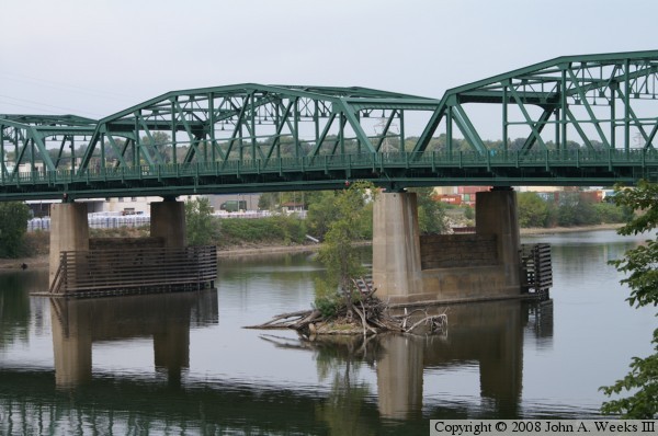
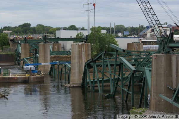
The photo above was taken in late September, 2008, after the bridge had been closed about 6 months, from the new riverside park just south of the bridge. The photo below is a closer view of the main navigation channel.
Update—the Lowry Bridge demolition project headed to court in late 2008 and early 2009. One group challenged the project stating that the existing bridge could be fixed for $10-million, a savings of over $70-million to the taxpayers compared to the cost of a new bridge. Another group argued that the bridge could not be removed because of its historic status. The court ruled that while the bridge was located in a historic district, the bridge itself is not designated as a historic structure. MN-DOT announced on June 10, 2009, that the bridge would be brought down in a controlled demolition on or about June 21.
Update—the Lowry Bridge was dropped into the Mississippi River on Sunday, June 21, 2009, at 9:08 AM using 198 pounds of explosives. It is expected to take just 24 hours to clear the river navigation channel.