Current Weather Conditions
John A. Weeks III
Thursday, April 18, 2024, 7:01:11 AM CDT
Home Photo Tours Rail Fan 12 Easy Steps
Aviation Spacecraft Highways & Bridges About The Author
 
Google Search
Maps   Groups   Images   Search
 
  Home
  • 12 Easy Steps
  • Aviation
  • Spacecraft
  • Highways & Bridges
    » Bridge Photography
      - MSP River Bridges
      - C & D Canal
      - Illinois River
      - Minnehaha Creek
        › Minnetonka
          · Bushaway Road Br
          · Headwaters Structure
          · Headwaters Pk Footbr
          · Headwaters Pk Bdwk
          · Civic Cntr Trail Br
          · McGinty Rd Br (West)
          · I-494 Bridge
          · I-494 Interchange
          · Minnetonka Mill Site
          · McGinty Rd Br (East)
          · Burwell Dr Bridge
          · Big Willow Pk Foot Br
          · BNSF RR Br (West)
          · St Albans Mill Site
          · StP&P RR Br Ruins
          · St Albans Mill Rd Br
          · Springdale Farm Br
          · Cedar Crossings Br
          · BNSF RR Br (East)
          · Hopkins X-Road Tr Br
        › Hopkins & SLP West
        › SLP East & Edina
        › Minnehaha Pkwy West
        › Minnehaha Pkwy Cntrl
        › Minnehaha Pkwy East
        › Minnehaha Falls Area
      - Minnesota River
      - Mississippi River
      - Missouri River
      - St. Croix River
      - St. Louis River
      - Wisconsin River
      - Best Miss River Photos
      - Cable Stayed Bridges
      - McGilvray Road Bridges
      - I-35W Bridge Disaster
      - Miscellaneous Bridges
      - Madison County Bridges
      - Hist Br Weekend 2013
    » Road Geek Topics
  • Photo Tours
  • Rail Fan
  • About The Author
 
Site Search By JRank
Highways, Byways, And Bridge Photography
Bushaway Road Bridge
Minnehaha Creek Highway Crossing
Minnetonka, MN

Bushaway Road Bridge

• Structure ID: NBI 27A58.
• Location: River Mile 22.2.
• River Elevation: 929 Feet.
• Structure Type: Highway Bridge.
• Construction: Concrete Slab.
• Length: 261 Feet, 79 Foot Longest Span.
• Width: 35 Feet, 2 Lanes.
• Height Above Water: ??? Feet.
• Date Built: 2000.
The Historic Bushaway Road, which dates back to October, 1858, was one of the first roads to be surveyed in Minnesota after the establishment of a state government. The road ran between Dayton and Shakopee, essentially connecting the Minnesota and Mississippi Rivers. It was an important connector, and it served to promote settlement and development around Lake Minnetonka.

Bushaway Road was added to the state highway system in 1933 as MN-101. MN/DOT proposed an extensive rebuild and improvement of the road near Lake Minnetonka, including a tunnel at McGinty Road and a high bridge over the Burlington Northern Railroad tracks. Due to local opposition and disagreements between stakeholders, MN/DOT ended up turning the road back to the county in the early 1990s. Since then, Hennepin County has again proposed an extensive upgrade to the road, which would result in cutting the trees and bulldozing many of the historic features along the route. Local residents formed a neighborhood group to oppose this plan. This group sponsored a 150th birthday party for Bushaway Road the first weekend of November in 2008.

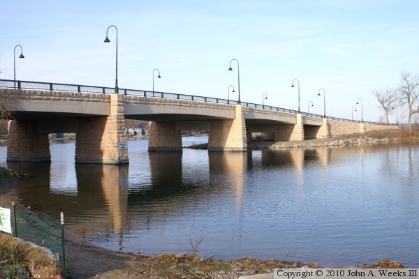
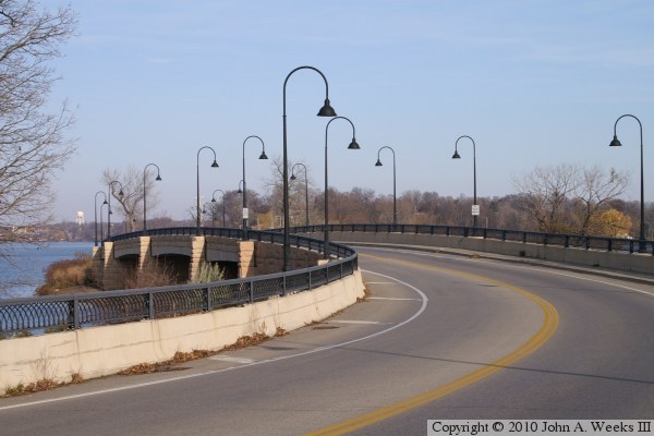
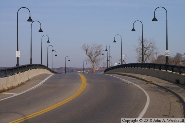
I do not know when the first bridge was built over the channel between Lake Minnetonka and Gray's Bay. I suspect that a wooden wagon bridge was built as early as the mid to late 1800s. A traditional highway bridge was in place until the current bridge was built in 2000. The highway bridge was narrow and had a sharp turn near the south end of the structure. The new bridge is a much larger structure. It features sweeping turns the fit much better into the space, and the decorative features are outstanding.

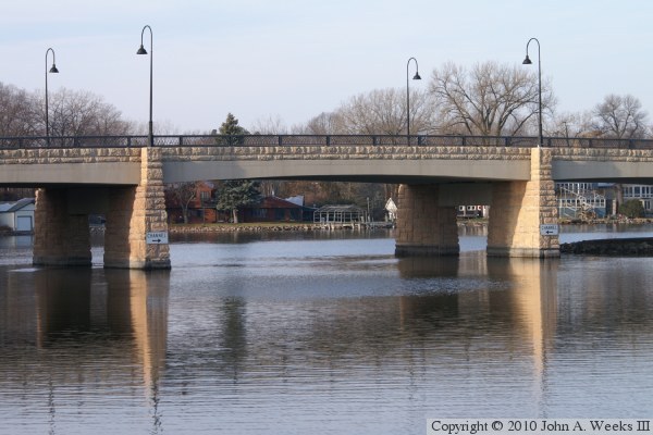
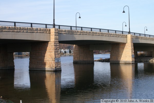
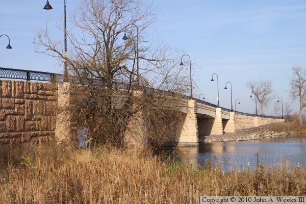
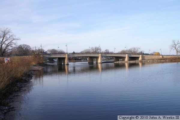
The photo above is a profile view of the bridge looking west from a public park pier on Gray's Bay. The photo below is a view of the channel crossing spans as seen from the south shore of Gray's Bay.


Bushaway Road Bridge
These two photos are views of the main boat channel under the Bushaway Bridge. The photo above is looking west from the public park on the south shore of Gray's Bay. The photo below is a similar view from the boat landing at that park.

Bushaway Road Bridge
These two photos are looking north along the bridge deck. The photo above is a view of the sweeping turn that leads to the south bridge approach. The photo below is a view looking north down the center of the bridge deck.

Bushaway Road Bridge
These two photos show some of the decorative elements of the bridge. The photo above shows the stonework on the bridge. This is a natural Minnesota sandstone that is applied as a veneer. The photo below is a close view of the railing and retro-style street lamps.

Bushaway Road Bridge

Made With Macintosh
Authored by John A. Weeks III, Copyright © 1996—2016, all rights reserved.
For further information, contact: john@johnweeks.com