Current Weather Conditions
John A. Weeks III
Friday, April 19, 2024, 10:59:19 AM CDT
Home Photo Tours Rail Fan 12 Easy Steps
Aviation Spacecraft Highways & Bridges About The Author
 
Google Search
Maps   Groups   Images   Search
 
  Home
  • 12 Easy Steps
  • Aviation
  • Spacecraft
  • Highways & Bridges
    » Bridge Photography
      - MSP River Bridges
      - C & D Canal
      - Illinois River
      - Minnehaha Creek
        › Minnetonka
          · Bushaway Road Br
          · Headwaters Structure
          · Headwaters Pk Footbr
          · Headwaters Pk Bdwk
          · Civic Cntr Trail Br
          · McGinty Rd Br (West)
          · I-494 Bridge
          · I-494 Interchange
          · Minnetonka Mill Site
          · McGinty Rd Br (East)
          · Burwell Dr Bridge
          · Big Willow Pk Foot Br
          · BNSF RR Br (West)
          · St Albans Mill Site
          · StP&P RR Br Ruins
          · St Albans Mill Rd Br
          · Springdale Farm Br
          · Cedar Crossings Br
          · BNSF RR Br (East)
          · Hopkins X-Road Tr Br
        › Hopkins & SLP West
        › SLP East & Edina
        › Minnehaha Pkwy West
        › Minnehaha Pkwy Cntrl
        › Minnehaha Pkwy East
        › Minnehaha Falls Area
      - Minnesota River
      - Mississippi River
      - Missouri River
      - St. Croix River
      - St. Louis River
      - Wisconsin River
      - Best Miss River Photos
      - Cable Stayed Bridges
      - McGilvray Road Bridges
      - I-35W Bridge Disaster
      - Miscellaneous Bridges
      - Madison County Bridges
      - Hist Br Weekend 2013
    » Road Geek Topics
  • Photo Tours
  • Rail Fan
  • About The Author
 
Site Search By JRank
Highways, Byways, And Bridge Photography
Civic Center Trail Bridge
Minnehaha Creek Footbridge Crossing
Minnetonka, MN

Civic Center Trail Bridge

• Structure ID: N/A.
• Location: River Mile 20.3.
• River Elevation: 922 Feet.
• Structure Type: Pedestrian Bridge.
• Construction: Laminated Wood Beam.
• Length: 100 Feet, 100 Foot Longest Span.
• Width: 8 Feet.
• Height Above Water: ??? Feet.
• Date Built: 1983.
This pedestrian bridge is located behind the Minnetonka Civic Center just off of Hennepin County Highway 5, Minnetonka Boulevard, just west of Interstate highway I-494. It is the first bridge over the Minnehaha Creek when traveling southbound. The gorgeous laminated wood bridge majestically arches over the creek, carrying hikers and bicycles between the trail systems on each side of the Minnehaha.

Aerial photos indicate that the bridge was installed in 1983. It does not, however, look to be nearly 30 years old. It is either in really good condition, or it has recently been refurbished. In any event, this is a fantastic looking bridge no matter what its actual age happens to be.

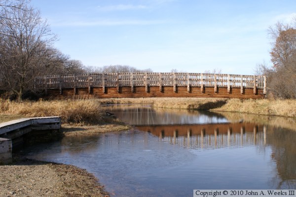
The photo above is looking west towards the downstream face of the Civic Center Trail Bridge. Note the reflection in the water where the bridge crosses the middle of the stream. There is a thin film of ice on the water where the reflection ends.


Civic Center Trail Bridge
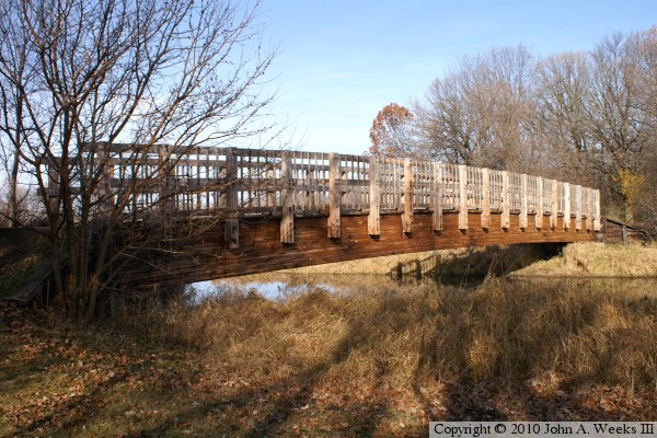
The photo above is a view of the downstream east face of the bridge as 
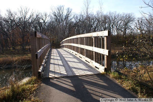
seen from the south shore of the Minnehaha Creek. The photo below is 
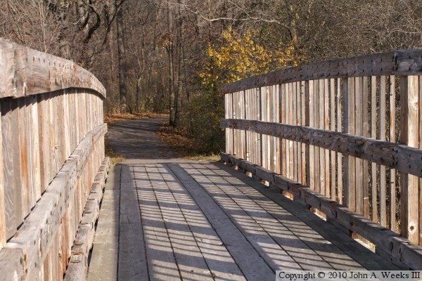
looking south down the length of the bridge deck.

Civic Center Trail Bridge
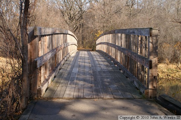
These two photos are views crossing the Civic Center Trail Bridge walking to the north. The photo above is the south end of the bridge, while the photo below is a view from mid-span.

Civic Center Trail Bridge

Made With Macintosh
Authored by John A. Weeks III, Copyright © 1996—2016, all rights reserved.
For further information, contact: john@johnweeks.com