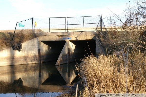
Minnehaha Creek used to follow a channel about 400 feet north of this location. The creek channel was diverted to the south and the wetlands area to the north was filled in when the Interstate was constructed. McGinty Road once continued to the east about one-half mile north of this location, but it was closed off by the highway project. It now runs south along the west side of I-494. This results in an odd interchange where the ramps to and from southbound I-494 branch off of the Interstate and connect with McGinty road just north of this bridge rather than connecting to Minnetonka Boulevard.
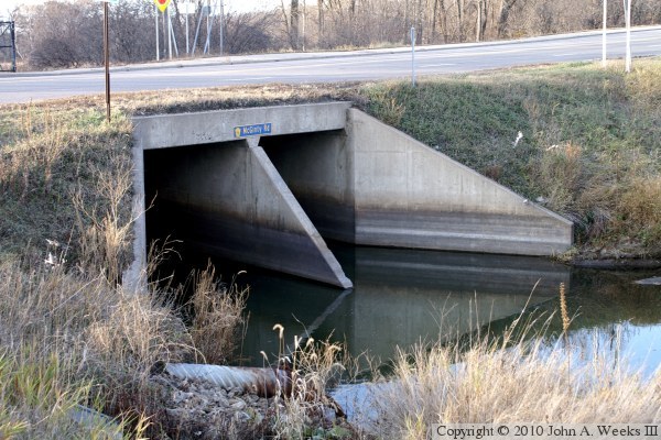
The photo above is looking north across the McGinty Road Bridge over the Minnehaha Creek from the west side of the highway on the south side of the creek. The bridge is located under the section of chain link fence on the left side of the photo.