Current Weather Conditions
John A. Weeks III
Saturday, July 27, 2024, 8:49:40 AM CDT
Home Photo Tours Rail Fan 12 Easy Steps
Aviation Spacecraft Highways & Bridges About The Author
 
Google Search
Maps   Groups   Images   Search
 
  Home
  • 12 Easy Steps
  • Aviation
  • Spacecraft
  • Highways & Bridges
    » Bridge Photography
      - MSP River Bridges
      - C & D Canal
      - Illinois River
      - Minnehaha Creek
      - Minnesota River
        › Ortonville - Odessa
        › Correll - Wegdahl
        › Granite Fls - Rdwd Fls
        › Morton - Judson
          · US-71 Bridge (Old)
          · US-71 Bridge (Back)
          · US-71 Bridge (Main)
          · Sulphur Lake Bridge
          · MN Valley Railroad
          · Ren Co 5 Brn Co 11
          · Petersen Bridge
          · MN-4 Bridge
          · Hinderman Bridge
          · Beussmann Bridge
          · US-14 Bridge (NU)
          · Nicollet Co 37 Br
          · Redstone Bridge
          · Nic Co 24 BE Co 45
          · Nic Co 23 BE Co 42
        › Mankato - Jordan
        › MSP West Metro
        › MSP South Metro
      - Mississippi River
      - Missouri River
      - St. Croix River
      - St. Louis River
      - Wisconsin River
      - Best Miss River Photos
      - Cable Stayed Bridges
      - McGilvray Road Bridges
      - I-35W Bridge Disaster
      - Miscellaneous Bridges
      - Madison County Bridges
      - Hist Br Weekend 2013
    » Road Geek Topics
  • Photo Tours
  • Rail Fan
  • About The Author
 
Site Search By JRank
Highways, Byways, And Bridge Photography
MN Valley Railroad Bridge
Minnesota River Railroad Crossing
Morton, MN

Minnesota Valley Railroad Bridge

• Structure ID: N/A.
• Location: River Mile 202.4.
• River Elevation: 815 Feet.
• Railroad: Minnesota Prairie Line.
• Daily Traffic Count: 1 Train Per Day (Estimated).
• Bridge Type: Steel Through Truss.
• Length: ??? Feet.
• Width: 1 Track.
• Navigation Channel Width: Non-Navigable.
• Height Above Water: ??? Feet.
• Date Built: Opened July 3, 1884.
The Minnesota Valley Railroad Bridge consists of two structures, a wood timber trestle crossing a Minnesota River backchannel known as Sulphur Lake, and this steel truss bridge crossing the main river channel.

The MN Valley Railroad Bridge is used by the Minnesota Prairie Line Railroad, which started operating the 94 miles of track between Norwood and Hanley Falls, MN, in October of 2002. The rail line dates back to 1870 when the Minneapolis and Saint Louis Railway was chartered. That railroad eventually reached from the Twin Cities to central Illinois. A branch line was extended through Morton to South Dakota. The M&StL was always operating on the edge, and spent decades operating under bankruptcy. The line was finally taken over by the Chicago & North Western in 1960. The C&NW abandoned most of the track, and sold other sections to various short-line railroads. The Minnesota Valley Authority ran this line for a while, and later the Minnesota Central Railroad, both having little success.

The Minnesota Prairie Line hopes to do much better than previous operators. The emergence of ethanol and biodiesel as major products manufactured in western Minnesota leave the MPL in an ideal spot to capture much of that business. In fact, the MPL has become the first railroad to run exclusively on biodiesel. As a result of the improved business outlook, the state legislature has approved a $6-million allocation to allow the MPL to rebuild the track with 115-pound rails and increase the operating speed to 25 miles per hour average.

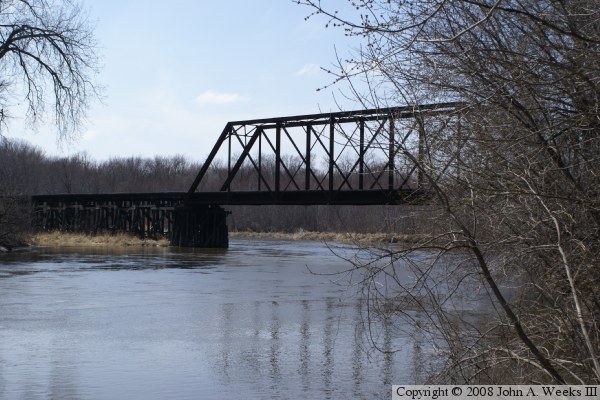
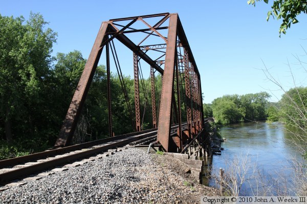
So far, I have learned little about the river bridge. If you can fill in the details, please let me know. The bridge appears in a post card dated 1884, and appears to have been built as part of the 1883 and 1884 expansion of the M&StL. While the bridge appears to look like the bridge in the post card, one never knows if it has been replaced or rebuilt since that time.

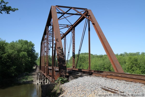
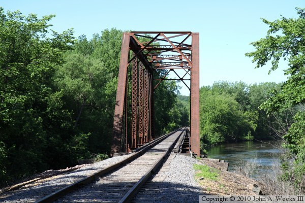
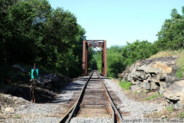
The photo above is looking southwest down the tracks from the grade crossing at West 1st Street. The photo below is looking west from the north bank of the Minnesota River from a vantage point located downstream of the bridge and behind the city water treatment plant.


Minnesota Valley Railroad Bridge
The photo above is a view looking down the downstream face of the Minnesota Valley Railroad Bridge from the north bank of the Minnesota River. The photo below is a view looking southwest down the tracks through the truss structure.

Minnesota Valley Railroad Bridge
These two photos are views looking down the upstream northeast face of the Minnesota Valley Railroad Bridge. The photo above is taken from a little further back from the truss span, so it shows more greenery than the photo below. The photo below shows how the river runs along the northeast side of the bridge prior to making a sharp right hand turn and passing under the structure.

Minnesota Valley Railroad Bridge

Made With Macintosh
Authored by John A. Weeks III, Copyright © 1996—2016, all rights reserved.
For further information, contact: john@johnweeks.com