Current Weather Conditions
John A. Weeks III
Saturday, July 27, 2024, 2:39:58 AM CDT
Home Photo Tours Rail Fan 12 Easy Steps
Aviation Spacecraft Highways & Bridges About The Author
 
Google Search
Maps   Groups   Images   Search
 
  Home
  • 12 Easy Steps
  • Aviation
  • Spacecraft
  • Highways & Bridges
    » Bridge Photography
      - MSP River Bridges
      - C & D Canal
      - Illinois River
      - Minnehaha Creek
      - Minnesota River
      - Mississippi River
        › Lake Itasca Area
        › Bemidji Area
        › Cass Lake - Ball Club
        › Grand Rapids Area
        › Blackberry - Crosby
        › Brainerd Lakes Area
        › Little Falls Area
        › St. Cloud Area
        › North Metro Area
        › Port Of Minneapolis
        › St. Anthony Falls Area
        › Mississippi Rvr Gorge
        › St. Paul Area
        › S St. Paul - Hastings
          · Wakota Bridge (N)
          · Wakota Bridge (O)
          · Rock Island Swing Br
          · Rock Island Rec Pier
          · Levee Park Ped Br
          · Grey Cloud Channel
          · Grey Cloud Island Br
          · Grey Cloud Trail Br
          · Lock & Dam #2
          · Hastings High Bridge
          · Hastings Spiral Br
          · Milwaukee Road Br
        › Red Wing - Winona
        › La Crosse Area
        › Lansing - Clinton
        › Quad Cities Area
        › Muscatine - Louisiana
        › St. Louis Area
        › Chester - Cairo
        › Miss - Tenn - Ark
        › Ark - Miss - Louisiana
        › Louisiana Structures
      - Missouri River
      - St. Croix River
      - St. Louis River
      - Wisconsin River
      - Best Miss River Photos
      - Cable Stayed Bridges
      - McGilvray Road Bridges
      - I-35W Bridge Disaster
      - Miscellaneous Bridges
      - Madison County Bridges
      - Hist Br Weekend 2013
    » Road Geek Topics
  • Photo Tours
  • Rail Fan
  • About The Author
 
Site Search By JRank
Highways, Byways, And Bridge Photography
Grey Cloud Trail Bridge
Grey Cloud Trail Mississippi River Crossing
Cottage Grove, MN

Grey Cloud Trail Bridge

• Structure ID: NBI: L8159.
• Location: River Mile 822.4.
• River Elevation: 686 Feet.
• Highway: Grey Cloud Trail South.
• Daily Traffic Count: 412 (1978).
• Bridge Type: Steel Truss Thru Deck.
• Length: 128 Feet.
• Width: 1 Traffic Lane, 18 Feet.
• Navigation Channel Width: Non-Navigable.
• Height Above Water: 7 Feet (Estimated).
• Date Built: Built 1946, Rebuilt 1992.
This page features the Grey Cloud Trail Bridge. It is one of three bridges that cross a side channel of the Mississippi River in Cottage Grove, Minnesota, to provide access to Grey Cloud Island. Grey Cloud Island is a large island in the Mississippi River between Hastings and Saint Paul.

Grey Cloud island sits in a corner of the river where the Mississippi River makes a sharp curve from flowing east and west near Hastings to flowing north and south upriver as far as downtown Saint Paul. While Saint Paul Park and Cottage Grove have seen rapid development, the area near and on Grey Cloud Island is still relatively rural. In fact, most of the island is dominated by two very large sand and gravel operations.

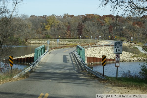
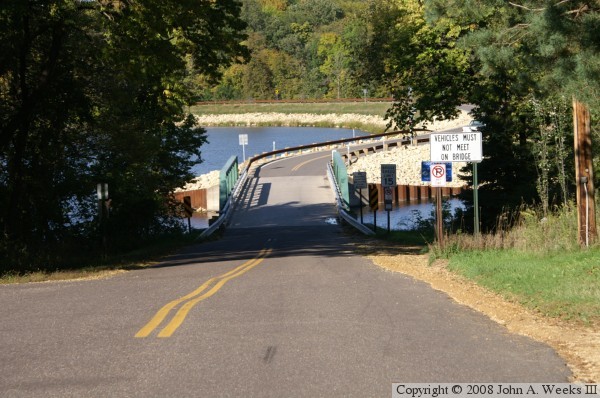
The Grey Cloud Trail Bridge consists of a causeway and bridge on Grey Cloud Trail South at approximately River Mile 822.4. While this bridge looks sturdy and well maintained, it has a very low weight limit, and signs prohibit two cars from meeting on the bridge. The deck and the steel truss are both built very light, so the city would like to avoid having it pounded to smithereens by heavy traffic. Traffic on the bridge is so light that it really would not be cost effective to replace it, so preserving it is the best option at this time.

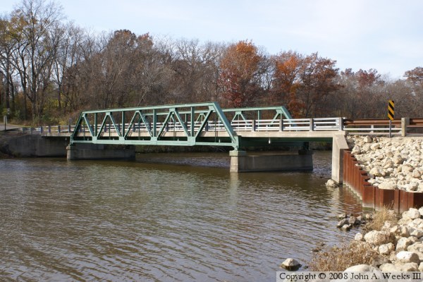
The photo above is a profile view of the bridge taken from a walkway along the river channel. The photo below is your first view of the bridge when heading northbound on Grey Cloud Trail. Notice the highway sign that prohibits vehicles from meeting on the bridge.

Grey Cloud Trail Bridge
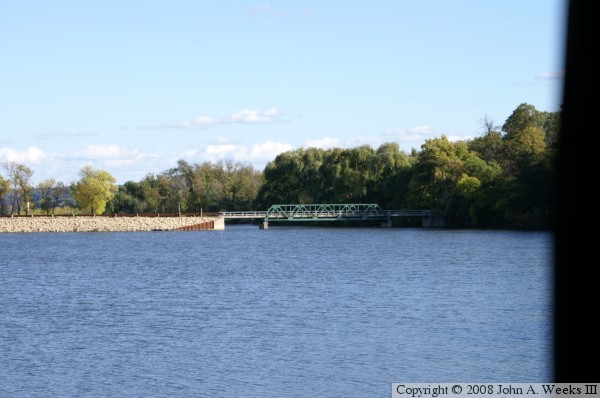
The photo above is a view from south of the bridge looking north across the river channel. This gives a good view of the causeway. The photo below was taken from the Grey Cloud Island Bridge, which is just upstream from the Grey Cloud Trail Bridge.

Grey Cloud Trail Bridge

Made With Macintosh
Authored by John A. Weeks III, Copyright © 1996—2016, all rights reserved.
For further information, contact: john@johnweeks.com