Current Weather Conditions
John A. Weeks III
Friday, July 26, 2024, 11:08:56 PM CDT
Home Photo Tours Rail Fan 12 Easy Steps
Aviation Spacecraft Highways & Bridges About The Author
 
Google Search
Maps   Groups   Images   Search
 
  Home
  • 12 Easy Steps
  • Aviation
  • Spacecraft
  • Highways & Bridges
    » Bridge Photography
      - MSP River Bridges
      - C & D Canal
      - Illinois River
      - Minnehaha Creek
      - Minnesota River
      - Mississippi River
        › Lake Itasca Area
        › Bemidji Area
        › Cass Lake - Ball Club
        › Grand Rapids Area
        › Blackberry - Crosby
        › Brainerd Lakes Area
        › Little Falls Area
        › St. Cloud Area
        › North Metro Area
        › Port Of Minneapolis
        › St. Anthony Falls Area
        › Mississippi Rvr Gorge
        › St. Paul Area
        › S St. Paul - Hastings
          · Wakota Bridge (N)
          · Wakota Bridge (O)
          · Rock Island Swing Br
          · Rock Island Rec Pier
          · Levee Park Ped Br
          · Grey Cloud Channel
          · Grey Cloud Island Br
          · Grey Cloud Trail Br
          · Lock & Dam #2
          · Hastings High Bridge
          · Hastings Spiral Br
          · Milwaukee Road Br
        › Red Wing - Winona
        › La Crosse Area
        › Lansing - Clinton
        › Quad Cities Area
        › Muscatine - Louisiana
        › St. Louis Area
        › Chester - Cairo
        › Miss - Tenn - Ark
        › Ark - Miss - Louisiana
        › Louisiana Structures
      - Missouri River
      - St. Croix River
      - St. Louis River
      - Wisconsin River
      - Best Miss River Photos
      - Cable Stayed Bridges
      - McGilvray Road Bridges
      - I-35W Bridge Disaster
      - Miscellaneous Bridges
      - Madison County Bridges
      - Hist Br Weekend 2013
    » Road Geek Topics
  • Photo Tours
  • Rail Fan
  • About The Author
 
Site Search By JRank
Highways, Byways, And Bridge Photography
Grey Cloud Channel Bridge
Grey Cloud Island Drive Mississippi River Crossing
Cottage Grove, MN

Grey Cloud Channel Bridge

• Structure ID: N/A.
• Location: River Mile 827.3.
• River Elevation: 686 Feet.
• Highway: Grey Cloud Island Drive.
• Daily Traffic Count: 710 (2007).
• Bridge Type: Unknown.
• Length: Unknown.
• Width: 24 Feet (Estimated), 2 Traffic Lanes.
• Navigation Channel Width: Non-Navigable.
• Height Above Water: Unknown.
• Date Built: Unknown.
This page features the Grey Cloud Channel Bridge. It is one of three bridges that cross a side channel of the Mississippi River in Cottage Grove, Minnesota, to provide access to Grey Cloud Island. Grey Cloud Island is a large island in the Mississippi River between Hastings and Saint Paul.

Grey Cloud island sits in a corner of the river where the Mississippi River makes a sharp curve from flowing east and west near Hastings to flowing north and south upriver as far as downtown Saint Paul. While Saint Paul Park and Cottage Grove have seen rapid development, the area near and on Grey Cloud Island is still relatively rural. In fact, most of the island is dominated by two very large sand and gravel operations.

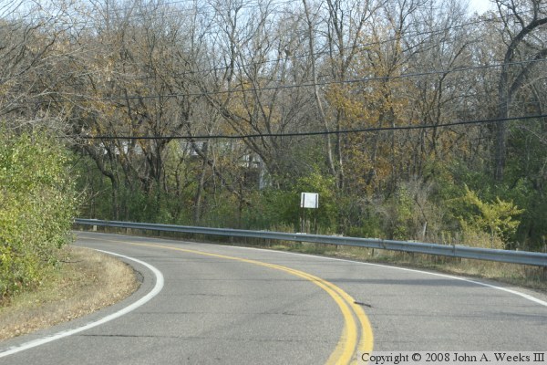
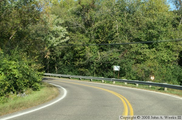
The Grey Cloud Channel Bridge consists of a causeway on Grey Cloud Island Drive at approximately River Mile 827.3. The bridge is not visible from the roadway. In fact, I am not completely sure that there is a bridge or culvert at this location. Such a structure is either obscured by the thick vegetation, or is located below the water line. The water is relatively calm and deep, so there is no visible indication of water flowing through a culvert. At the same time, the water is clear enough that it does not appear to be stagnant. Given the sharp drop and deep water, plus the blind corner on the road, it is too risky to explore the banks of the causeway. At any rate, it would be a crime against nature to simply block off a river channel. If that is the case, then I suggest naming this feature as an earthen dam.

The photo above and below were taken at the same vantage point south of the suspected bridge looking north. The photo above was taken in 2007 just as the trees were starting to turn colors. The photo below was taken in 2008 just at the tail end of the color season.


Grey Cloud Channel Bridge

Made With Macintosh
Authored by John A. Weeks III, Copyright © 1996—2016, all rights reserved.
For further information, contact: john@johnweeks.com