| Highways, Byways, And Bridge Photography |
Lock & Dam #1
Mississippi River Lock & Dam
Minneapolis/Saint Paul, MN
|
• Structure: |
Lock & Dam #1. |
|
• Location: |
River Mile 847.9. |
|
• Dam Width: |
950 Feet Overall, 574 Foot Longest Structure. |
|
• River Elevation (Pool): |
725 Feet. |
|
• River Elevation (Outflow): |
686 Feet. |
|
• Water Fall: |
38 Feet. |
|
• Annual Lock Traffic: |
4,949 Vessels, 1,160,000 Tons (2005). |
|
• Date Opened: |
Completed 1917. |
Also called the Ford Dam, this is this only twin lock structure in the Saint
Paul District of the US Army Corps of Engineers 9 foot navigation channel
project. Each lock is 56 feet wide by 400 feet long. The hydro power station,
which generates 14.4-megawatts of electricity, is owned by Brookfield Power
Company. It was built to supply power to the nearby Ford Motor Assembly
plant, but excess power sold to Excel Energy and fed into the regional power
grid.
The history of the Ford Dam is the result of a 50 year struggle between
Minneapolis and Saint Paul to exploit hydro power and navigation rights
on the great river. The original project was for two low-water dams.
Lock & Dam #2 was to be built just north of Lake Street, and Lock &
Dam #1 was to be built just south of Ford Parkway. Lock & Dam #2 was
started around 1897, and finished in 1907. It featured a single small
steamship-sized lock. Locals now call this Meeker Island Lock & Dam
since it was built at the site of the former Meeker Island. Lock &
Dam #1 was started about 1912. Just as the low water dam and locks
were finished, the US Government stepped in and declared that the
Lock & Dam #1 would become a high-water power dam. The result is
that Lock & Dam #2, which had been in operation only 5 years, was
closed and demolished. The downriver dam was rebuilt, and a power
house was installed. While the logic of having one high water dam
with a single set of locks makes great sense, it is too bad that all
the work was invested in building and later demolishing the Meeker Island
Lock & Dam.
Lock & Dam #1 has an excellent visitor center and observation area.
Parking is available along the road leading to the lock & dam. The
visitor experience starts as you get out of your car, or as you walk down
the hill from the West River Parkway, where can get a good view of the
upstream side of the locks. You can then head in towards the visitor
center, where you can walk along the western side of the locks. At the
visitor center, you can walk up a stairway (or take the elevator) to a
series of bridges located high over the locks. This allows you to walk to
the south end of the locks, then across the locks. You can get a great view
of the locks in operation from the observation deck located on the lock
& dam control tower. From here, you can walk down to a large plaza
situated between the locks and the dam spillway. This gives a good view of
the eastern of the parallel locks, and also provides a spectacular view of
the dam spillway. Of all the visitor facilities operated by the US Army
Corps of Engineers on the Mississippi River, this one gives the best view
of the river, the locks, and the waterfall.
The locks at this dam were closed from August 1, 2007 to October 5, 2007,
following the collapse of the I-35W bridge. The river was closed above this
lock & dam during the recovery and bridge clean-up operations. The
river level was dropped by two feet to aide in the bridge collapse clean-up.
Update—The Brookfield Power Company purchased the power plant from
Ford Motor Company in 2007. Ford is planning to close the nearby automobile
assembly plant, so the hydropower will be used to feed the regional power
grid. Brookfield is building a new hydropower station at Lower Saint
Anthony Falls, and also operates the power plant at the Old River Control
Structure some 1,500 miles downstream.
Update—On May 28, 2009, the US Army Corps of Engineers issued a
warning that the Ford Dam was potentially unsafe. They are concerned
that water might be seeping under the dam, putting it at risk of failure.
If the dam would fail, it would put a halt to navigation above Saint
Paul, and flood areas of the river below the structure. The Corps plan
to perform a detailed inspection of the dam to determine the extent of
the problem.
Update—Lock & Dam #1 was in the news in October, 2011, after
an invasive species of fish known as silver carp, a subspecies of Asian
carp, was found on the downstream side of the dam. This was not totally
unexpected since the carp have been moving upstream for several years.
Lock & Dam #1 is one of the few structures on the river that could
block the fish from moving even further upstream, but only if the navigation
locks were permanently closed. The invasive fish could devastate the sport
fishing industry in the state if they move further north. At the same time,
closing the navigation locks would have a negative economic impact and cost
hundreds of jobs.
Update—Lock & Dam #1, as well as both the Upper and Lower Saint
Anthony Falls Locks & Dams, were closed twice during 2012 due to high
water flows following unusually large rainfalls in central Minnesota.
The first closing was to recreational users on May 28 and May 30 for
commercial users. The locks were reopened on June 8. They were closed
again on June 22 for recreational use and June 24 for commercial use,
then reopened on June 28. The US Army Corps of Engineers closes the locks
to recreational users when the flow hits 30,000 cubic feet per second, and
closes to commercial traffic at 40,000 cubic feet per second.
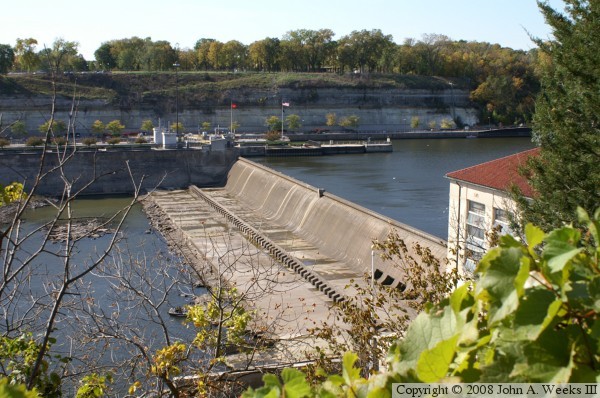
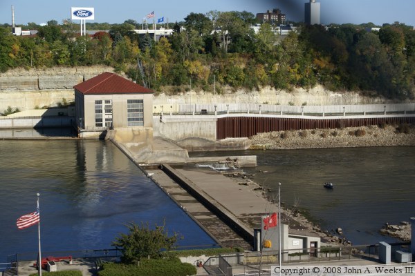
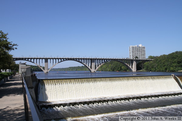
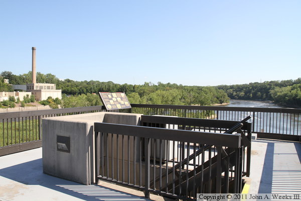
The photo above is a view from the scenic overlook on the East River
Parkway. During much of the year, the dam remains dry, and the river
current passes through the power house. A small gate next to the power
house maintains the pool level behind the dam just below the level of
the top of the main dam structure.
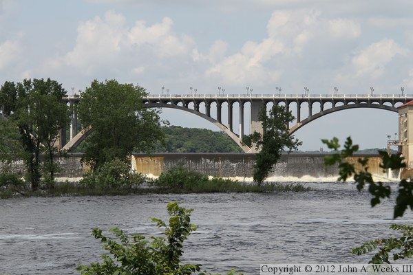
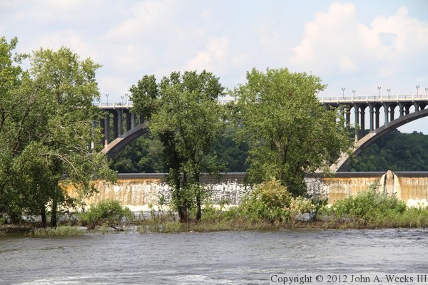
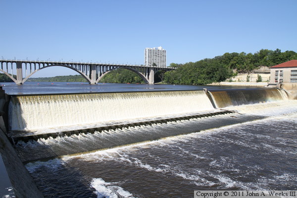
In contrast to the photo at the top of the page, the photo above shows a
high water flow over the dam. This is unusual for late summer, but a very
wet winter in 2010/2011 lead to the reservoirs being full in northern
Minnesota, resulting in high water flow rates most of the summer. The vantage
point for this photo is the east bank of the river located about 1,400 feet
downstream of the dam, an area that is not open to the general public. The
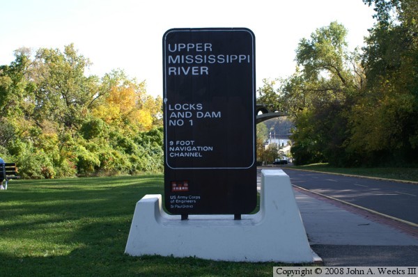
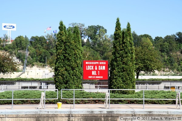
photo below is the official project sign at the entrance to the lock & dam
from the West River Parkway. The entrance road is a bit hard to find since it
is at the back of a small parking lot to the north of the Intercity Bridge,
while the lock & dam is south of the bridge.
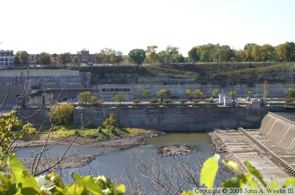
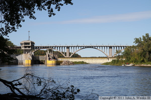
The photo above is a view of the locks from the overlook on the east side
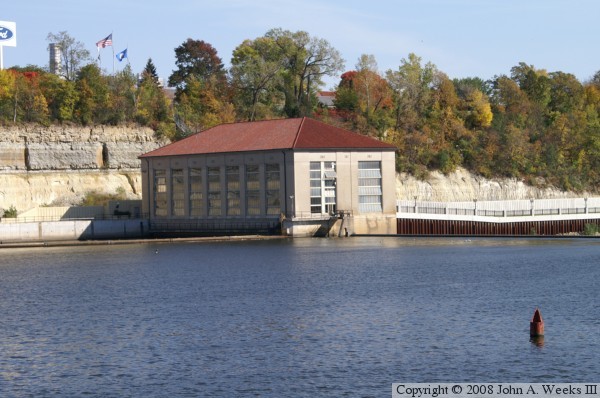
of the river. The photo below is the power house as seen from the visitors
center on the west side of the river.
The photo above is a view of the locks from river level just upriver
of the lock & dam structure. The photo below is a view of the
dam and power house taken from the same location on the west side of
the river. The water is about 40 feet deep at this location.

The photo above is a close view of one of the locks just after the
upstream door has opened. These boats are headed up river, and have
just been lifted 38 feet. The photo below is a close view of the Ford
Motor Company sign on the east side of the river. The Ford assembly
plant is the reason that the dam was built some 90 years ago. The
Ford plant builds Ford Ranger light pickup trucks as this was written
in 2008. The plant is slated to close down at some point in the near
future, and the land will be redeveloped.


The photo above is a view of the lock structure as seen from the
Intercity Bridge. The access road and visitor observation area is on the
right side of the photo. The Minnehaha Creek flows into the Mississippi
River just below the lock structure, and just below the Minnesota
Veterans Home. The photo below is a view of the power house from the
same location. Note the small gate on the right side of the power house.

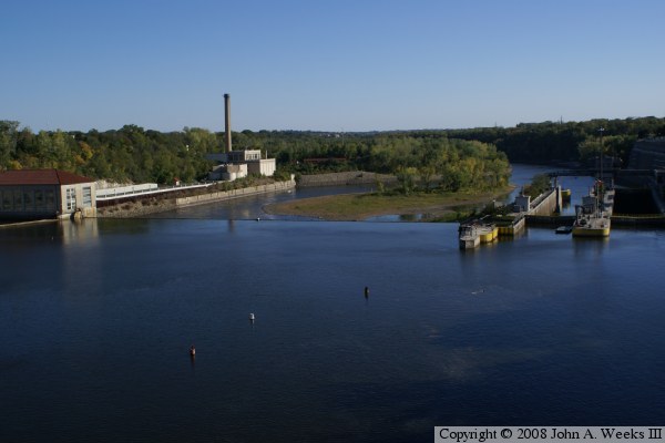
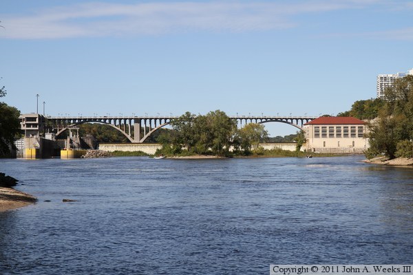
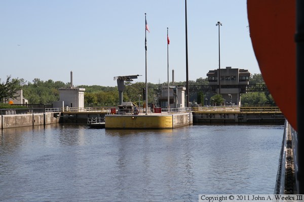
The photo above is an overview of the lock & dam project as seen
from the Intercity Bridge. The photo below is a view of the dam and
power house as seen from Minnehaha Park, which is on top of the bluff
on the west side of the river.
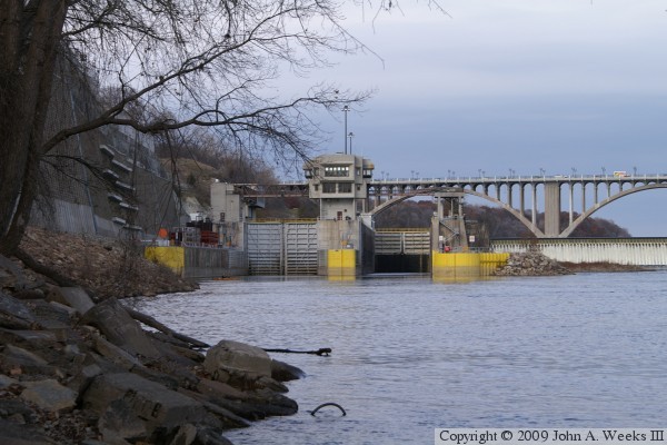
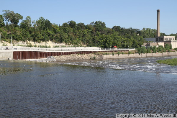
These two photos are views from Hidden Falls Regional Park located just
downstream of the lock & dam on the east river bank. The photo above
is the downstream side of the west boat lock. The photo below is the western
half of the dam spillway. The lock gates are about 1,100 feet from this
vantage point, while the dam is about 1,400 feet to the north of this spot.
These two photos are additional views from Hidden Falls Regional Park located
just downstream of the lock & dam on the east river bank. The photo above
is the eastern half of the main dam spillway. The photo below is the power
house building. Note the small gate located just to the left of the power
house building. That gate is used to regulate the pool water level during
times of lower river flow rates.

These two photos are views of Lock & Dam #1 as seen from the west bank
of the Mississippi River just downstream of the structure. The photo above
is looking to the north towards the two parallel locks. The right lock has
its downstream doors open, allowing the upstream doors to be visible. The
photo below is a view of the dam spillway.
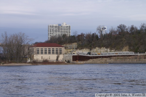
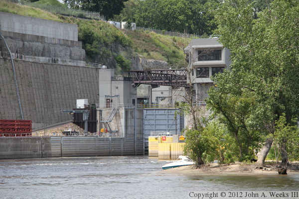
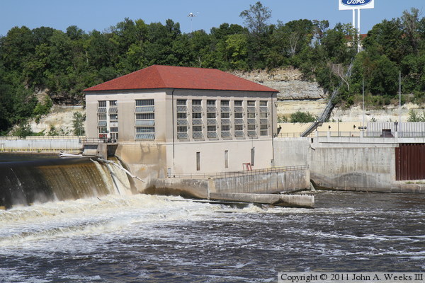
These two photos are views of Lock & Dam #1 as seen from the west bank of
the Mississippi River just downstream of the structure. The photo above is
the hydroelectric power plant. The photo below is an overview of the lock and
dam with the mouth of the Minnehaha Creek in the foreground and the Intercity
Bridge in the background.
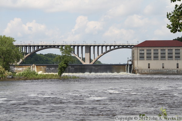
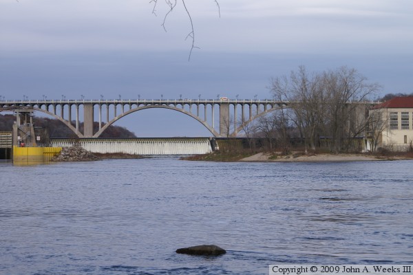
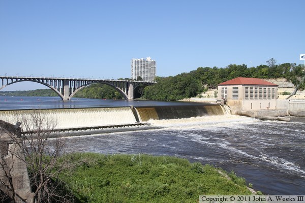
The photo above is looking upriver to the north towards the western half of
the dam spillway, with the Intercity Bridge in the background. The vantage
point is the visitor center plaza at the lock and dam. The photo below is
a cold winter view looking north from the edge of the bluffs in Minnehaha
Park.

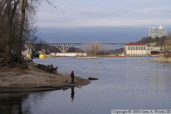
These two photos are looking upstream towards the south face of Lock &
Dam #1, with the Intercity Bridge in the background. The photo above is
from the west shore of the river just upstream of Minnehaha Creek. The
photo below is from the edge of the bluffs just below Minnehaha Creek.
The photo above is a view looking east across the boat locks from the parking
area at the lock and dam. Note the Ford Motor Company sign in the background
at the Ford assembly plant. This plant is slated to close in 2011. The
photo below is looking south towards the upstream entrances to the two parallel
boat locks.
These two photos are looking east across the western of the two boat locks
at the location of the upstream entrance doors (top gate). In the photo
above, the gate is fully closed. In the photo below, the gate is opening
to allow boats to exit the lock.

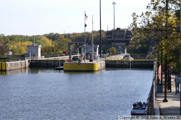
The photo above is the western lock looking north towards the Intercity
Bridge. The lock top gate is open, and several boats are exiting the lock,
with a few smaller boats near the riverbank waiting to enter the lock. The
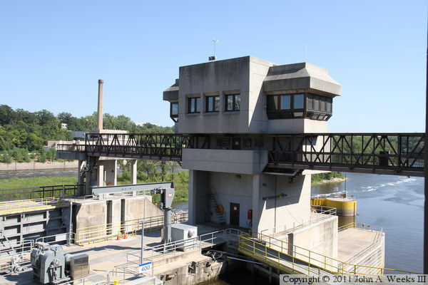
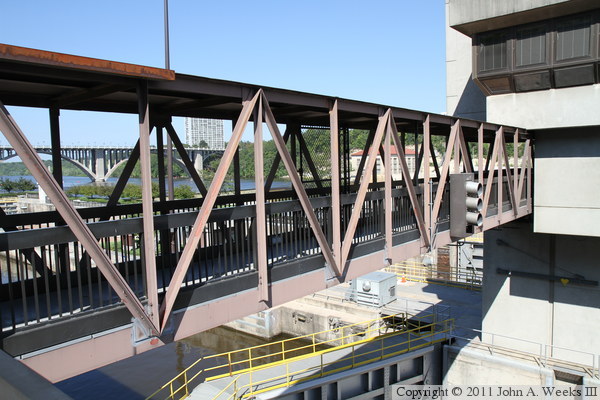
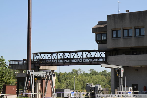
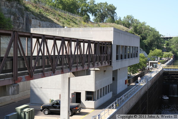
photo below is the control tower for the lock. The truss bridges not only
allow workers to get to the control center, but it also allows the public
access to the plaza located between the locks and the dam spillway.
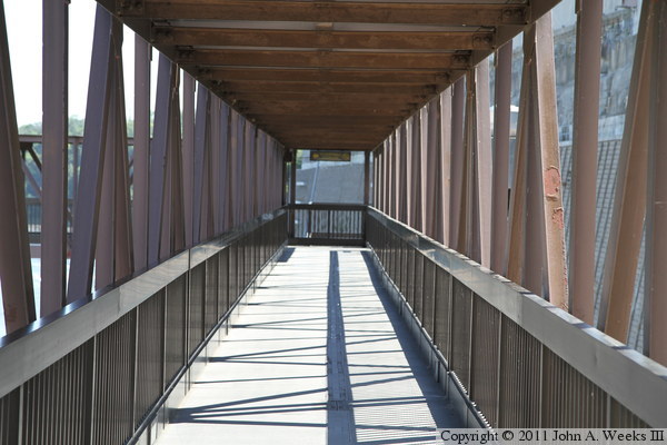
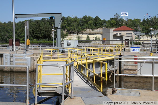
The photo above is looking south along the walkway bridge leading from
the visitor center entrance to the south end of the locks. The photo
below is looking east down the length of the two walkway bridges that
cross the boat locks.

The photo above is the downstream face of the truss bridge that crosses
the western of the two boat locks. Note the stop light head mounted on
the bridge to signal to boats when it is safe to enter the lock. The
photo below is looking down towards the bottom gate (downstream exit doors)
for the western of the two boat locks.

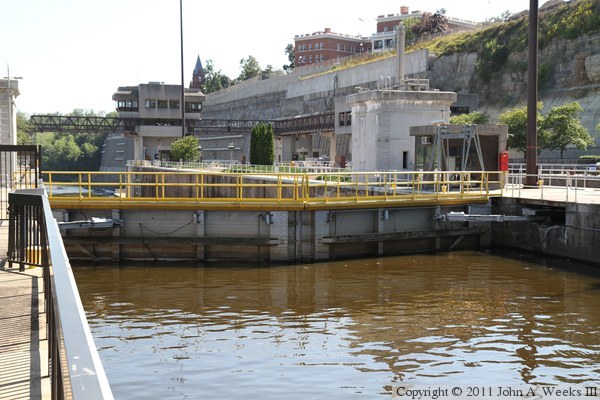
The photo above is looking upstream down the length of the western of the
two parallel boat locks. Note that the two small boats that we saw waiting
to enter the lock above are now entering the lock. The photo below is
the eastern of the two boat locks, which was empty and not in use on the
day that I visited. The visitors plaza is located to the right of this lock.

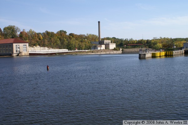
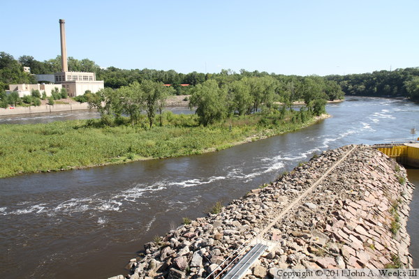
The photo above is looking downstream along the exit from the eastern of the
two boat locks. The photo below is the main channel of the Mississippi River
as it flows downstream from the dam spillway and powerhouse. There is a
sizable island just below the dam that splits the channel. The building
with a smoke stack is a power plant for the Ford Motor Company.
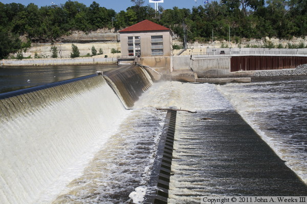
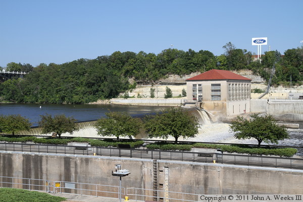
The photo above is looking northeast across the river channel towards the
hydropower plant. The photo below is a view of the dam spillway from the
same location. The dam structure has a inflatable section at the top that
can be used to adjust the pool level. The inflatable section on the right
side of the dam is a little lower, allowing more water to flow over that
side of the dam. The concrete blocks at the base of the dam are called
‘grinders.’ The clam the flow of water at the base of the dam.
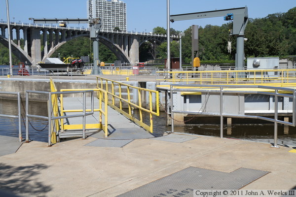
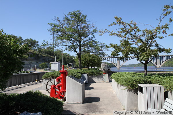
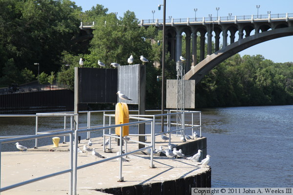
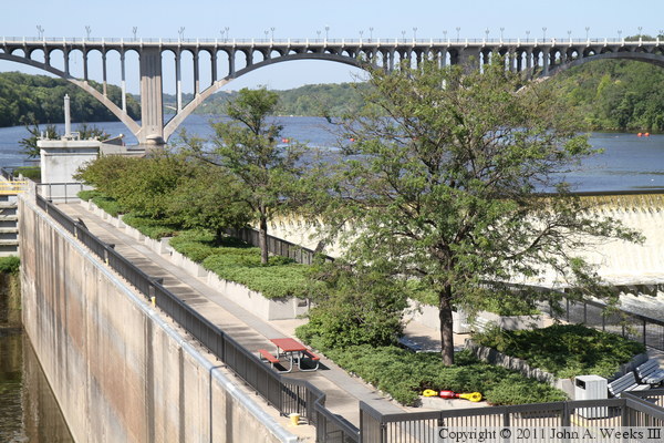
The photo above is looking southeast from the east end of the pedestrian
bridge that crosses the locks. The stairway leads down to the plaza located
between the locks and the dam spillway. The photo below is looking north
along the visitor plaza.
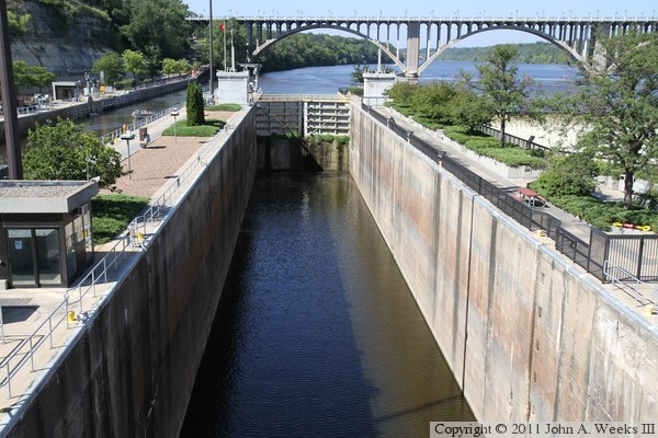
These two photos are views of the dam spillway from the visitor plaza. The
photo above is looking upstream towards the face of the spillway, while the
photo below is looking downstream. The 38 foot drop is almost invisible
from this vantage point.
The photo above is looking east across the river along the apron located
in front of the dam spillway. The photo below is looking east across the
river along the crest of the water fall.

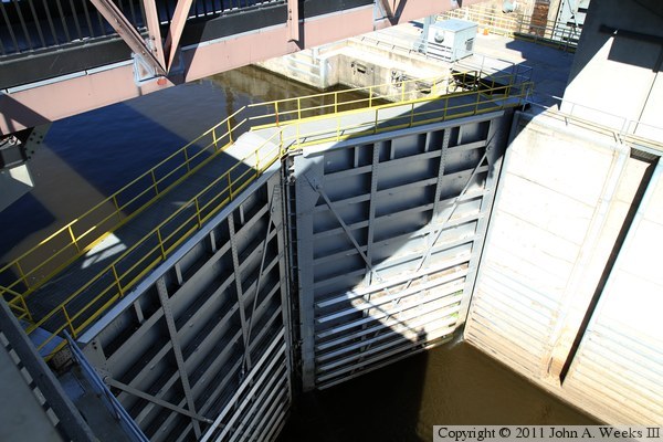
The photo above is the upstream side of the top gate of the eastern of the two
boat locks. The photo below is looking west across that top gate, which has
a walkway for workers.

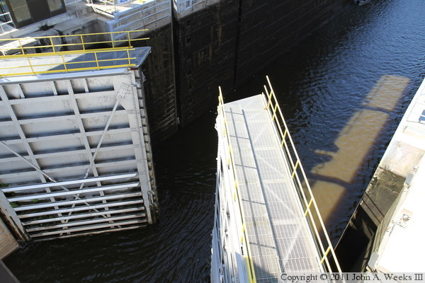
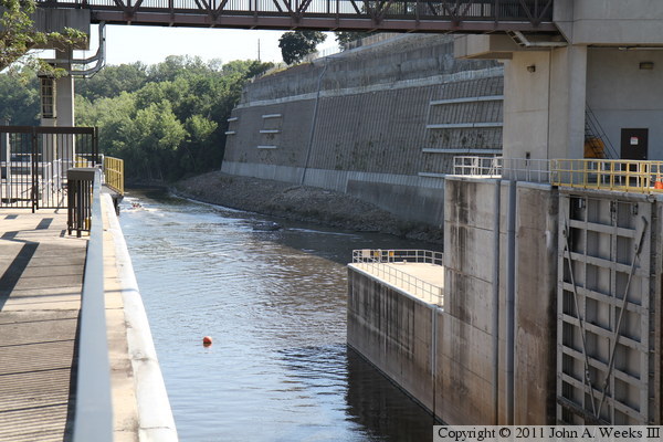
The photo above is the north end of the wall between the eastern boat lock
and the channel leading to the dam spillway. The photo below is looking
down from the pedestrian walkway towards the bottom gate on the western
lock as it opens to allow boats to exit from the lock heading downstream.
These two photos are two different views of the walkway over the eastern of
the two boat locks. The photo above is from near the entrance to the visitor
center, while the photo below is from the plaza located between the locks and
the spillway. We can see the two small boats (from the photos above) exiting
the locks.

The photo above is looking downstream through the open bottom gate of the
eastern boat lock. The photo below is a view of the walkway bridges between
the visitor center and the lock control tower. These walkways are open to the
public to allow access to the plaza overlooking the spillway. The buildings
above the retaining wall are part of the Minnesota Veterans Home.


The photo above is a closer view of the walkways located between the visitor
center and the control tower. The photo below is a view of the bridge
leading from the visitor center as seen from the observation deck on the
control tower.
These two photos are views of the visitor plaza located between the locks and
the dam spillway. The photo above is looking northeast from the observation
deck on the control tower. The photo below is looking east from the walkway
bridge near the visitor center.
|
