The I-94 connection between Minneapolis and Saint Paul was grossly over
capacity by the late 1980s. MN-DOT developed a project to reconstruct
I-94, but it would be the mid-1990s before that project would be funded
and ready to go. Public outcry did not let up as the traffic got worse,
so MN-DOT proposed an innovative stop-gap project called Add-A-Lane. Over
four weekends in the early 1990s, MN-DOT brought in contractors to work the
entire weekends to move curbs, fill in missing roadway, move guard rails,
and otherwise make room to paint a 3rd through lane on I-94. The project
essentially added 50% to the highway capacity in one month.
The reconstruction project was eventually completed in the mid-1990s.
Part of that project was to rebuild the Dartmouth bridge over the
Mississippi River, making it wider and adding auxiliary lanes and shoulders.
The rebuild was completed in stages without having to close the bridge.
First step was to modify the piers and abutments to make them wider.
Then new steel girders were placed on the outside of of the existing span
resting on the wider piers. The new outside lanes were then completed.
Once the outside lanes were ready, the existing lanes were removed and
rebuilt, one side at a time. The net result is that the bridge was totally
rebuilt in place without ever closing the bridge to highway traffic. This
is quite a feat of engineering when you consider that this is the busiest
highway bridge in the state of Minnesota and the busiest highway bridge
anywhere on the Mississippi River.
The newly rebuilt Dartmouth Bridge was painted to support three through
traffic lanes in each direction, plus an auxiliary lane on the outside,
and reasonable shoulders to accommodate breakdowns. After the I-35W bridge
collapse, the I-35W traffic was detoured onto I-94 and MN-280. To handle
this additional traffic, MN-DOT repainted I-94 to add an additional lane. The
Dartmouth Bridge carried 4 through lanes each way, an exit lane on each edge,
and very little room for shoulders. After the new I-35W bridge was opened,
the lanes were adjusted slightly. While there are still 5 slightly narrow
lanes in each direction, one lane headed westbound now has a forced exit
onto Riverside Ave. This small change has resulted in unexpectedly large
traffic backups, so this configuration may change once again.
The Dartmouth bridge was built to look much like the mainline I-94 freeway.
As a result, you hardly notice that you are crossing one of the major
waterways of the world. Critics have described the bridge as being
uninspired. An engineer would counter that the ideal bridge is one that
you do not even notice when you are using it. Given all the spectacular
bridges in the area, any freeway bridge would have a hard time competing for
attention.
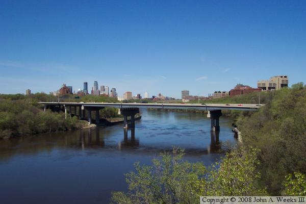
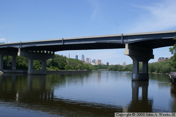
The photo at the top of this page is a profile view taken from the
Cappelen Memorial Bridge (Franklin Avenue). Downtown Minneapolis is in
the background on the left, and the University Hospital complex is in
the background on the right.
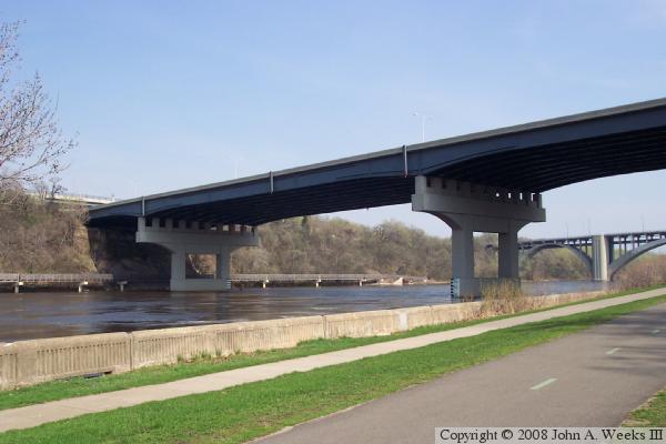
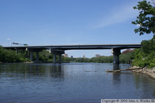
The photo above is a view looking west across the river crossing from the
East River Parkway overpass. This photo shows the lane markings prior to
the I-35W bridge collapse, which is three through lanes each direction,
plus an auxiliary lane and shoulders on each side.
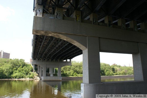
The photo below is a view under the Dartmouth Bridge from the West River
Parkway in an area of the city known as Bohemian Flats. The Cappelen Bridge
is visible in the background, and the East River Flats Catwalk is visible on
the far side of the Mississippi River.
The photo above is the south face of the bridge as seen from the East
River Flats Catwalk, a walking bridge that runs under the east end of
the Dartmouth Bridge. The photo below is a view under the bridge
structure, also from from the catwalk.
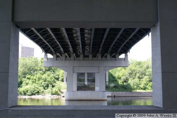
The photo above is a view looking directly west under the bridge structure.
Notice that the cross-bracing between the bridge girders is different on
the outer two girders on each side of the bridge. These girders were added
to the structure when it was rebuilt in 1994. The photo below is a view
of the anchor point on the river bluff on the east end of the bridge.
The photo above is the main span bridge pier on the east side of the
navigation channel. The photo below is a view of the main bridge span.
Both photos are looking to the north from the east river bank. The
bridge structure near the river level is the East River Flats Catwalk,
which supports a walking and bicycle trail along the east river bank.
The photo above is a profile view of the Dartmouth Bridge looking north from
the edge of the river on the east river bank. The photo below is the first
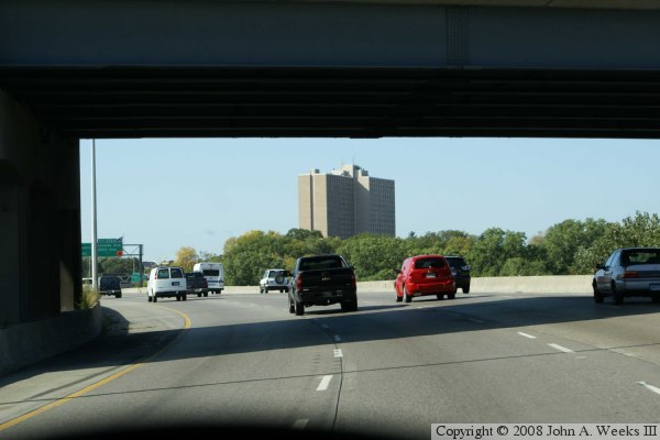
of three photos showing a typical crossing of the Dartmouth Bridge. In this
first view, we are crossing under the East River Parkway overpass, and
entering the east end of the bridge heading westbound.
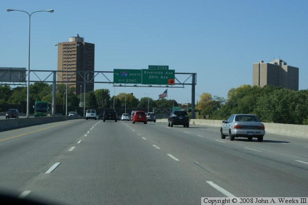
These two photos complete the Mississippi River crossing headed westbound.
In the photo above, we are about a third of the way across the bridge.
In the photo below, we are nearing the end of the structure. These photos
show the lane markings after the new I-35W bridge was completed.