Current Weather Conditions
John A. Weeks III
Sunday, January 19, 2025, 10:31:47 PM CST
Home Photo Tours Rail Fan 12 Easy Steps
Aviation Spacecraft Highways & Bridges About The Author
 
Google Search
Maps   Groups   Images   Search
 
  Home
  • 12 Easy Steps
  • Aviation
  • Spacecraft
  • Highways & Bridges
    » Bridge Photography
      - MSP River Bridges
      - C & D Canal
      - Illinois River
      - Minnehaha Creek
      - Minnesota River
      - Mississippi River
        › Lake Itasca Area
        › Bemidji Area
        › Cass Lake - Ball Club
        › Grand Rapids Area
        › Blackberry - Crosby
        › Brainerd Lakes Area
        › Little Falls Area
        › St. Cloud Area
        › North Metro Area
        › Port Of Minneapolis
        › St. Anthony Falls Area
        › Mississippi Rvr Gorge
        › St. Paul Area
          · Lexington Bridge
          · Miss River Br #15
          · Smith Ave High Br
          · Raspberry Island Br
          · Wabasha Street Br
          · Great Western Bridge
          · Robert Street Bridge
          · Lafayette Bridge
          · C&NW Bridge
        › S St. Paul - Hastings
        › Red Wing - Winona
        › La Crosse Area
        › Lansing - Clinton
        › Quad Cities Area
        › Muscatine - Louisiana
        › St. Louis Area
        › Chester - Cairo
        › Miss - Tenn - Ark
        › Ark - Miss - Louisiana
        › Louisiana Structures
      - Missouri River
      - St. Croix River
      - St. Louis River
      - Wisconsin River
      - Best Miss River Photos
      - Cable Stayed Bridges
      - McGilvray Road Bridges
      - I-35W Bridge Disaster
      - Miscellaneous Bridges
      - Madison County Bridges
      - Hist Br Weekend 2013
    » Road Geek Topics
  • Photo Tours
  • Rail Fan
  • About The Author
 
Site Search By JRank
Highways, Byways, And Bridge Photography
Robert Street Bridge
Robert Street Mississippi River Crossing
Saint Paul, MN

Robert Street Bridge

• Structure ID: NBI: 9036.
• Location: River Mile 839.20.
• River Elevation: 686 Feet.
• Highway: Robert Street.
• Daily Traffic Count: 17,000 (2002).
• Bridge Type: Concrete Arch.
• Length: 1,534.4 Feet, 264 Foot Main Span.
• Width: 5 Traffic Lanes, 78.5 Feet.
• Navigation Channel Width: 158 Feet.
• Height Above Water: 62 Feet.
• Date Built: Opened August 6, 1926.
The first bridge at this location was built as a wagon bridge in 1884 and 1885. According to the Minnesota Historical Society, the bridge had become inadequate due to traffic by the 1920s. In 1920, the bridge was carrying 2,630 vehicles and 400 street cars during the prime business day. The vehicle traffic increased 55% by 1922 when the road was widened and connected to University Avenue. As a result, work began on a replacement bridge on June 19, 1924.

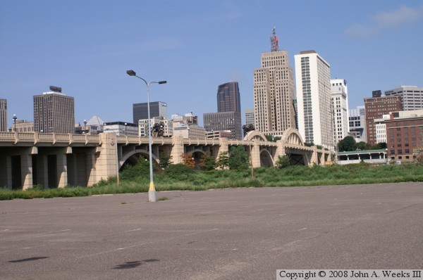
The new bridge took just over 2 years to complete. The finished structure is a masterpiece of urban architecture. The bridge looks nice, and it makes a statement. It is not dressed up, yet it looks very ornate. More importantly, it was built to do a job, and does that job so well that it still a key river crossing in downtown Saint Paul some 80 years later. The Robert Street Bridge was listed on the National Register of Historic Places in 1989. That same year, the bridge was extensively refurbished.

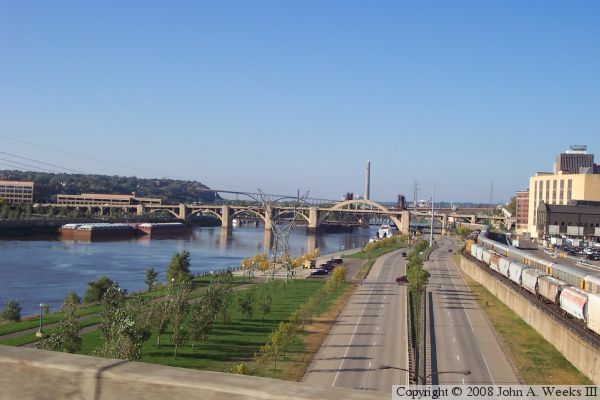
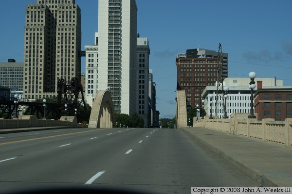
One feature of the bridge is that it appears to fit so well to its surroundings. Perhaps the reason for that is that the bridge was so difficult to fit around all the obstacles at that location. This includes having to be high enough for river boat traffic, low enough to meet the low grade south of the river without having too steep of grade (as required by street cars), it has to be high enough for trains to pass under, yet it had to match the height of Kellogg Blvd. The result is that the bridge design was dictated by each of these constraints.

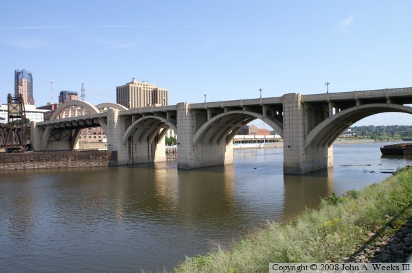
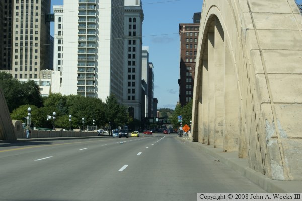
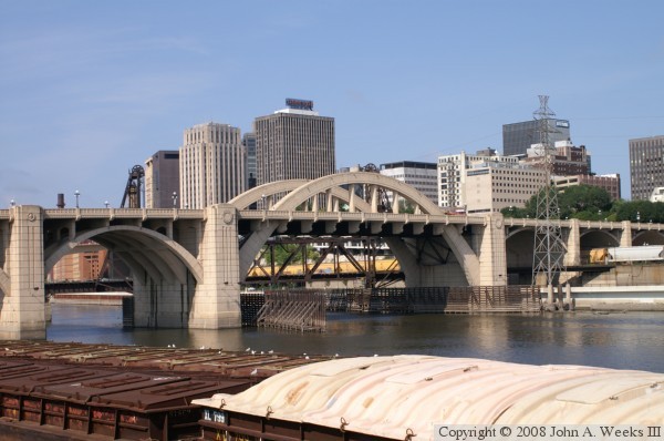
The key feature of the Robert Street Bridge is the large rainbow arch. A rainbow arch has parts of the arch both below and above the traffic deck. It is a rather unusual bridge style. It was selected because concrete arches were the style of the day. But if the entire arch had been below the traffic deck, too much of the arch would have been in the way of river navigation traffic. The rainbow arch allowed the navigation channel to be maintained wider, and also put part of the arch above the traffic deck for bridge traffic to see.

The six secondary arch spans consist of five individual concrete arches, while the main span has only 2 individual arches. The reason is the rainbow style arch. There was no way to add more arches above the roadway without using up much of the width of the roadway. As a result, engineers designed a steel structure that sits under the main span to help support the roadway over the main span.

The photo above shows a good view of the main span rainbow arch. Notice that there is steel work under the bridge deck to help support the roadway. Also notice the Great Western railroad lift bridge behind the Robert Street Bridge. The railroad bridge was built many years before the Robert Street Bridge.


Robert Street Bridge
The photo above shows the main channel span and the smaller arch spans from the river walk on the south side of the river. The photo below is a view from the parking lot at the River Park Plaza office complex. This view shows a series of girder spans, 4 arch spans, the main channel rainbow arch span, and 3 more arch spans.

Robert Street Bridge
The photo above is looking south down the highway deck from street level. The photo below was taken from the passenger window of a moving car while headed southbound on the Lafayette Bridge. In addition to the Robert Street Bridge, we can see the Great Western lift bridge, the Wabasha Street Bridge, and the Smith Avenue High Bridge, plus a glimpse of the railing of the Lafayette Bridge in the foreground.

Robert Street Bridge
The photo above is the first of 4 photos showing a typical crossing of the Robert Street Bridge heading northbound. In this photo, we are just entering the south end of the bridge. In the photo below, we are about halfway across the 4 smaller arch spans.

Robert Street Bridge
The photo above shows our progress crossing the Robert Street Bridge heading northbound. In this photo, we are just entering the main rainbow arch span crossing the main channel of the Mississippi River. In the photo below, we are approaching the traffic light with Kellogg Street at the end of the bridge.

Robert Street Bridge

Made With Macintosh
Authored by John A. Weeks III, Copyright © 1996—2016, all rights reserved.
For further information, contact: john@johnweeks.com