Current Weather Conditions
John A. Weeks III
Friday, April 19, 2024, 9:32:49 PM CDT
Home Photo Tours Rail Fan 12 Easy Steps
Aviation Spacecraft Highways & Bridges About The Author
 
Google Search
Maps   Groups   Images   Search
 
  Home
  • 12 Easy Steps
  • Aviation
  • Spacecraft
  • Highways & Bridges
    » Bridge Photography
      - MSP River Bridges
      - C & D Canal
      - Illinois River
      - Minnehaha Creek
      - Minnesota River
      - Mississippi River
        › Lake Itasca Area
        › Bemidji Area
        › Cass Lake - Ball Club
        › Grand Rapids Area
        › Blackberry - Crosby
          · Blackberry Bridge
          · Old Blackberry Br
          · Jacobson Bridge
          · MN-232 Bridge
          · Soo Line Br (Palisade)
          · US-169 Br (Aitkin)
          · Aitkin Low Hd Dam
          · Aitkin Flood Channel
          · Aitkin Co. Hwy 1 Br
          · Aitkin Co. Hwy 22 Br
          · Punteney Bridge
          · MN-6 Br (Crosby)
        › Brainerd Lakes Area
        › Little Falls Area
        › St. Cloud Area
        › North Metro Area
        › Port Of Minneapolis
        › St. Anthony Falls Area
        › Mississippi Rvr Gorge
        › St. Paul Area
        › S St. Paul - Hastings
        › Red Wing - Winona
        › La Crosse Area
        › Lansing - Clinton
        › Quad Cities Area
        › Muscatine - Louisiana
        › St. Louis Area
        › Chester - Cairo
        › Miss - Tenn - Ark
        › Ark - Miss - Louisiana
        › Louisiana Structures
      - Missouri River
      - St. Croix River
      - St. Louis River
      - Wisconsin River
      - Best Miss River Photos
      - Cable Stayed Bridges
      - McGilvray Road Bridges
      - I-35W Bridge Disaster
      - Miscellaneous Bridges
      - Madison County Bridges
      - Hist Br Weekend 2013
    » Road Geek Topics
  • Photo Tours
  • Rail Fan
  • About The Author
 
Site Search By JRank
Highways, Byways, And Bridge Photography
Aitkin Co. Highway 22
Mississippi River Flood Diversion Channel Bridge
Aitkin, MN

Aitkin Co. Highway 22 Bridge

• Structure ID: NBI 01526
• Location: 1.2 Miles Up Stream From End Of Diversion Channel
• River Elevation: 1,185 Feet
• County: Aitkin
• Highway: Aitkin CSAH 22
• Daily Traffic Count: 610 (2004)
• Bridge Type: Concrete Girder
• Bridge Length: 242 Feet Overall, 80 Foot Longest Span
• Bridge Width: 36 Feet, 2 Lanes
• Height Above Water:
• Date Built: 2007
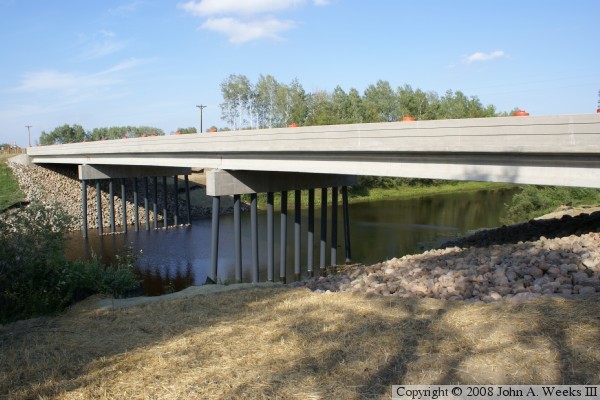
This bridge is newly opened in 2007. In fact, traffic barrels are still present on the deck when these photo were taken. It spans the Mississippi River Flood Diversion Channel, the western most of two such bridges. The bridge carries mostly farm traffic, so it doesn't have to be as strongly built as a mainline highway bridge. This structure replaced bridge #01501, which was rated as structurally deficient.

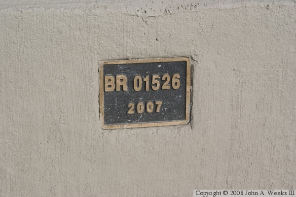
The photo above is a view from the south bank of the channel located to the west of the structure. The photo below is the bridge plate.


Aitkin Co. Highway 22 Bridge
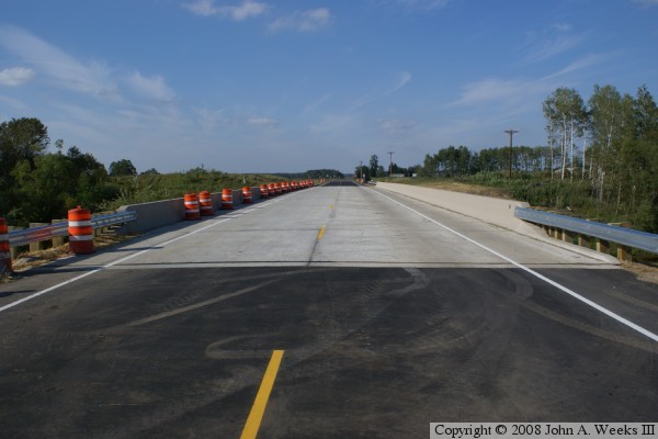
The photo above is a view looking north down the length of the traffic deck. The orange barrels remain from the project to add the final lift 
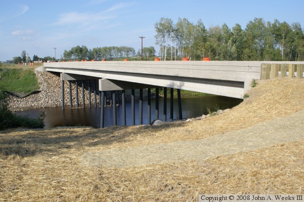
of pavement to the approaches. The photo below is a view from near the southwest corner of the structure.

Aitkin Co. Highway 22 Bridge

Made With Macintosh
Authored by John A. Weeks III, Copyright © 1996—2016, all rights reserved.
For further information, contact: john@johnweeks.com