Current Weather Conditions
John A. Weeks III
Saturday, July 27, 2024, 3:27:34 AM CDT
Home Photo Tours Rail Fan 12 Easy Steps
Aviation Spacecraft Highways & Bridges About The Author
 
Google Search
Maps   Groups   Images   Search
 
  Home
  • 12 Easy Steps
  • Aviation
  • Spacecraft
  • Highways & Bridges
    » Bridge Photography
      - MSP River Bridges
      - C & D Canal
      - Illinois River
      - Minnehaha Creek
      - Minnesota River
      - Mississippi River
      - Missouri River
      - St. Croix River
      - St. Louis River
        › St. Louis Headwaters
        › Upper St. Louis River
        › Forbes - US-53 Area
          · Town Line Road Br
          · US-53 Bridge (NB)
          · US-53 Bridge (SB)
          · Hawks Trail Bridge
          · DW&P RR Bridge
          · Evtac Road Bridge
          · Forbes Dam
          · CSAH-7 Bridge
          · DM&IR RR Forbes
        › Up Mid St. Louis River
        › Lw Mid St. Louis River
        › Fond du Lac Reservatn
        › Cloquet - Scanlon
        › Jay Cooke State Park
        › Twin Ports Harbor
      - Wisconsin River
      - Best Miss River Photos
      - Cable Stayed Bridges
      - McGilvray Road Bridges
      - I-35W Bridge Disaster
      - Miscellaneous Bridges
      - Madison County Bridges
      - Hist Br Weekend 2013
    » Road Geek Topics
  • Photo Tours
  • Rail Fan
  • About The Author
 
Site Search By JRank
Highways, Byways, And Bridge Photography
CSAH-7 Bridge
CSAH-7 Saint Louis River Highway Crossing
Forbes, MN

CSAH-7 Bridge

• Structure ID: NBI: 69609
• Location: River Mile 124.6
• River Elevation: 1,300 Feet
• Highways: CSAH-7
• Daily Traffic Count: 1,400 (2003)
• Bridge Type: Prestressed Concrete Girder, Concrete Deck
• Bridge Length: 181 Feet, 90 Foot Longest Span
• Bridge Width: 44 Feet, 2 Lanes
• Navigation Channel Width: Non-Navigable
• Height Above Water: 24 Feet
• Date Built: 1996
Saint Louis County Highway CSAH-7 is a larger connector highway that starts just a few miles north of the Duluth International Airport, and runs north parallel to (and west of) US-53, ending in Virginia, Minnesota. The highway serves all types of traffic from local farmers, landowners, commuters, and the mining industry. CSAH-7 was named the Bobby Aro Memorial Highway in honor of the singer, songwriter, and radio personality who was born and lived near this bridge.

The CSAH-7 bridge is located a few miles south of the village of Forbes. The Saint Louis River, which had been flowing south, has made a turn and is now flowing from the east. There are several bridges in this area in close proximity, including the DM&IR bridge, Forbes Dam, DW&P bridge, a regional trail, two spans of US-53, and a township road.

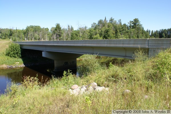
The photo above is the west face of the bridge as seen from the downriver side of the structure. This bridge is very typical of the prestressed concrete girder bridges that are favored by MN-DOT for long life and ease of maintenance. In this case, the bridge has two spans supported by a single reinforced concrete T-pier.


CSAH-7 Bridge
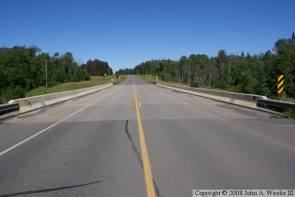
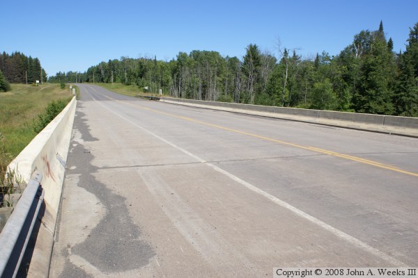
The photo above is looking north down the length of the bridge deck from the center of the highway. The photo below is a view from the southwest corner of the structure. The bridge has full width lanes, wide shoulders, and the modern style guardrails. Despite being 12 years old in these photos, the bridge appears to be in like new condition.

CSAH-7 Bridge
CSAH-7 Bridge
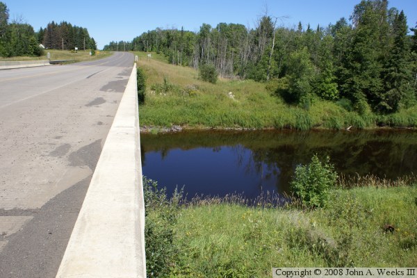
The photo above is looking to the north from the southeast corner of the structure. The previous bridge at this location was located in the clearing 
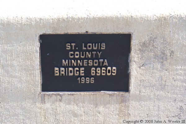
just to the east of the current bridge. The photo below is the bridge plate.

CSAH-7 Bridge

Made With Macintosh
Authored by John A. Weeks III, Copyright © 1996—2016, all rights reserved.
For further information, contact: john@johnweeks.com