The Duluth, Virginia, & Rainy Lake Railway started building a railroad
north from Virginia in 1901. The railroad was bought by the Canadian
National Railway, who renamed the line to be the Duluth, Rainy Lake, &
Winnipeg Railway. They reached the Canadian border in 1908, then started
building south towards Duluth in 1909. The line was completed to Duluth in
1912 after having been renamed again to be the Duluth, Winnipeg, &
Pacific Railway. The DW&P operated under that name until 1995, at which
time the CN rebranded the railroad under the CN logo.
The DW&P bridge is located about 620 feet south of the intersection of
Saint Louis County Highway 16 and Peary Road, which is located about 2-3/4
miles west of US-53. Heading south of the Saint Louis River, the DW&P
right-of-way skirts the huge Evtac mine, the first mine on the Iron Range
to produce iron ore in the form of taconite pellets.
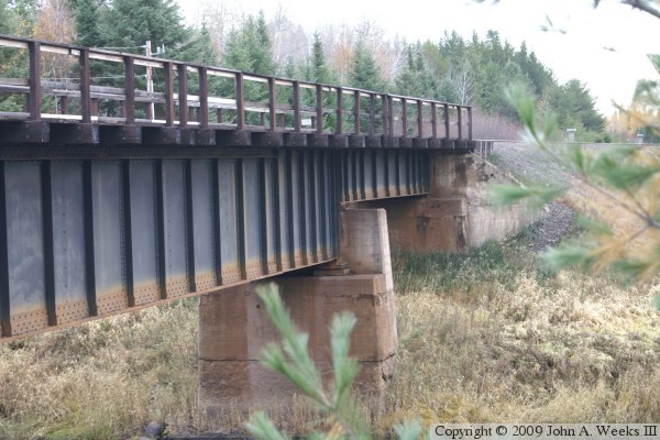
I have not been able to date this bridge as of yet. The rail line was built
in this area in the years 1909 and 1910. The reinforced concrete piers and
steel girders appear to be more modern than 1910. At the same time, the
rivet construction is probably at least 50 years old. I suspect that the
original bridge at this location was replaced as railroad equipment became
ever heavier in the 1920s and 1930s, and the volume of iron ore shipments
picked up as the mining industry focused on the Mesabi Range.
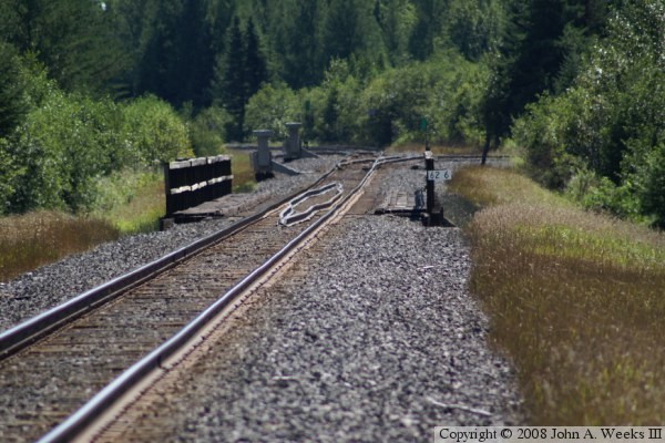
The photo above is looking southwest from County Road 16 using a telephoto
lens. The branch line heading off to the west just south of the bridge is
a feeder line for the Evtac mine. The sign lettered ‘1000’ is
a reference for train crews indicating that they are 1,000 feet from the
switch points.
These two photos are looking south from Saint Louis County 16 towards the
bridge over the Saint Louis River. The photo above is a view looking
down the railroad tracks. The photo below is the west side of the bridge.
In these photos, we can see that there are actually two switches located
just below the bridge. The first switch leads to the west for a siding
that heads into the Evtac mine. The second switch branches to the east
for a passing siding that runs for about 1-1/3 miles.
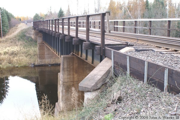
The photo above is a view from the northeast corner of the bridge, while the
photo below is from the northwest corner of the structure. It would have
been nice to get photos that were not looking into the midday sun, but
crossing a railroad bridge is a very bad idea, even when there are no trains
in sight. There could always be a train nearby, and you don't want to be
caught on a bridge if a train arrives unexpectedly.
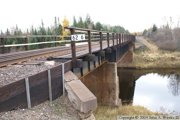
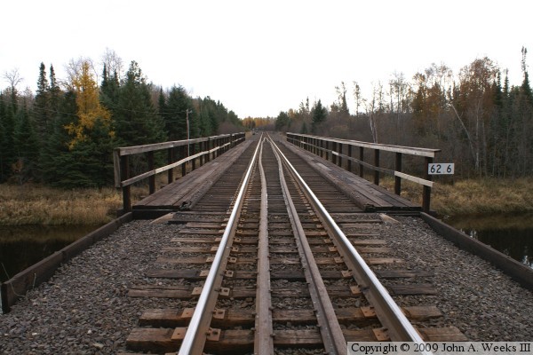
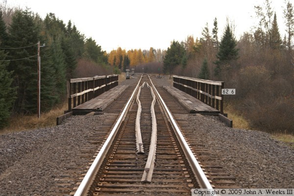
These two photos are views looking south down the length of the bridge deck.
The photo above is a little closer to the bridge, while the photo below is
an overview of the bridge. The curved rails between the main rails are guard
rails. They are designed to keep the wheels of any derailed cars near the
center of the bridge to prevent the cars from falling into the river. While
the main rails are bolted to tie plates, the guard rails are simply spiked
to the wooden ties. The sign lettered ‘62.2’ is a mile marker
sign. This bridge is 62.2 miles from the start of the railroad in Duluth.
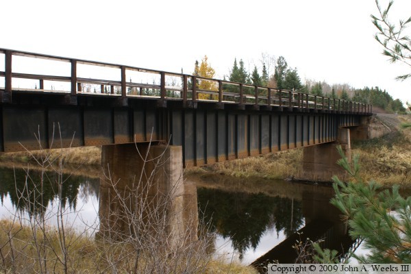
The photo above is a view from the north side of the river from a vantage
point located just downstream of the structure. This view shows the main
river span to good advantage. The photo below is a closer view of the far
side of the bridge and the south bridge abutment.