The early Spanish explorers did not treat the local indigenous Indians very well, de Soto included. Students from nearby Saint Cloud State University held a protest rally in the spring of 2005 demanding that the name of the bridge be changed out of respect for the Indians. 50 students attended the event.
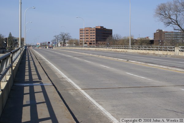
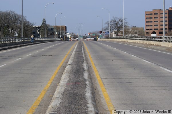
The DeSoto bridge is the first river crossing at this location. It was built in the late 1950s as part of a new MN-23 highway alignment that acted as a bypass around downtown Saint Cloud. The new MN-23 followed Division street for several miles, so the new bridge is often called the Division Street Bridge. Ironically, MN-23 diverges from Division street more than a mile before the river, where it follows 1st St S, then 2nd St S up to the river, and 3rd St SE north of the river.
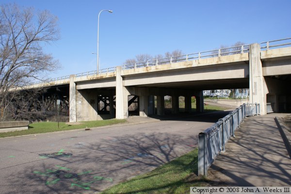
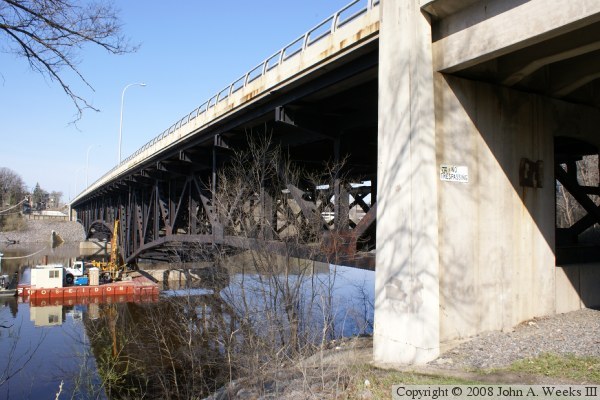
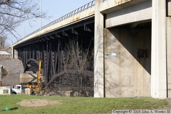
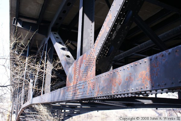
The bridge itself is a steel deck truss. This is much like the big metal monster bridges on the lower Mississippi, except shorter, and turned upside-down so the metal structure is under the roadway. The main span looks like an arch, but the bridge does not gain strength from the arch. Rather, the strength is from the truss lattice work. The bridge project was started in 1957, and finished in October of 1958. It was officially dedicated September 16, 1959.
The deck truss bridge design is considered to be obsolete today. The key issue is that it is non-redundant. That is, there are key parts of the bridge that if they fail, the whole bridge can fail. This was dramatically demonstrated in August, 2007, when I-35W bridge collapsed in Minneapolis. That bridge was very similar to this bridge, but longer, wider, and newer. There was another similar deck truss bridge just up stream, the Old Sauk Rapids Bridge. That bridge was replaced and was demolished in 2008.
The DeSoto Bridge is an impressive structure. Its seems to fill an important visual niche just where it sits. The black paint, unusual for a highway bridge, competes the illusion of being a fortress like structure left over from the middle ages. The City of St Cloud has built a very nice park on the west end of the bridge. In fact, the city is gradually building parks and trails along the river to try to rejoin the city to the great river. This park is very well done, kudos to the city for both the vision and the execution of the plan for this park.
This bridge is of the same design as the I-35W bridge that collapsed, and it was built by the same contractors. As a result, the Minnesota Department of Transportation performed a detailed inspection of the bridge following the I-35W bridge disaster. Several gusset plates were found to be deformed and the main arch was bowed slightly, appearing to inspectors that the bridge would fail if steps were not taken to fix the bridge structure. MN-DOT ordered the DeSoto bridge to be closed until further notice on March 20, 2008 due to the bridge being unsafe.
MN-DOT later announced that the MN-23 bridge problem is fatal. The bridge had been scheduled for replacement in 2014, but these events moved that date up by 5 years. The DeSoto Bridge was removed during September and October of 2008. The project started with the removal of the concrete deck. Next, the metal parts were slowly cut away with torches and lowered to barges using a pair of track cranes sitting on barges. The last pieces of the bridge to be demolished, the two piers, were completed on October 16, 2008.
This page includes two sets of photos. The photos with the gray skies were were taken 2 years before the bridge was closed. The photos with the blue skies were taken shortly after the bridge was closed. The destruction of the DeSoto Bridge was a huge loss. It was the last deck truss bridge remaining over the main channel of the Mississippi River, and it is a bridge style that is unlikely to ever be built again in the future. This was a last chance to get up close and personal with such a magnificent structure.
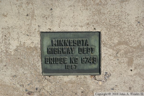
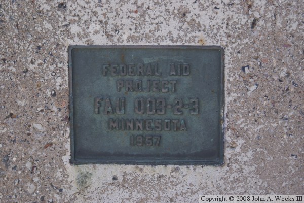
The photo above is the downriver face of the bridge as seen from the small memorial park on the west end of the structure. The photo below is the marker on display in that park.