The Saint Cloud Dam, also called the Tenth Street Dam, is located adjacent
to the Saint Cloud State University campus. The dam was originally built
for flood control. Currently, the dam operates as a real life classroom
for hydrology students. The power plant features two 4.5-megawatt
generators. The power is fed into the Xcel Energy power grid. The
hydropower generators run in the run-of-river mode, which means that
all water that flows into the dam each day has to pass over the dam
or through the powerplant. There is no storage space for water
behind the dam.
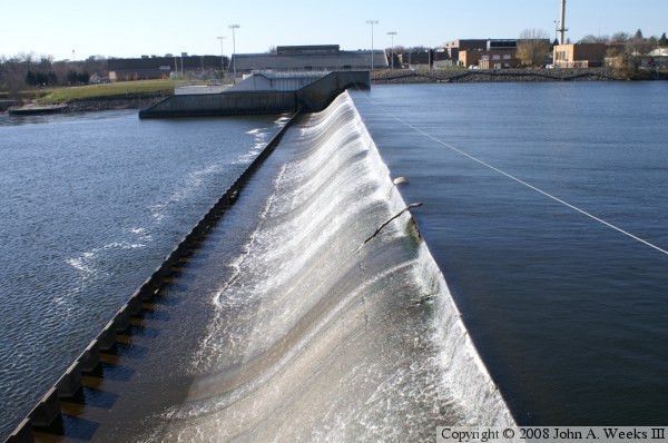
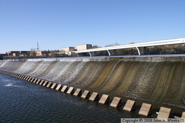
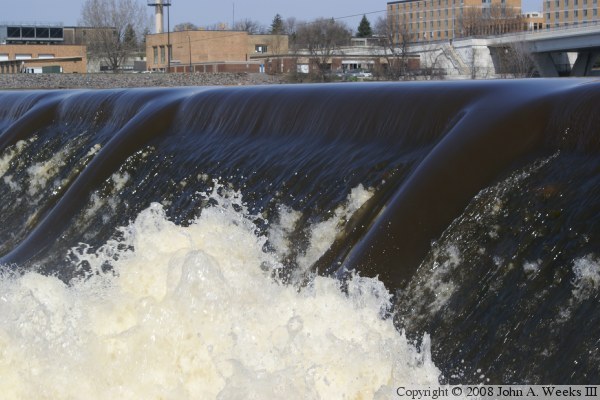
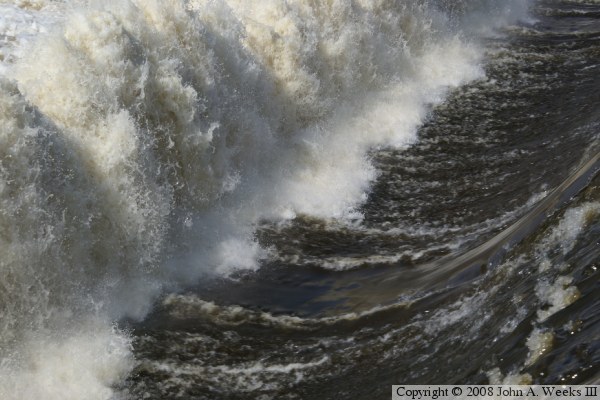
The dam has two interesting features. First, it features lift-up gates
that can control the water level by up to three feet. Second, the dam
has grinders (also called dragon teeth) at the bottom of the falls to
grind up debris and calm down the water. These grinders are a series
of tooth-shaped concrete blocks that stick up about a foot and a half
from the river bed. You can see the action of the grinders in the upper
photo, and see the grinders themselves in the bottom photo. They are
located under the section of white water at the base
of the falls. At the same time, notice how calm the water is only a
few dozen feet downstream.
The Saint Cloud Dam was rebuilt in 1970. A cofferdam was built just
upstream to keep the construction site dry. That cofferdam failed
on October 31, 1970, releasing the entire dam pool downstream,
causing extensive damage.
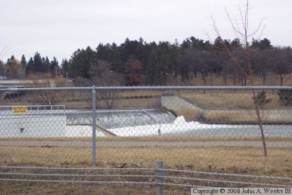
The photo above is a view of the dam site as seen from the west side of the
river. The river is about 800 feet wide at this location. The dam
consists of 220 feet of earthen embankment, a 550 foot wide spillway,
and approximately 130 feet of structure on the west end of the dam supporting
the powerplant, intakes, and tailrace.
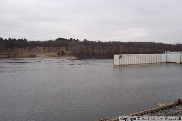
The photo above is a view of the dam from upstream of the structure looking
to the south. The powerplant is located on the near side of the river.
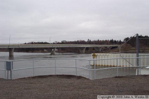
The photo below is a view looking upstream from the dam powerplant. The
University Bridge crosses the Mississippi River just upstream from the
Saint Cloud Dam.
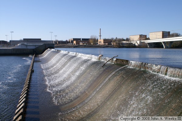
These two photos are views of the dam spillway structure as seen from the
east bank of the Mississippi River. The power plant is located on the
far end of the dam. The campus of Saint Cloud State University is located
on the west bank of the river.
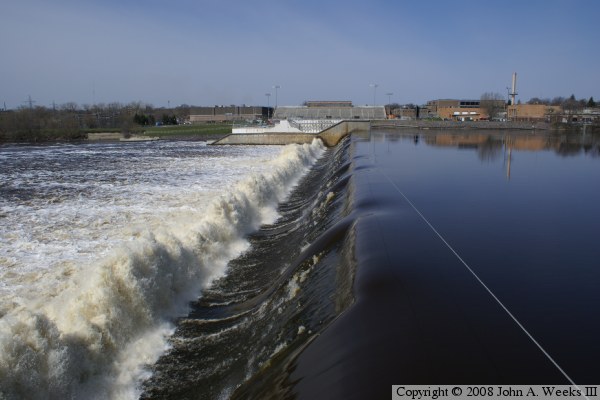
The photo above shows just a trickle of water flowing over the dam during
a late summer afternoon. In contrast, the photo below shows a large volume
of water spilling over the dam structure during the spring run-off season.
These two photos demonstrate the action of the grinders at the base of the
waterfall. The photo above shows the high spring run-off water flowing over
the dam and hitting the grinders. The photo below is a close view of this
action. Columns of water a dozen feet tall bubble up from the surface as
the fast moving water hits the concrete grinders.