Current Weather Conditions
John A. Weeks III
Friday, July 26, 2024, 10:50:25 PM CDT
Home Photo Tours Rail Fan 12 Easy Steps
Aviation Spacecraft Highways & Bridges About The Author
 
Google Search
Maps   Groups   Images   Search
 
  Home
  • 12 Easy Steps
  • Aviation
  • Spacecraft
  • Highways & Bridges
    » Bridge Photography
      - MSP River Bridges
      - C & D Canal
      - Illinois River
      - Minnehaha Creek
      - Minnesota River
        › Ortonville - Odessa
        › Correll - Wegdahl
        › Granite Fls - Rdwd Fls
          · BNSF RR Gran Falls
          · Oak Street Bridge
          · Granite Falls Dam
          · The Walking Bridge
          · US-212 Bridge (GF)
          · Minnesota Falls Dam
          · Williams Pipeline Br
          · Ren Co 10 YM Co 21
          · Ren Co 9 RW Co 7
          · Ren Co 12 RW Co 19
          · Ren Co 6 RW Co 6
          · Ren Co 21 RW Co 17
          · R Co 1 RW Co 101 B
          · R Co 1 RW Co 101
        › Morton - Judson
        › Mankato - Jordan
        › MSP West Metro
        › MSP South Metro
      - Mississippi River
      - Missouri River
      - St. Croix River
      - St. Louis River
      - Wisconsin River
      - Best Miss River Photos
      - Cable Stayed Bridges
      - McGilvray Road Bridges
      - I-35W Bridge Disaster
      - Miscellaneous Bridges
      - Madison County Bridges
      - Hist Br Weekend 2013
    » Road Geek Topics
  • Photo Tours
  • Rail Fan
  • About The Author
 
Site Search By JRank
Highways, Byways, And Bridge Photography
Renville Co 1 - Redwood Co 101 Bck Ch Br
Minnesota River Highway Crossing
Redwood Falls, MN

Renville Co 1 - Redwood Co 101 Backchannel Bridge

• Structure ID: NBI: 65543.
• Location: River Mile 212.0.
• River Elevation: 922 Feet.
• Highway: Renville Co 1, Redwood Co 101.
• Daily Traffic Count: 1,650 (2003).
• Bridge Type: Concrete Girder, Concrete Deck.
• Length: 101 Feet.
• Width: 39 Feet.
• Navigation Channel Width: Non-Navigable.
• Height Above Water: ??? Feet.
• Date Built: 2000.
The main bridge in the Renville Co 1 and Redwood Co 101 river crossing is about 3,000 feet south of this location. The Minnesota River has a number of very large loops in this area, often nearly looping back upon itself. In this location, the main bridge is at the apex of a loop. At some point in the past, a channel was cut between the two legs of the loop. This bridge crosses that channel.

At this time, I have not determined why this channel was cut. It is used today as a flood overflow channel. It seems unlikely it was cut just for this purpose since there are no other overflow channels nearby. There also appears to be some ruins where the channel exits the upstream leg of the loop. I suspect that this was some type of mill in the distant past, and the channel was cut as a tailrace for the mill waterwheel. I hope to one day learn the full history of this location.

The bridge itself is a very routine concrete bridge. What the bridge lacks in character and decoration, it makes up for in functionality and being located in a very scenic location.

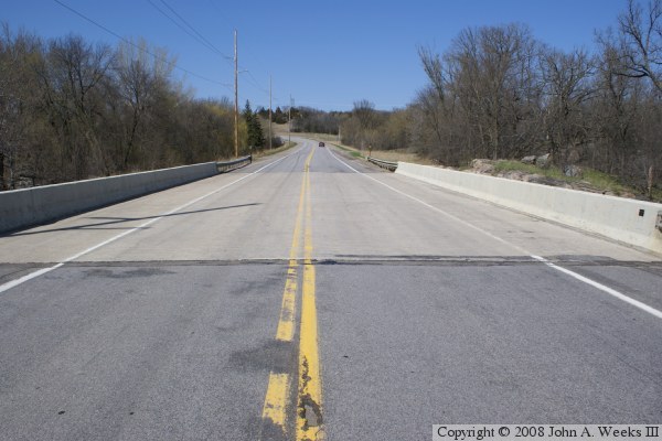
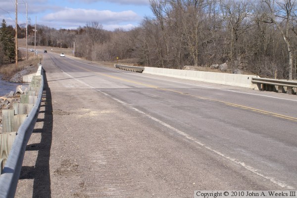
The photo above is looking north down the length of the bridge deck from the center of Renville County highway 1.


Renville Co 1 - Redwood Co 101 Backchannel Bridge
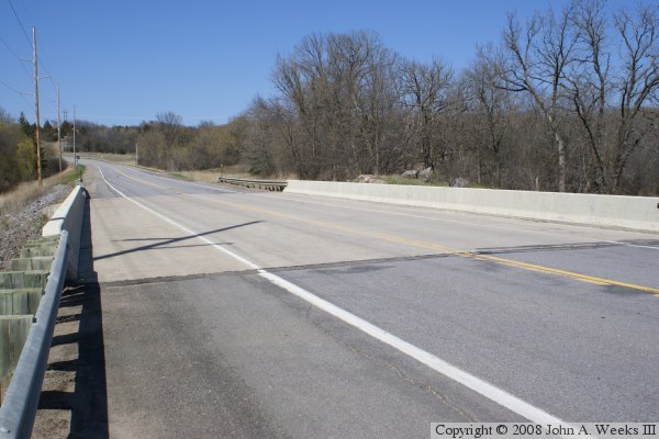
The photo above is looking north down the upstream west face of the backchannel bridge. The photo below is looking north down the length of the bridge deck from the southwest corner of the structure.

Renville Co 1 - Redwood Co 101 Backchannel Bridge
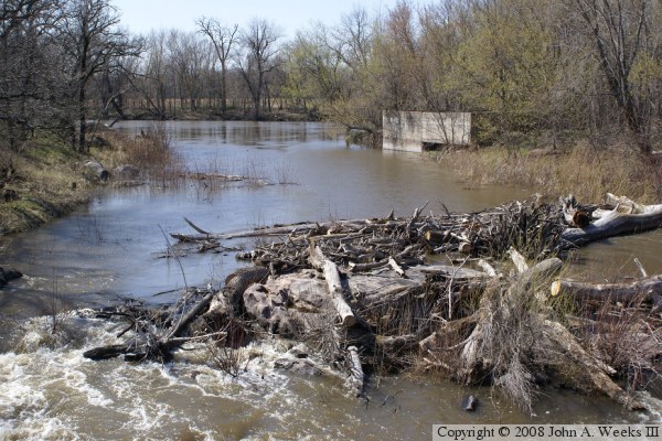
The photo above is looking upstream from the backchannel bridge towards the main channel of the Minnesota River. The concrete foundation suggests that a 
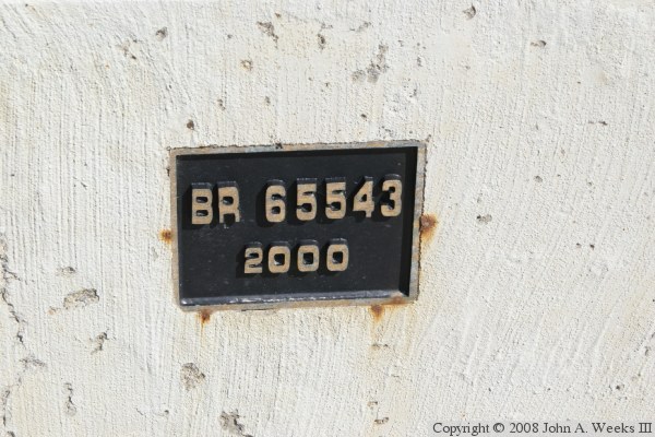
mill once stood at that location. The photo below is the bridge plate.

Renville Co 1 - Redwood Co 101 Backchannel Bridge
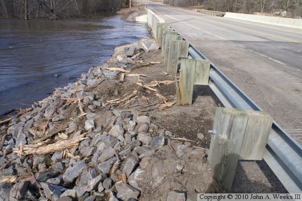
These two photos are from the spring flood of 2010. The photo above is looking north down the length of the bridge deck. Notice that the guard rail is bent, there are crawler tracks on the shoulder, and sawdust on the ground. The photo below is a closer view of the aftermath of the flood at the southwest corner of the bridge. It appears that flood water pushed debris up onto the riverbank and into the guard rail, pushing the guard rail over and breaking at least one of the support posts. A backhoe was brought in to help clear the mess.

Renville Co 1 - Redwood Co 101 Backchannel Bridge
These two photos are more views from the spring flood of 2010. The photo above is the upriver west face of the bridge. Flood waters have dropped a bit and are just below the level of the bridge deck. The photo below is looking upriver towards the concrete remains that are also pictured above during a period of normal water levels.

Renville Co 1 - Redwood Co 101 Backchannel Bridge

Made With Macintosh
Authored by John A. Weeks III, Copyright © 1996—2016, all rights reserved.
For further information, contact: john@johnweeks.com