Current Weather Conditions
John A. Weeks III
Saturday, July 27, 2024, 2:37:40 AM CDT
Home Photo Tours Rail Fan 12 Easy Steps
Aviation Spacecraft Highways & Bridges About The Author
 
Google Search
Maps   Groups   Images   Search
 
  Home
  • 12 Easy Steps
  • Aviation
  • Spacecraft
  • Highways & Bridges
    » Bridge Photography
      - MSP River Bridges
      - C & D Canal
      - Illinois River
      - Minnehaha Creek
      - Minnesota River
        › Ortonville - Odessa
        › Correll - Wegdahl
        › Granite Fls - Rdwd Fls
          · BNSF RR Gran Falls
          · Oak Street Bridge
          · Granite Falls Dam
          · The Walking Bridge
          · US-212 Bridge (GF)
          · Minnesota Falls Dam
          · Williams Pipeline Br
          · Ren Co 10 YM Co 21
          · Ren Co 9 RW Co 7
          · Ren Co 12 RW Co 19
          · Ren Co 6 RW Co 6
          · Ren Co 21 RW Co 17
          · R Co 1 RW Co 101 B
          · R Co 1 RW Co 101
        › Morton - Judson
        › Mankato - Jordan
        › MSP West Metro
        › MSP South Metro
      - Mississippi River
      - Missouri River
      - St. Croix River
      - St. Louis River
      - Wisconsin River
      - Best Miss River Photos
      - Cable Stayed Bridges
      - McGilvray Road Bridges
      - I-35W Bridge Disaster
      - Miscellaneous Bridges
      - Madison County Bridges
      - Hist Br Weekend 2013
    » Road Geek Topics
  • Photo Tours
  • Rail Fan
  • About The Author
 
Site Search By JRank
Highways, Byways, And Bridge Photography
Minnesota Falls Dam
Minnesota River Dam
Granite Falls, MN

Minnesota Falls Dam

• Structure: Minnesota Falls Dam.
• Location: River Mile 249.8.
• Dam Width: 600 Feet.
• River Elevation (Pool): 881 Feet.
• River Elevation (Outflow): 871 Feet.
• Water Fall: 10 Feet.
• Date Built: 1905.
This 1905 era dam is owned by Northern States Power, which is now known as Xcel Energy. The hydro power generator was dismantled in 1961. The dam was used to store cooling water for the nearby Minnesota Valley Generating Plant. That plant closed in 2004, leaving the dam obsolete. Xcel Energy considered rebuilding the dam, but the hydro power potential was too small to be worth rebuilding by a major utility.

The City of Granite Falls, which is located just a few miles upriver, was interested in the project since they already owned a small dam. A study suggested that the city could operate both dams in tandem and improve the economics of both projects. The idea was that water could be released from the upstream dam at peak periods, which would then generate power as second time at Minnesota Falls. Since peak power sells at a higher rate per kilowatt-hour, the city would recover their investment far more quickly. During non-peak times, the two dams would produce enough hydro power to satisfy the needs of 75% of the city.

As of 2009, a deal has not been made for the City of Granite Falls to purchase the project. Xcel Energy is considering removing the dam. Other options including performing maintenance on the structure and leaving it as-is, or drawing down the level of the reservoir.

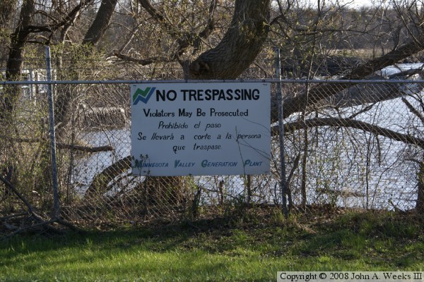
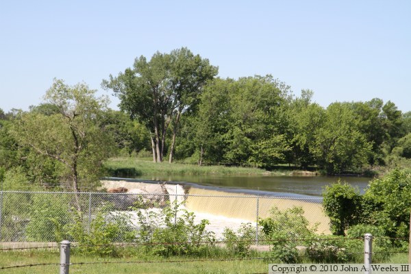
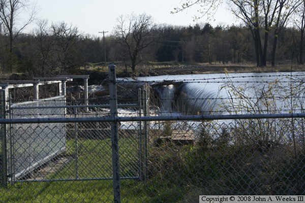
The area on the east side of the dam was once a small park area. That area has been fenced off in recent years. The west side of the river is the site of the abandoned town of Minnesota Falls. That town was essentially wiped out in a flood during the spring of 1881. A railroad bridge once crossed the river about a mile south of this location. That bride was also destroyed in the 1881 flood.

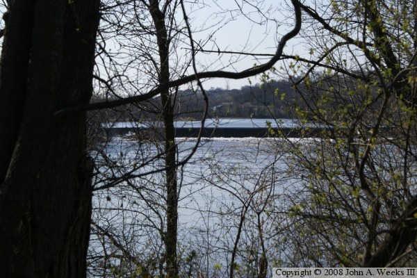
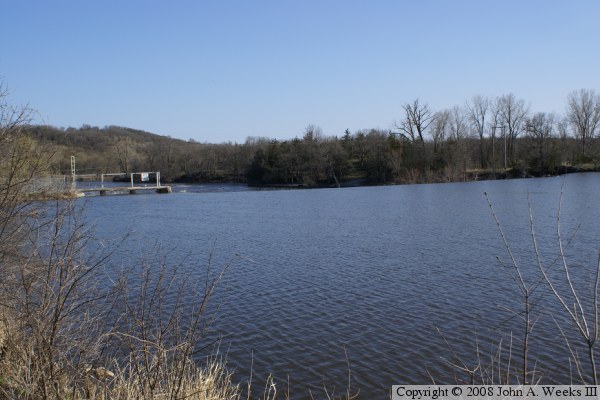
The photo above is a view of the falls from the north side of the Minnesota River. The dam control structure is located on the left side of the photo, with a small channel located on the near side of the river feeding water from the dam pool to the location where the intake to the hydro generator was once located..


Minnesota Falls Dam
The photo above is looking south across the Minnesota River from the north side of the river just downstream of the falls. The photo below is looking upstream to the west from the edge of the river at a spot where the river makes a sharp turn to the south.

Minnesota Falls Dam
Minnesota Falls Dam
The photo above is looking east towards the dam from the upstream north riverbank. The photo below is a sign suggesting that people not enter the property.

Minnesota Falls Dam
Minnesota Falls Dam
These two photos are views of the falls from early summer of 2010. The photo above is a peak at the falls through a hole in the trees. The photo below is a view from the highway along the north bank of the river. The falls is actually quite beautiful, but private property and trees block the best views.

Minnesota Falls Dam

Made With Macintosh
Authored by John A. Weeks III, Copyright © 1996—2016, all rights reserved.
For further information, contact: john@johnweeks.com